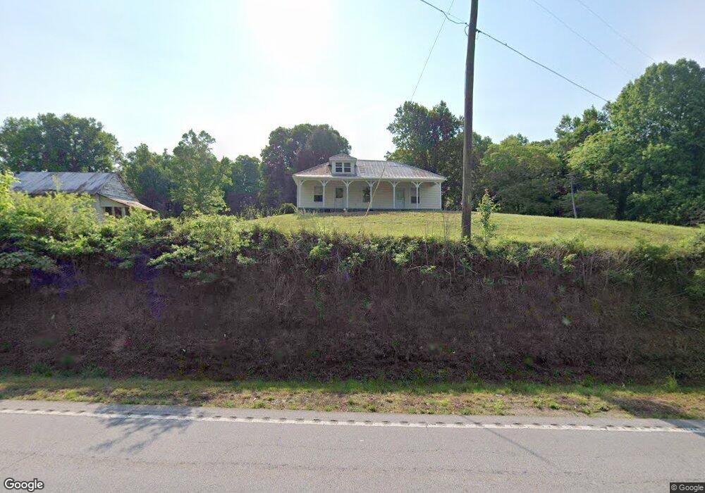
3184 Highway 197 Mount Airy, GA 30563
Estimated Value: $246,810 - $288,000
3
Beds
2
Baths
1,800
Sq Ft
$148/Sq Ft
Est. Value
About This Home
This home is located at 3184 Highway 197, Mount Airy, GA 30563 and is currently estimated at $266,203, approximately $147 per square foot. 3184 Highway 197 is a home located in Habersham County with nearby schools including Demorest Elementary School, Habersham Success Academy, and Wilbanks Middle School.
Ownership History
Date
Name
Owned For
Owner Type
Purchase Details
Closed on
Apr 22, 2005
Sold by
Mtg Electronic Registratio
Bought by
Dover Barry
Current Estimated Value
Home Financials for this Owner
Home Financials are based on the most recent Mortgage that was taken out on this home.
Original Mortgage
$63,900
Interest Rate
5.99%
Mortgage Type
New Conventional
Create a Home Valuation Report for This Property
The Home Valuation Report is an in-depth analysis detailing your home's value as well as a comparison with similar homes in the area
Home Values in the Area
Average Home Value in this Area
Purchase History
| Date | Buyer | Sale Price | Title Company |
|---|---|---|---|
| Dover Barry | $71,000 | -- |
Source: Public Records
Mortgage History
| Date | Status | Borrower | Loan Amount |
|---|---|---|---|
| Closed | Dover Barry | $63,900 |
Source: Public Records
Tax History Compared to Growth
Tax History
| Year | Tax Paid | Tax Assessment Tax Assessment Total Assessment is a certain percentage of the fair market value that is determined by local assessors to be the total taxable value of land and additions on the property. | Land | Improvement |
|---|---|---|---|---|
| 2025 | $1,650 | $68,322 | $28,342 | $39,980 |
| 2024 | $1,344 | $51,796 | $25,344 | $26,452 |
| 2023 | $974 | $38,976 | $18,432 | $20,544 |
| 2022 | $927 | $35,552 | $18,432 | $17,120 |
| 2021 | $807 | $31,100 | $16,128 | $14,972 |
| 2020 | $714 | $26,540 | $13,824 | $12,716 |
| 2019 | $715 | $26,540 | $13,824 | $12,716 |
| 2018 | $709 | $26,540 | $13,824 | $12,716 |
| 2017 | $578 | $21,524 | $10,368 | $11,156 |
| 2016 | $561 | $53,810 | $10,368 | $11,156 |
| 2015 | $555 | $53,810 | $10,368 | $11,156 |
| 2014 | $547 | $52,070 | $10,368 | $10,460 |
| 2013 | -- | $20,828 | $10,368 | $10,460 |
Source: Public Records
Map
Nearby Homes
- 2240 Hazel Creek Rd
- 787 Ansley Rd
- 309 Morning Star Ln
- 222 N Mize Rd
- 676 Sweetgrass Dr
- 799 Sweetgrass Dr
- 136 Sweetgrass Dr
- 0 Gladston Rd
- 161 Wayward Winds Dr
- 1126 Sydney Ln
- 815 Sweetgrass Ct
- 1132 Sydney Ln
- 865 Sweetgrass Ct
- 877 Sweetgrass Ct
- 0 Sweetgrass Dr Unit 7658113
- 0 Sweetgrass Dr Unit 7658111
- 144 Rolling Ridge Rd
- 1344 Blue Grass Ct
- 0 N Highway 365 Unit 10006830
- 417 Sweetgrass Dr
- 148 Briarcliff Trail
- 115 Evergreen Trail
- 3178 Highway 197
- 2360 Hazel Creek Rd
- 115 Briarcliff Trail
- 0 Briarcliff Trail Unit 8475553
- 0 Briarcliff Trail Unit 8271036
- 184 Briarcliff Trail
- 790 Ansley Rd
- 190 Evergreen Trail
- 0 Possum Trot Trail Unit 7169131
- 0 Possum Trot Trail
- 3124 S St Highway 197
- 3124 Highway 197
- 145 Evergreen Trail
- 222 Briarcliff Trail
- 154 Evergreen Trail
- 2260 Hazel Creek Rd
- 2311 Hazel Creek Rd
- 2336 Hazel Creek Rd