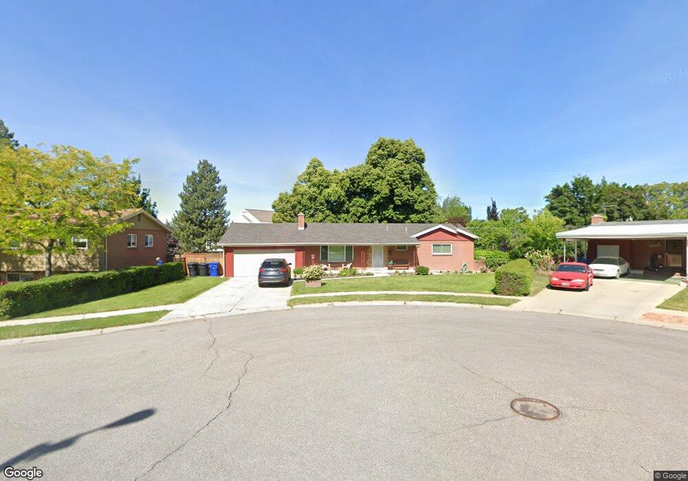
3186 S 2045 E Salt Lake City, UT 84109
Canyon Rim NeighborhoodEstimated Value: $695,000 - $786,000
4
Beds
3
Baths
2,246
Sq Ft
$337/Sq Ft
Est. Value
About This Home
This home is located at 3186 S 2045 E, Salt Lake City, UT 84109 and is currently estimated at $755,978, approximately $336 per square foot. 3186 S 2045 E is a home located in Salt Lake County with nearby schools including Rosecrest Elementary School, Evergreen Junior High School, and Olympus High School.
Ownership History
Date
Name
Owned For
Owner Type
Purchase Details
Closed on
Jun 2, 2017
Sold by
Rydman Kathee Taylor and Brimley Kathee
Bought by
Johnson Allison
Current Estimated Value
Home Financials for this Owner
Home Financials are based on the most recent Mortgage that was taken out on this home.
Original Mortgage
$380,000
Outstanding Balance
$315,647
Interest Rate
3.97%
Mortgage Type
New Conventional
Estimated Equity
$440,331
Purchase Details
Closed on
Apr 18, 2013
Sold by
Rydman Kathee Taylor and Brimley Kathee Taylor
Bought by
Rydman Kathee Taylor
Home Financials for this Owner
Home Financials are based on the most recent Mortgage that was taken out on this home.
Original Mortgage
$254,375
Interest Rate
3.51%
Mortgage Type
FHA
Purchase Details
Closed on
Oct 6, 2004
Sold by
Brimley Kathee Taylor and Taylor Robert E
Bought by
Brimley Kathee Taylor
Home Financials for this Owner
Home Financials are based on the most recent Mortgage that was taken out on this home.
Original Mortgage
$185,500
Interest Rate
5.77%
Mortgage Type
Stand Alone Refi Refinance Of Original Loan
Purchase Details
Closed on
Apr 23, 2003
Sold by
Mansfield Alicia N
Bought by
Brimley Kathee Taylor and Taylor Robert E
Purchase Details
Closed on
Feb 26, 2002
Sold by
Mansfield Alicia N
Bought by
Mansfield Alicia N and Alicia N Mansfield Family Living Trust
Purchase Details
Closed on
Apr 16, 1998
Sold by
Blount Douglas A and Blount Jennifer S
Bought by
Mansfield Alicia N
Purchase Details
Closed on
Aug 25, 1994
Sold by
Whitehouse David A and Whitehouse Deborah A
Bought by
Blount Douglas A and Blount Jennifer S
Home Financials for this Owner
Home Financials are based on the most recent Mortgage that was taken out on this home.
Original Mortgage
$111,000
Interest Rate
8.8%
Mortgage Type
Purchase Money Mortgage
Purchase Details
Closed on
Nov 1, 1993
Sold by
Henroid Richard H and Henroid Tanya
Bought by
Whitehouse David A and Whitehouse Deborah A
Home Financials for this Owner
Home Financials are based on the most recent Mortgage that was taken out on this home.
Original Mortgage
$85,000
Interest Rate
6.97%
Mortgage Type
Purchase Money Mortgage
Create a Home Valuation Report for This Property
The Home Valuation Report is an in-depth analysis detailing your home's value as well as a comparison with similar homes in the area
Home Values in the Area
Average Home Value in this Area
Purchase History
| Date | Buyer | Sale Price | Title Company |
|---|---|---|---|
| Johnson Allison | -- | Us Title | |
| Rydman Kathee Taylor | -- | None Available | |
| Brimley Kathee Taylor | -- | First American Title | |
| Brimley Kathee Taylor | -- | First American Title | |
| Mansfield Alicia N | -- | -- | |
| Mansfield Alicia N | -- | -- | |
| Blount Douglas A | -- | -- | |
| Whitehouse David A | -- | -- |
Source: Public Records
Mortgage History
| Date | Status | Borrower | Loan Amount |
|---|---|---|---|
| Open | Johnson Allison | $380,000 | |
| Previous Owner | Rydman Kathee Taylor | $254,375 | |
| Previous Owner | Brimley Kathee Taylor | $185,500 | |
| Previous Owner | Blount Douglas A | $111,000 | |
| Previous Owner | Whitehouse David A | $85,000 |
Source: Public Records
Tax History Compared to Growth
Tax History
| Year | Tax Paid | Tax Assessment Tax Assessment Total Assessment is a certain percentage of the fair market value that is determined by local assessors to be the total taxable value of land and additions on the property. | Land | Improvement |
|---|---|---|---|---|
| 2025 | $3,881 | $673,300 | $312,800 | $360,500 |
| 2024 | $3,881 | $621,400 | $303,200 | $318,200 |
| 2023 | $3,774 | $583,300 | $300,200 | $283,100 |
| 2022 | $3,836 | $596,000 | $294,300 | $301,700 |
| 2021 | $3,370 | $453,900 | $274,700 | $179,200 |
| 2020 | $3,352 | $426,200 | $235,400 | $190,800 |
| 2019 | $3,363 | $417,600 | $192,300 | $225,300 |
| 2018 | $3,258 | $389,600 | $141,300 | $248,300 |
| 2017 | $2,489 | $311,900 | $141,300 | $170,600 |
| 2016 | $2,258 | $285,600 | $141,300 | $144,300 |
| 2015 | $2,434 | $288,200 | $168,500 | $119,700 |
| 2014 | $2,517 | $291,500 | $165,300 | $126,200 |
Source: Public Records
Map
Nearby Homes
- 2070 E 3335 S Unit 32
- 2070 E 3335 S Unit 13
- 2150 E 3205 S
- 2129 E Georgetown Square
- 3176 S 1885 E
- 2193 E Lambourne Ave Unit 3
- 2215 E 3205 S
- 3404 S 2130 E
- 3129 S 1810 E
- 3000 S Connor St Unit 11
- 1805 E 3170 S
- 1977 E Millbrook Dr
- 2066 Sierra Ridge Ct
- 3094 S 2300 E
- 2272 E 3380 S
- 1821 Bosham Ln S
- 2221 E Fisher Ln
- 1930 E Atkin Ave
- 1700 E 3300 S
- 3206 S Imperial St
- 3185 S 2000 E
- 3196 S 2045 E
- 2041 E 3185 S
- 2019 Windham Cir
- 2019 E Windham Cir
- 2017 Windham Cir
- 2017 E Windham Cir
- 2024 Windham Cir
- 3171 S 2000 E
- 2024 E 3210 S
- 3206 S 2045 E
- 2013 Windham Cir
- 3207 S 2045 E
- 2022 E Windham Cir
- 2022 Windham Cir
- 2011 E Windham Cir
- 3169 S 2000 E
- 2011 Windham Cir
- 2036 Lambourne Ave
- 3216 S 2045 E