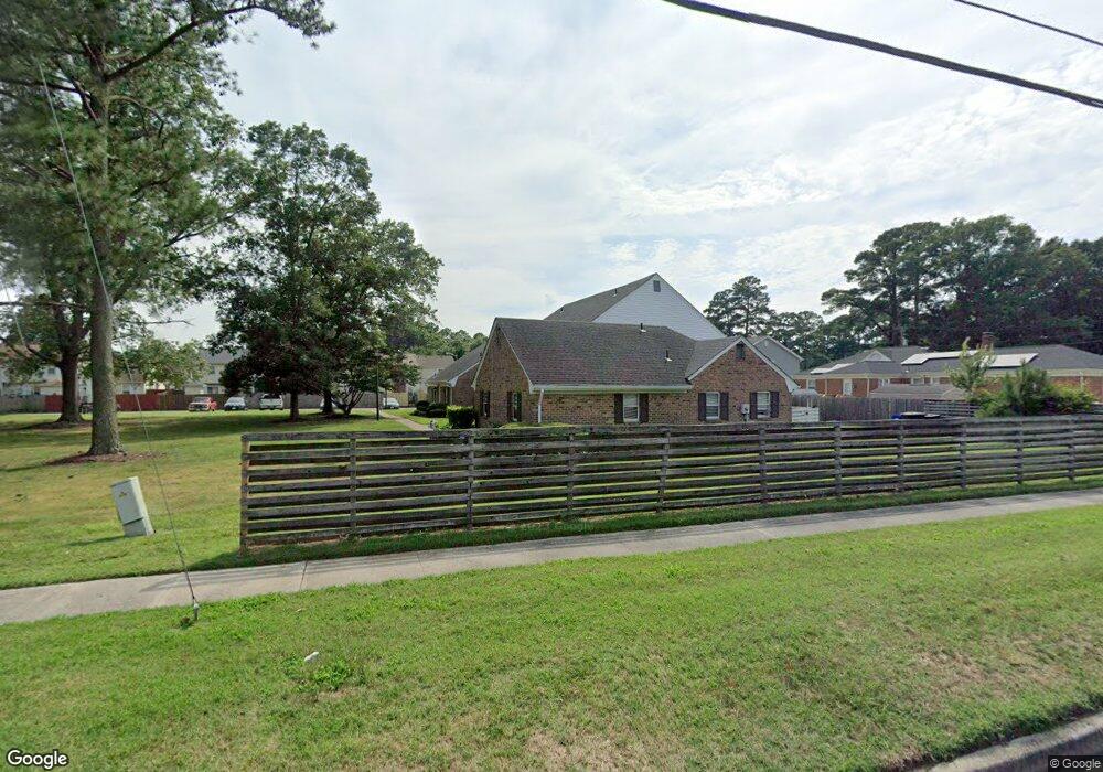
3188 Reese Dr Portsmouth, VA 23703
Churchland NeighborhoodEstimated Value: $194,000 - $224,778
3
Beds
3
Baths
1,344
Sq Ft
$158/Sq Ft
Est. Value
About This Home
This home is located at 3188 Reese Dr, Portsmouth, VA 23703 and is currently estimated at $212,695, approximately $158 per square foot. 3188 Reese Dr is a home located in Portsmouth City with nearby schools including Churchland Elementary School, Churchland Academy Elementary School, and Churchland Middle School.
Ownership History
Date
Name
Owned For
Owner Type
Purchase Details
Closed on
Aug 11, 2009
Sold by
Santa Peggy D
Bought by
Mutter Kyle W and Nelms Amanda N
Current Estimated Value
Home Financials for this Owner
Home Financials are based on the most recent Mortgage that was taken out on this home.
Original Mortgage
$133,045
Outstanding Balance
$86,214
Interest Rate
5.17%
Mortgage Type
FHA
Estimated Equity
$126,481
Purchase Details
Closed on
Nov 16, 2000
Sold by
Edmonds Walter M
Bought by
Neal Lois D and Neal Koski,Peggy D
Home Financials for this Owner
Home Financials are based on the most recent Mortgage that was taken out on this home.
Original Mortgage
$29,200
Interest Rate
7.78%
Purchase Details
Closed on
Feb 18, 2000
Sold by
Hughes Wayne J
Bought by
Beazley Lloyd W
Create a Home Valuation Report for This Property
The Home Valuation Report is an in-depth analysis detailing your home's value as well as a comparison with similar homes in the area
Home Values in the Area
Average Home Value in this Area
Purchase History
| Date | Buyer | Sale Price | Title Company |
|---|---|---|---|
| Mutter Kyle W | $135,500 | -- | |
| Neal Lois D | $69,500 | -- | |
| Beazley Lloyd W | $39,000 | -- |
Source: Public Records
Mortgage History
| Date | Status | Borrower | Loan Amount |
|---|---|---|---|
| Open | Mutter Kyle W | $133,045 | |
| Previous Owner | Neal Lois D | $29,200 |
Source: Public Records
Tax History Compared to Growth
Tax History
| Year | Tax Paid | Tax Assessment Tax Assessment Total Assessment is a certain percentage of the fair market value that is determined by local assessors to be the total taxable value of land and additions on the property. | Land | Improvement |
|---|---|---|---|---|
| 2025 | $2,503 | $195,720 | $50,000 | $145,720 |
| 2024 | $2,503 | $189,610 | $50,000 | $139,610 |
| 2023 | $2,026 | $162,090 | $50,000 | $112,090 |
| 2022 | $1,619 | $124,520 | $22,000 | $102,520 |
| 2021 | $1,496 | $115,070 | $20,000 | $95,070 |
| 2020 | $1,472 | $113,200 | $20,000 | $93,200 |
| 2019 | $1,446 | $111,200 | $18,000 | $93,200 |
| 2018 | $1,508 | $115,980 | $17,300 | $98,680 |
| 2017 | $1,508 | $115,980 | $17,300 | $98,680 |
| 2016 | $1,508 | $115,980 | $17,300 | $98,680 |
| 2015 | $1,508 | $115,980 | $17,300 | $98,680 |
| 2014 | $1,473 | $115,980 | $17,300 | $98,680 |
Source: Public Records
Map
Nearby Homes
- 3205 Clover Hill Dr
- 3233 Clover Hill Dr
- 5006 High St W
- 5221 High St W
- 4011 Reese Dr S
- 5220 Clover Hill Dr
- 3000 Ferguson Dr
- 5111 Sweetbriar Cir
- 3200 Westwood Crescent
- 5302 High St W
- 5304 High St W
- 3425 Cedar Ln
- 3101 Laurel Ln
- 3432 Carter Rd
- 4417 Gannon Rd
- 3405 Canterbury Dr
- 4313 Templar Dr
- 3509 Spence Rd
- 3130 Sterling Point Dr
- 3128 Sterling Point Dr
- 3186 Reese Dr
- 3190 Reese Dr
- 3184 Reese Dr
- 3113 Ferguson Dr
- 3109 Ferguson Dr
- 3111 Ferguson Dr
- 5118 Radcliff Cir
- 5116 Radcliff Cir
- 5114 Radcliff Cir
- 5120 Radcliff Cir
- 5112 Radcliff Cir
- 5110 Radcliff Cir
- 5108 Radcliff Cir
- 5106 Radcliff Cir
- 5104 Radcliff Cir
- 5102 Radcliff Cir
- 3107 Ferguson Dr
- 3200 Reese Dr
- 5100 Radcliff Cir
- 3105 Ferguson Dr