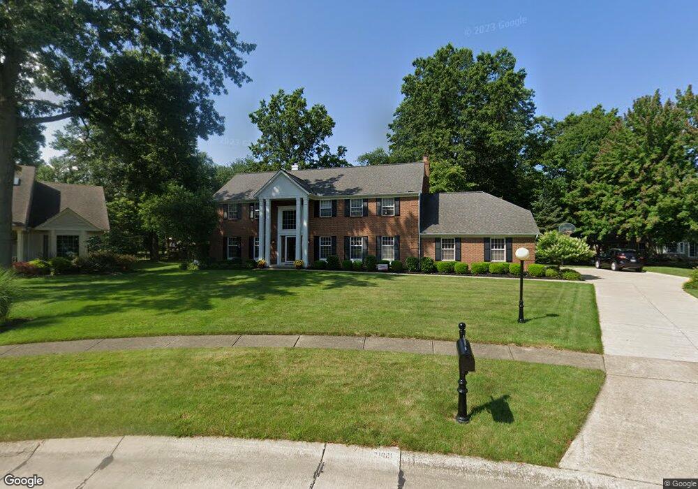
31881 Port Cove Avon Lake, OH 44012
Estimated Value: $612,000 - $662,000
4
Beds
3
Baths
3,034
Sq Ft
$210/Sq Ft
Est. Value
About This Home
This home is located at 31881 Port Cove, Avon Lake, OH 44012 and is currently estimated at $636,186, approximately $209 per square foot. 31881 Port Cove is a home located in Lorain County with nearby schools including Eastview Elementary School, Troy Intermediate Elementary School, and Learwood Middle School.
Ownership History
Date
Name
Owned For
Owner Type
Purchase Details
Closed on
Feb 15, 2012
Sold by
Hrenovsky Douglas A
Bought by
Khrenovsky Marsha L
Current Estimated Value
Purchase Details
Closed on
Jun 30, 2009
Sold by
Marquard David J and Marquard Catherine
Bought by
Khrenovsky Douglas A and Khrenovsky Marsha L
Home Financials for this Owner
Home Financials are based on the most recent Mortgage that was taken out on this home.
Original Mortgage
$228,000
Interest Rate
4.86%
Mortgage Type
Purchase Money Mortgage
Create a Home Valuation Report for This Property
The Home Valuation Report is an in-depth analysis detailing your home's value as well as a comparison with similar homes in the area
Home Values in the Area
Average Home Value in this Area
Purchase History
| Date | Buyer | Sale Price | Title Company |
|---|---|---|---|
| Khrenovsky Marsha L | -- | Attorney | |
| Khrenovsky Douglas A | $303,000 | Old Republic Title |
Source: Public Records
Mortgage History
| Date | Status | Borrower | Loan Amount |
|---|---|---|---|
| Previous Owner | Khrenovsky Douglas A | $228,000 |
Source: Public Records
Tax History Compared to Growth
Tax History
| Year | Tax Paid | Tax Assessment Tax Assessment Total Assessment is a certain percentage of the fair market value that is determined by local assessors to be the total taxable value of land and additions on the property. | Land | Improvement |
|---|---|---|---|---|
| 2024 | $7,899 | $166,926 | $61,600 | $105,326 |
| 2023 | $6,714 | $126,224 | $39,407 | $86,818 |
| 2022 | $6,644 | $126,224 | $39,407 | $86,818 |
| 2021 | $6,537 | $126,224 | $39,407 | $86,818 |
| 2020 | $6,036 | $106,480 | $33,710 | $72,770 |
| 2019 | $6,004 | $106,480 | $33,710 | $72,770 |
| 2018 | $3,046 | $106,480 | $33,710 | $72,770 |
| 2017 | $6,836 | $111,230 | $31,230 | $80,000 |
| 2016 | $6,802 | $111,230 | $31,230 | $80,000 |
| 2015 | $6,834 | $111,230 | $31,230 | $80,000 |
| 2014 | $6,630 | $102,850 | $28,880 | $73,970 |
| 2013 | $6,681 | $102,850 | $28,880 | $73,970 |
Source: Public Records
Map
Nearby Homes
- 208 Westwind Dr
- 161 Tomahawk Dr
- 225 Westwind Dr Unit 39
- 225 Westwind Dr Unit 33
- 225 Westwind Dr Unit 2
- 235 S Point Dr
- 239 S Point Dr
- 31791 Lake Rd
- 110 Oakwood Dr
- 31910 Lake Rd
- 31918 Lake Rd
- 191 Norman Ave
- 309 Bayview Dr
- 124 Norman Ave
- 372 Harbor Ct
- 31635 Lake Rd
- 32062 Tuscan Ln Unit L-4
- 32054 Tuscan Ln Unit L-2
- 32150 Ventanas Cir
- 31727 Tradewinds Dr
- 31877 Port Cove
- 215 Seaward Way
- 209 Seaward Way
- 223 Seaward Way
- 201 Seaward Way
- 222 Westwind Dr
- 228 Westwind Dr
- 31876 Port Cove
- 238 Westwind Dr
- 231 Seaward Way
- 189 Seaward Way
- 208 Seaward Way
- 246 Westwind Dr
- 181 Seaward Way
- 214 Seaward Way
- 200 Seaward Way
- 200 Westwind Dr
- 222 Seaward Way
- 194 Seaward Way
- 175 Seaward Way