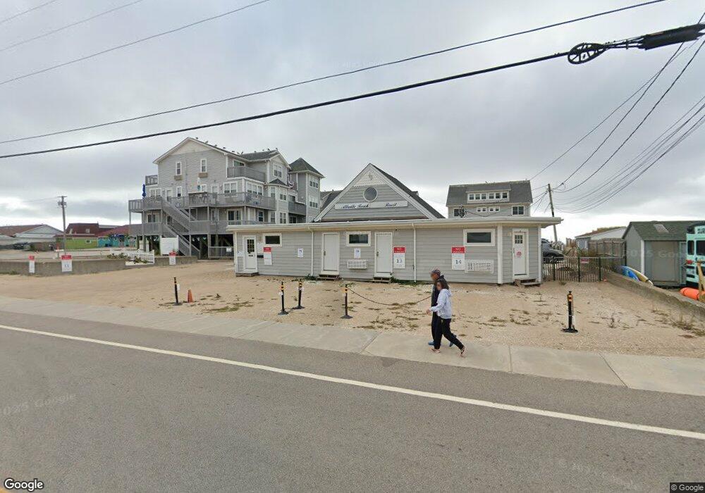
319 Atlantic Ave Unit 10 Westerly, RI 02891
Estimated Value: $622,207 - $946,000
2
Beds
1
Bath
1,098
Sq Ft
$670/Sq Ft
Est. Value
About This Home
This home is located at 319 Atlantic Ave Unit 10, Westerly, RI 02891 and is currently estimated at $735,552, approximately $669 per square foot. 319 Atlantic Ave Unit 10 is a home located in Washington County with nearby schools including Westerly High School.
Ownership History
Date
Name
Owned For
Owner Type
Purchase Details
Closed on
Nov 23, 2019
Sold by
Raymond J Quinlan Ret
Bought by
Rjq Ventures Llc
Current Estimated Value
Purchase Details
Closed on
Jun 14, 2018
Sold by
Quinlan Raymond J
Bought by
Raymond J Quinlan Ret
Purchase Details
Closed on
Mar 21, 2018
Sold by
Summer Westerly Llc
Bought by
Quinlan Raymond J
Purchase Details
Closed on
Mar 27, 2012
Sold by
Goldberg Robert J
Bought by
Summer Westerly Llc
Create a Home Valuation Report for This Property
The Home Valuation Report is an in-depth analysis detailing your home's value as well as a comparison with similar homes in the area
Home Values in the Area
Average Home Value in this Area
Purchase History
| Date | Buyer | Sale Price | Title Company |
|---|---|---|---|
| Rjq Ventures Llc | -- | None Available | |
| Raymond J Quinlan Ret | -- | -- | |
| Quinlan Raymond J | $480,000 | -- | |
| Summer Westerly Llc | -- | -- | |
| Summer Westerly Llc | -- | -- |
Source: Public Records
Mortgage History
| Date | Status | Borrower | Loan Amount |
|---|---|---|---|
| Previous Owner | Summer Westerly Llc | $325,000 |
Source: Public Records
Tax History Compared to Growth
Tax History
| Year | Tax Paid | Tax Assessment Tax Assessment Total Assessment is a certain percentage of the fair market value that is determined by local assessors to be the total taxable value of land and additions on the property. | Land | Improvement |
|---|---|---|---|---|
| 2025 | $3,758 | $528,600 | $0 | $528,600 |
| 2024 | $4,837 | $493,100 | $0 | $493,100 |
| 2023 | $4,744 | $493,100 | $0 | $493,100 |
| 2022 | $4,714 | $493,100 | $0 | $493,100 |
| 2021 | $5,273 | $457,700 | $0 | $457,700 |
| 2020 | $5,177 | $457,700 | $0 | $457,700 |
| 2019 | $5,126 | $457,700 | $0 | $457,700 |
| 2018 | $5,527 | $465,200 | $0 | $465,200 |
| 2017 | $5,392 | $465,200 | $0 | $465,200 |
| 2016 | $5,434 | $465,200 | $0 | $465,200 |
| 2015 | $5,204 | $481,000 | $0 | $481,000 |
| 2014 | $5,118 | $481,000 | $0 | $481,000 |
Source: Public Records
Map
Nearby Homes
- 432 Atlantic Ave
- 470 Atlantic Ave
- 9 Compass Way Unit 201
- 9 Compass Way Unit 202
- 9 Compass Way Unit 101
- 9 Compass Way Unit 102
- 9 Compass Way Unit 103
- 9 Compass Way Unit 203
- 597 Atlantic Ave
- 10 Tristam St
- 2 Belle Rose Dr Unit A
- 13 No Bottom Ridge Rd
- 22 Breach Dr
- 54 Sherwood Dr
- 15 Breach Dr
- 30 Clifford Dr
- 26 Windward Dr
- 18 No Bottom Ridge Ridge
- 17 Plateau Rd
- 4 Shore Rd
- 319 Atlantic Ave Unit 9
- 319 Atlantic Ave Unit 14
- 319 Atlantic Ave Unit 13
- 319 Atlantic Ave Unit 12
- 319 Atlantic Ave Unit 11
- 319 Atlantic Ave Unit 4
- 319 Atlantic Ave Unit 5
- 319 Atlantic Ave Unit 3
- 319 Atlantic Ave Unit 2
- 319 Atlantic Ave Unit 1
- 319 Atlantic Ave
- 319 Atlantic Ave Unit 6
- 319 Atlantic Ave
- 319 Atlantic Ave Unit 7&8
- 315 Atlantic Ave Unit 4 wk 40
- 315 Atlantic Ave Unit 7
- 315 Atlantic Ave Unit 14
- 315 Atlantic Ave Unit 3
- 315 Atlatic Ave
- 315 Atlantic Ave Unit 2