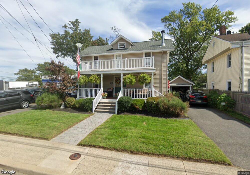
319 Branchport Ave Long Branch, NJ 07740
Estimated Value: $459,000 - $497,000
2
Beds
2
Baths
1,180
Sq Ft
$403/Sq Ft
Est. Value
About This Home
This home is located at 319 Branchport Ave, Long Branch, NJ 07740 and is currently estimated at $475,796, approximately $403 per square foot. 319 Branchport Ave is a home located in Monmouth County with nearby schools including Long Branch High School and Holy Trinity School.
Ownership History
Date
Name
Owned For
Owner Type
Purchase Details
Closed on
Nov 15, 1993
Sold by
Puth Charles
Bought by
Wampler Kevin and Wampler Tanja
Current Estimated Value
Home Financials for this Owner
Home Financials are based on the most recent Mortgage that was taken out on this home.
Original Mortgage
$71,000
Interest Rate
6.69%
Create a Home Valuation Report for This Property
The Home Valuation Report is an in-depth analysis detailing your home's value as well as a comparison with similar homes in the area
Home Values in the Area
Average Home Value in this Area
Purchase History
| Date | Buyer | Sale Price | Title Company |
|---|---|---|---|
| Wampler Kevin | $79,900 | -- |
Source: Public Records
Mortgage History
| Date | Status | Borrower | Loan Amount |
|---|---|---|---|
| Closed | Wampler Kevin | $71,000 |
Source: Public Records
Tax History Compared to Growth
Tax History
| Year | Tax Paid | Tax Assessment Tax Assessment Total Assessment is a certain percentage of the fair market value that is determined by local assessors to be the total taxable value of land and additions on the property. | Land | Improvement |
|---|---|---|---|---|
| 2025 | $6,525 | $453,500 | $247,600 | $205,900 |
| 2024 | $5,833 | $424,500 | $227,600 | $196,900 |
| 2023 | $5,833 | $375,600 | $187,600 | $188,000 |
| 2022 | $5,065 | $298,700 | $135,500 | $163,200 |
| 2021 | $5,065 | $253,100 | $100,500 | $152,600 |
| 2020 | $4,999 | $239,200 | $87,500 | $151,700 |
| 2019 | $4,797 | $228,200 | $83,500 | $144,700 |
| 2018 | $4,670 | $220,900 | $81,500 | $139,400 |
| 2017 | $4,672 | $226,700 | $79,500 | $147,200 |
| 2016 | $4,727 | $233,900 | $90,500 | $143,400 |
| 2015 | $4,002 | $179,700 | $48,300 | $131,400 |
| 2014 | $3,751 | $177,500 | $60,900 | $116,600 |
Source: Public Records
Map
Nearby Homes
- 238 Branchport Ave
- 572 Jay St
- 565 Joline Ave
- 222 Coleman Ave
- 13 Morris Place
- 631 Irving Place
- 401 Joline Ave
- 119 Washington St
- 190 Spruce St Unit 4
- 15 Signal Ave
- 11 Clay St
- 148 Sixth Ave
- 66 Shrewsbury Ave
- 184 N 5th Ave
- 211 Rockwell Ave
- 151 N 5th Ave
- 28 Norwood Ave
- 10 Asbury Ave
- 40 N 5th Ave
- 14 Slocum Place
- 315 Branchport Ave
- 311 Branchport Ave
- 521 East St
- 523 East St
- 307 Branchport Ave Unit 1
- 316 Branchport Ave
- 316 Branchport Ave Unit 2
- 316 Branchport Ave Unit 1
- 525 East St
- 293 Branchport Ave
- 527 East St
- 516 Atlantic Ave
- 529 East St
- 526 East St
- 531 East St
- 298 Branchport Ave
- 298 Branchport Ave Unit 1
- 553 Berdan Place
- 291 Branchport Ave
- 530 East St