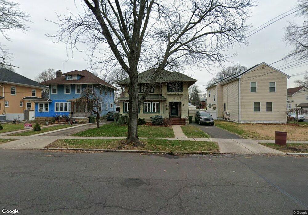
319 E 2nd Ave Roselle, NJ 07203
Estimated Value: $342,000 - $532,000
Studio
--
Bath
2,551
Sq Ft
$172/Sq Ft
Est. Value
About This Home
This home is located at 319 E 2nd Ave, Roselle, NJ 07203 and is currently estimated at $438,081, approximately $171 per square foot. 319 E 2nd Ave is a home located in Union County with nearby schools including Harrison Elementary School, Leonard V. Moore Middle School, and Grace Wilday Junior High School.
Ownership History
Date
Name
Owned For
Owner Type
Purchase Details
Closed on
Aug 14, 2025
Sold by
Mcclendon John and Mcclendon Ian Seth
Bought by
Dela Paz-Beard Beatrice and Beard Lawrence Vernel
Current Estimated Value
Home Financials for this Owner
Home Financials are based on the most recent Mortgage that was taken out on this home.
Original Mortgage
$332,500
Outstanding Balance
$332,212
Interest Rate
6.72%
Mortgage Type
New Conventional
Estimated Equity
$105,869
Purchase Details
Closed on
Dec 15, 1988
Bought by
Mcclendon John and Mcclendon Catherine
Create a Home Valuation Report for This Property
The Home Valuation Report is an in-depth analysis detailing your home's value as well as a comparison with similar homes in the area
Home Values in the Area
Average Home Value in this Area
Purchase History
| Date | Buyer | Sale Price | Title Company |
|---|---|---|---|
| Dela Paz-Beard Beatrice | $350,000 | Westcor Land Title | |
| Dela Paz-Beard Beatrice | $350,000 | Westcor Land Title | |
| Mcclendon John | $60,000 | -- |
Source: Public Records
Mortgage History
| Date | Status | Borrower | Loan Amount |
|---|---|---|---|
| Open | Dela Paz-Beard Beatrice | $332,500 |
Source: Public Records
Tax History
| Year | Tax Paid | Tax Assessment Tax Assessment Total Assessment is a certain percentage of the fair market value that is determined by local assessors to be the total taxable value of land and additions on the property. | Land | Improvement |
|---|---|---|---|---|
| 2025 | $12,495 | $143,700 | $57,400 | $86,300 |
| 2024 | $12,181 | $143,700 | $57,400 | $86,300 |
| 2023 | $12,181 | $143,700 | $57,400 | $86,300 |
| 2022 | $12,266 | $143,700 | $57,400 | $86,300 |
| 2021 | $12,193 | $143,700 | $57,400 | $86,300 |
| 2020 | $12,154 | $143,700 | $57,400 | $86,300 |
| 2019 | $11,999 | $143,700 | $57,400 | $86,300 |
| 2018 | $11,933 | $143,700 | $57,400 | $86,300 |
| 2017 | $11,870 | $143,700 | $57,400 | $86,300 |
| 2016 | $11,608 | $143,700 | $57,400 | $86,300 |
| 2015 | $11,607 | $143,700 | $57,400 | $86,300 |
| 2014 | $11,283 | $143,700 | $57,400 | $86,300 |
Source: Public Records
Map
Nearby Homes
- 415 E 3rd Ave Unit 3
- 425 Mercer Ave
- 121 Myrtle St
- 221 E Westfield Ave
- 424 E 4th Ave
- 418 E 5th Ave
- 426 Walnut St
- 410 Harrison Ave
- 117 Pershing Ave
- 210 Pershing Ave
- 111 Sheridan Ave
- 540 E 3rd Ave
- 502 Drake Ave
- 247 E 7th Ave
- 123 E 6th Ave
- 353 E Grant Ave
- 119 E Grant Ave
- 206 E Clay Ave
- 332 Pershing Ave
- 522 Thompson Ave
- 321 E 2nd Ave
- 315 E 2nd Ave
- 122 Chandler Ave
- 307 E 2nd Ave
- 118 Chandler Ave
- 305 E 2nd Ave
- 123 Chandler Ave
- 114 Chandler Ave
- 119 Chandler Ave
- 117 Poplar St
- 303 E 2nd Ave
- 115 Chandler Ave
- 324 E 2nd Ave
- 113 Poplar St
- 120 Monroe St
- 320 E 2nd Ave
- 316 E 2nd Ave
- 111 Chandler Ave
- 109 Poplar St
- 118 Monroe St
Your Personal Tour Guide
Ask me questions while you tour the home.