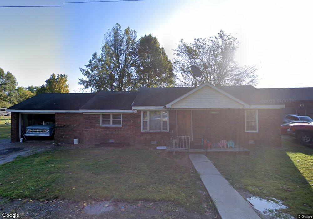
319 Locust St Benton, KY 42025
Estimated Value: $88,000 - $137,000
4
Beds
1
Bath
1,180
Sq Ft
$93/Sq Ft
Est. Value
About This Home
This home is located at 319 Locust St, Benton, KY 42025 and is currently estimated at $110,262, approximately $93 per square foot. 319 Locust St is a home located in Marshall County with nearby schools including Benton Elementary School and Marshall County High School.
Ownership History
Date
Name
Owned For
Owner Type
Purchase Details
Closed on
Feb 13, 2007
Sold by
Lane William Michael and Lane Barbara Jean
Bought by
Timmons Joel M and Timmons Kandy A
Current Estimated Value
Home Financials for this Owner
Home Financials are based on the most recent Mortgage that was taken out on this home.
Original Mortgage
$50,000
Outstanding Balance
$29,814
Interest Rate
6.08%
Mortgage Type
New Conventional
Estimated Equity
$80,448
Purchase Details
Closed on
Aug 18, 2005
Sold by
Lane Danny K and Lane Tyree J
Bought by
Lane Michael
Create a Home Valuation Report for This Property
The Home Valuation Report is an in-depth analysis detailing your home's value as well as a comparison with similar homes in the area
Home Values in the Area
Average Home Value in this Area
Purchase History
| Date | Buyer | Sale Price | Title Company |
|---|---|---|---|
| Timmons Joel M | $50,000 | None Available | |
| Lane Michael | -- | None Available |
Source: Public Records
Mortgage History
| Date | Status | Borrower | Loan Amount |
|---|---|---|---|
| Open | Timmons Joel M | $50,000 |
Source: Public Records
Tax History Compared to Growth
Tax History
| Year | Tax Paid | Tax Assessment Tax Assessment Total Assessment is a certain percentage of the fair market value that is determined by local assessors to be the total taxable value of land and additions on the property. | Land | Improvement |
|---|---|---|---|---|
| 2024 | $485 | $53,500 | $10,000 | $43,500 |
| 2023 | $503 | $53,500 | $10,000 | $43,500 |
| 2022 | $526 | $53,500 | $10,000 | $43,500 |
| 2021 | $533 | $53,500 | $10,000 | $43,500 |
| 2020 | $538 | $53,500 | $10,000 | $43,500 |
| 2019 | $538 | $53,500 | $10,000 | $43,500 |
| 2018 | $525 | $52,000 | $10,000 | $42,000 |
| 2017 | $525 | $52,000 | $10,000 | $42,000 |
| 2016 | $526 | $52,000 | $10,000 | $42,000 |
| 2015 | $509 | $50,000 | $8,000 | $42,000 |
| 2014 | $508 | $50,000 | $0 | $0 |
| 2010 | -- | $50,000 | $8,000 | $42,000 |
Source: Public Records
Map
Nearby Homes
- 318 Main St
- 320 Main St
- TBD W 5th St
- 608 Olive St
- 604 Pine St
- 00 Main St
- 220 Morningside Dr
- Lot 34 & 35 Woodtrace Subdivision
- Lot 33 Woodtrace Subdivision
- 2.41 Acres on Main St
- 501 Old Symsonia Rd
- 00 W 12th St
- 0000 Access Rd
- 301 E 13th St
- 931 Pine St
- 1305 Birch St
- 304 W 14th St Unit 306 W 14th St
- 1400 Walnut St
- 102 Harper Dr
- 1208 Shelby McCallum Dr