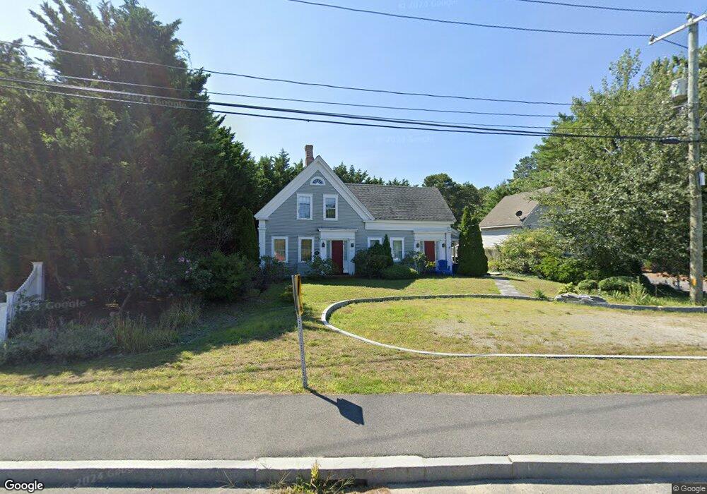
319 Main St Dennis Port, MA 02639
Dennis Port NeighborhoodEstimated Value: $518,000 - $896,000
4
Beds
2
Baths
1,627
Sq Ft
$383/Sq Ft
Est. Value
About This Home
This home is located at 319 Main St, Dennis Port, MA 02639 and is currently estimated at $623,624, approximately $383 per square foot. 319 Main St is a home located in Barnstable County with nearby schools including Dennis-Yarmouth Regional High School and St. Pius X. School.
Ownership History
Date
Name
Owned For
Owner Type
Purchase Details
Closed on
May 25, 2017
Sold by
Eastman George C and Eastman Susan M
Bought by
Lentz 3Rd Paul E and Lentz Meagan E
Current Estimated Value
Home Financials for this Owner
Home Financials are based on the most recent Mortgage that was taken out on this home.
Original Mortgage
$210,500
Outstanding Balance
$174,961
Interest Rate
4.08%
Mortgage Type
New Conventional
Estimated Equity
$448,663
Purchase Details
Closed on
Apr 3, 2002
Sold by
Iri Realty Prtnrs Lp
Bought by
Doherty Charles
Home Financials for this Owner
Home Financials are based on the most recent Mortgage that was taken out on this home.
Original Mortgage
$141,750
Interest Rate
6.85%
Mortgage Type
Purchase Money Mortgage
Purchase Details
Closed on
Jan 8, 1993
Sold by
Shealey Frank J and Shealey Glenn E
Bought by
Lamplighter Rt and Siddharth Siddharth
Home Financials for this Owner
Home Financials are based on the most recent Mortgage that was taken out on this home.
Original Mortgage
$275,000
Interest Rate
8.24%
Mortgage Type
Purchase Money Mortgage
Create a Home Valuation Report for This Property
The Home Valuation Report is an in-depth analysis detailing your home's value as well as a comparison with similar homes in the area
Home Values in the Area
Average Home Value in this Area
Purchase History
| Date | Buyer | Sale Price | Title Company |
|---|---|---|---|
| Lentz 3Rd Paul E | $260,000 | -- | |
| Doherty Charles | $157,500 | -- | |
| Lamplighter Rt | $275,000 | -- |
Source: Public Records
Mortgage History
| Date | Status | Borrower | Loan Amount |
|---|---|---|---|
| Open | Lentz 3Rd Paul E | $210,500 | |
| Previous Owner | Lamplighter Rt | $20,000 | |
| Previous Owner | Lamplighter Rt | $141,750 | |
| Previous Owner | Lamplighter Rt | $275,000 |
Source: Public Records
Tax History Compared to Growth
Tax History
| Year | Tax Paid | Tax Assessment Tax Assessment Total Assessment is a certain percentage of the fair market value that is determined by local assessors to be the total taxable value of land and additions on the property. | Land | Improvement |
|---|---|---|---|---|
| 2025 | $1,694 | $391,300 | $120,700 | $270,600 |
| 2024 | $1,711 | $389,800 | $122,900 | $266,900 |
| 2023 | $1,655 | $354,400 | $111,700 | $242,700 |
| 2022 | $1,630 | $291,000 | $111,800 | $179,200 |
| 2021 | $1,564 | $259,400 | $98,600 | $160,800 |
| 2020 | $1,573 | $257,900 | $98,600 | $159,300 |
| 2019 | $1,623 | $263,000 | $96,700 | $166,300 |
| 2018 | $1,746 | $275,400 | $133,000 | $142,400 |
| 2017 | $1,662 | $270,300 | $122,800 | $147,500 |
| 2016 | $1,875 | $287,100 | $127,900 | $159,200 |
| 2015 | $1,631 | $254,900 | $127,900 | $127,000 |
| 2014 | $1,549 | $244,000 | $112,500 | $131,500 |
Source: Public Records
Map
Nearby Homes
- 268 Main St
- 104 Toms Path
- 104 Toms Path
- 125 Main St Unit 3
- 4 Coffey Ln
- 10 Candlewood Ln Unit 2-1
- 12 Candlewood Ln Unit 2-9
- 12 Candlewood Ln Unit 1-6
- 18 Holiday Ln
- 71 Main St
- 9 Country Ln
- 78 Upper County Rd Unit A&B
- 78 Upper County Rd
- 12 Cross St
- 24 Indian Trail
- 47 Telegraph Rd Unit 1
- 22 Ferncliff Rd
- 102 Sea St
- 20 Aunt Debbys Rd
- 37-A Beach Hills Rd