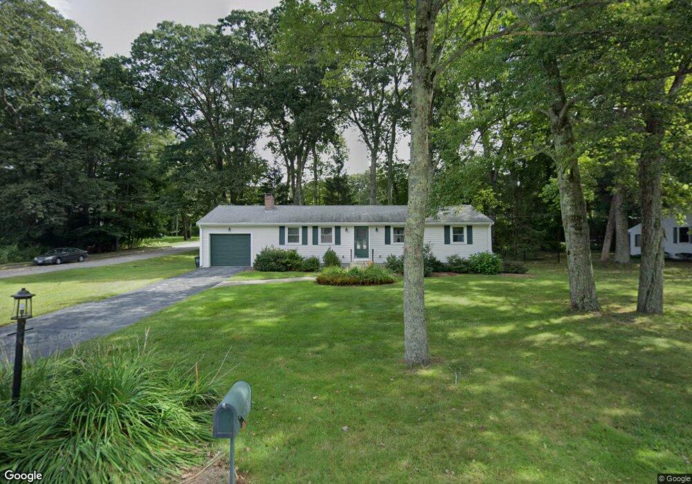
319 Marked Tree Rd Holliston, MA 01746
Estimated Value: $603,000 - $746,000
3
Beds
1
Bath
1,956
Sq Ft
$336/Sq Ft
Est. Value
About This Home
This home is located at 319 Marked Tree Rd, Holliston, MA 01746 and is currently estimated at $657,217, approximately $336 per square foot. 319 Marked Tree Rd is a home located in Middlesex County with nearby schools including Miller Elementary School, Robert H. Adams Middle School, and Holliston High School.
Ownership History
Date
Name
Owned For
Owner Type
Purchase Details
Closed on
Mar 10, 2023
Sold by
Savacool Mary J
Bought by
Savacool Ft
Current Estimated Value
Purchase Details
Closed on
Nov 23, 2010
Sold by
Knopf Reynold F
Bought by
Weinhold Jane S
Purchase Details
Closed on
Jan 21, 1994
Sold by
Harris Catherine A and Knopf Reynold R
Bought by
Knopf Reynold F
Purchase Details
Closed on
Oct 9, 1987
Sold by
Shea Patrick W
Bought by
Harris Catherine A
Create a Home Valuation Report for This Property
The Home Valuation Report is an in-depth analysis detailing your home's value as well as a comparison with similar homes in the area
Home Values in the Area
Average Home Value in this Area
Purchase History
| Date | Buyer | Sale Price | Title Company |
|---|---|---|---|
| Savacool Ft | -- | None Available | |
| Weinhold Jane S | $275,000 | -- | |
| Knopf Reynold F | $10,316 | -- | |
| Knopf Reynold F | $10,316 | -- | |
| Harris Catherine A | $175,000 | -- |
Source: Public Records
Mortgage History
| Date | Status | Borrower | Loan Amount |
|---|---|---|---|
| Previous Owner | Harris Catherine A | $60,000 | |
| Previous Owner | Harris Catherine A | $56,000 |
Source: Public Records
Tax History Compared to Growth
Tax History
| Year | Tax Paid | Tax Assessment Tax Assessment Total Assessment is a certain percentage of the fair market value that is determined by local assessors to be the total taxable value of land and additions on the property. | Land | Improvement |
|---|---|---|---|---|
| 2025 | $7,334 | $500,600 | $244,000 | $256,600 |
| 2024 | $6,729 | $446,800 | $244,000 | $202,800 |
| 2023 | $6,751 | $438,400 | $244,000 | $194,400 |
| 2022 | $6,617 | $380,700 | $244,000 | $136,700 |
| 2021 | $6,646 | $372,300 | $232,700 | $139,600 |
| 2020 | $6,541 | $347,000 | $210,400 | $136,600 |
| 2019 | $6,419 | $340,900 | $204,300 | $136,600 |
| 2018 | $6,365 | $340,900 | $204,300 | $136,600 |
| 2017 | $6,084 | $328,500 | $208,500 | $120,000 |
| 2016 | $5,620 | $299,100 | $179,100 | $120,000 |
| 2015 | $5,351 | $276,100 | $144,800 | $131,300 |
Source: Public Records
Map
Nearby Homes
- 1014 Highland St
- 43 Bittersweet Cir Unit 43
- 1366 Washington St
- 1037 Washington St
- 160 Winter St
- 154 Union St
- 11 Francine Dr
- 54 Westfield Dr
- 20 Hargrave Ave
- 110 Bonney Dr
- 75 Ridge Rd
- 56 Roy Ave
- 156 Mitchell Rd
- 150 Westfield Dr
- 195 High St
- 32 Colonial Way
- 133 Brooksmont Dr Unit 43
- 95 Brooksmont Dr Unit 26
- 131 Jennings Rd
- 59 Turner Rd
- 331 Marked Tree Rd
- 116 Robin Hill Rd
- 320 Marked Tree Rd
- 310 Marked Tree Rd
- 295 Marked Tree Rd
- 330 Marked Tree Rd
- 127 Robin Hill Rd
- 300 Marked Tree Rd
- 98 Robin Hill Rd
- 283 Marked Tree Rd
- 290 Marked Tree Rd
- 49 Greenview Dr
- 115 Robin Hill Rd
- 101 Robin Hill Rd
- 43 Greenview Dr
- 280 Marked Tree Rd
- 35 Greenview Dr
- 2 Robin Hill Rd
- 88 Robin Hill Rd
- 10 Robin Hill Rd