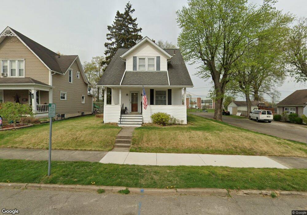
319 N 11th St Newark, OH 43055
Estimated Value: $159,000 - $208,000
3
Beds
1
Bath
1,144
Sq Ft
$166/Sq Ft
Est. Value
About This Home
This home is located at 319 N 11th St, Newark, OH 43055 and is currently estimated at $190,107, approximately $166 per square foot. 319 N 11th St is a home located in Licking County with nearby schools including John Clem Elementary School, Liberty Middle School, and Newark High School.
Ownership History
Date
Name
Owned For
Owner Type
Purchase Details
Closed on
Mar 30, 2018
Sold by
Cochran Dennise E
Bought by
Sayers Patrick R and Sayers Misty R
Current Estimated Value
Home Financials for this Owner
Home Financials are based on the most recent Mortgage that was taken out on this home.
Original Mortgage
$73,090
Outstanding Balance
$62,842
Interest Rate
4.43%
Mortgage Type
New Conventional
Estimated Equity
$127,265
Create a Home Valuation Report for This Property
The Home Valuation Report is an in-depth analysis detailing your home's value as well as a comparison with similar homes in the area
Home Values in the Area
Average Home Value in this Area
Purchase History
| Date | Buyer | Sale Price | Title Company |
|---|---|---|---|
| Sayers Patrick R | $77,000 | None Available |
Source: Public Records
Mortgage History
| Date | Status | Borrower | Loan Amount |
|---|---|---|---|
| Open | Sayers Patrick R | $73,090 |
Source: Public Records
Tax History Compared to Growth
Tax History
| Year | Tax Paid | Tax Assessment Tax Assessment Total Assessment is a certain percentage of the fair market value that is determined by local assessors to be the total taxable value of land and additions on the property. | Land | Improvement |
|---|---|---|---|---|
| 2024 | $1,648 | $46,130 | $13,440 | $32,690 |
| 2023 | $1,647 | $46,130 | $13,440 | $32,690 |
| 2022 | $1,380 | $34,370 | $7,560 | $26,810 |
| 2021 | $1,447 | $34,370 | $7,560 | $26,810 |
| 2020 | $1,482 | $34,370 | $7,560 | $26,810 |
| 2019 | $1,205 | $26,920 | $6,300 | $20,620 |
| 2018 | $1,206 | $0 | $0 | $0 |
| 2017 | $1,132 | $0 | $0 | $0 |
| 2016 | $1,086 | $0 | $0 | $0 |
| 2015 | $1,110 | $0 | $0 | $0 |
| 2014 | $1,421 | $0 | $0 | $0 |
| 2013 | $1,108 | $0 | $0 | $0 |
Source: Public Records
Map
Nearby Homes
- 333 N 10th St
- 425 N 11th St
- 355 Eddy St
- 361 Granville St
- 408 Granville St
- 383 Central Ave
- 64 N 10th St
- 218 Granville St
- 251 Merchant St
- 247 Buckingham St
- 69 Wallace St
- 467 Mount Vernon Rd
- 533 Leslie Dr
- 27 W North St
- 542 Mount Vernon Rd
- 188 Meadow Dr
- 184 Meadow Dr
- 423 Hudson Ave
- 355 Hudson Ave
- 249 W Locust St