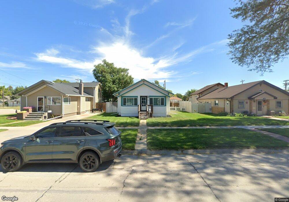
319 Platte Ave Alliance, NE 69301
Estimated Value: $79,000 - $106,000
2
Beds
1
Bath
780
Sq Ft
$115/Sq Ft
Est. Value
About This Home
This home is located at 319 Platte Ave, Alliance, NE 69301 and is currently estimated at $89,486, approximately $114 per square foot. 319 Platte Ave is a home located in Box Butte County with nearby schools including Alliance High School, St. Agnes Academy, and Immanuel Evangelical Lutheran School.
Ownership History
Date
Name
Owned For
Owner Type
Purchase Details
Closed on
Nov 23, 2021
Sold by
Trennepohl Roger A
Bought by
Airada Sergio
Current Estimated Value
Home Financials for this Owner
Home Financials are based on the most recent Mortgage that was taken out on this home.
Original Mortgage
$58,900
Outstanding Balance
$53,964
Interest Rate
2.98%
Mortgage Type
New Conventional
Estimated Equity
$35,522
Purchase Details
Closed on
Aug 1, 2008
Sold by
Bixby James S
Bought by
Trennepohl Marvin L
Home Financials for this Owner
Home Financials are based on the most recent Mortgage that was taken out on this home.
Original Mortgage
$42,750
Interest Rate
6.38%
Mortgage Type
Purchase Money Mortgage
Create a Home Valuation Report for This Property
The Home Valuation Report is an in-depth analysis detailing your home's value as well as a comparison with similar homes in the area
Home Values in the Area
Average Home Value in this Area
Purchase History
| Date | Buyer | Sale Price | Title Company |
|---|---|---|---|
| Airada Sergio | -- | None Listed On Document | |
| Trennepohl Marvin L | -- | Kunzman Title Co |
Source: Public Records
Mortgage History
| Date | Status | Borrower | Loan Amount |
|---|---|---|---|
| Open | Airada Sergio | $58,900 | |
| Previous Owner | Trennepohl Marvin L | $42,750 |
Source: Public Records
Tax History Compared to Growth
Tax History
| Year | Tax Paid | Tax Assessment Tax Assessment Total Assessment is a certain percentage of the fair market value that is determined by local assessors to be the total taxable value of land and additions on the property. | Land | Improvement |
|---|---|---|---|---|
| 2024 | $775 | $61,840 | $6,300 | $55,540 |
| 2023 | $1,063 | $61,840 | $6,300 | $55,540 |
| 2022 | $1,164 | $63,910 | $5,950 | $57,960 |
| 2021 | $1,178 | $63,910 | $5,950 | $57,960 |
| 2020 | $1,175 | $63,910 | $5,950 | $57,960 |
| 2019 | $1,147 | $63,910 | $5,950 | $57,960 |
| 2018 | $1,142 | $63,910 | $5,950 | $57,960 |
| 2017 | $830 | $44,713 | $4,550 | $40,163 |
| 2016 | $820 | $44,713 | $4,550 | $40,163 |
| 2015 | $824 | $42,440 | $4,550 | $37,890 |
| 2014 | $824 | $42,775 | $4,550 | $38,225 |
Source: Public Records
Map
Nearby Homes
- 316 Big Horn Ave
- 621 Emerson Ave
- 719 Toluca Ave
- 420 Laramie Ave
- 819 Black Hills Ave
- 911 Emerson Ave
- 907 Toluca Ave
- 928 Black Hills Ave
- 936 Platte Ave
- 924 Big Horn Ave
- 904 Laramie Ave
- 1021 Dakota Ave
- 615 Sweetwater Ave
- 1019 Laramie Ave
- 1232 Emerson Ave
- 1232 Cheyenne Ave
- 1239 Toluca Ave
- 613 Mississippi Ave
- 917 Missouri Ave
- 1004 Missouri Ave
- 315 Platte Ave
- 323 Platte Ave
- 320 Emerson Ave
- 403 Platte Ave
- 324 Emerson Ave
- 316 Emerson Ave
- 614 W 3rd St
- 312 Emerson Ave
- 407 Platte Ave
- 320 Platte Ave
- 308 Emerson Ave
- 316 Platte Ave
- 324 Platte Ave
- 618 W 4th St
- 402 Emerson Ave
- 411 Platte Ave
- 408 Emerson Ave
- 404 Platte Ave
- 408 Platte Ave
- 412 Emerson Ave