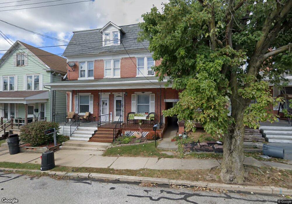
319 W Maple St Red Lion, PA 17356
Estimated Value: $156,000 - $177,000
3
Beds
1
Bath
1,736
Sq Ft
$96/Sq Ft
Est. Value
About This Home
This home is located at 319 W Maple St, Red Lion, PA 17356 and is currently estimated at $166,221, approximately $95 per square foot. 319 W Maple St is a home located in York County with nearby schools including Mazie Gable Elementary School, Red Lion Area Junior High School, and Red Lion Area Senior High School.
Ownership History
Date
Name
Owned For
Owner Type
Purchase Details
Closed on
Jun 24, 2009
Sold by
Horn Martha A and Horn Michael A
Bought by
Horn Michael A and Horn Martha A
Current Estimated Value
Home Financials for this Owner
Home Financials are based on the most recent Mortgage that was taken out on this home.
Original Mortgage
$64,800
Outstanding Balance
$41,140
Interest Rate
4.86%
Mortgage Type
New Conventional
Estimated Equity
$125,081
Purchase Details
Closed on
Sep 24, 2003
Sold by
Sinclair Enos E and Sinclair Shirley Joann
Bought by
Hilliar Martha A
Create a Home Valuation Report for This Property
The Home Valuation Report is an in-depth analysis detailing your home's value as well as a comparison with similar homes in the area
Home Values in the Area
Average Home Value in this Area
Purchase History
| Date | Buyer | Sale Price | Title Company |
|---|---|---|---|
| Horn Michael A | -- | None Available | |
| Hilliar Martha A | $67,500 | -- |
Source: Public Records
Mortgage History
| Date | Status | Borrower | Loan Amount |
|---|---|---|---|
| Open | Horn Michael A | $64,800 |
Source: Public Records
Tax History Compared to Growth
Tax History
| Year | Tax Paid | Tax Assessment Tax Assessment Total Assessment is a certain percentage of the fair market value that is determined by local assessors to be the total taxable value of land and additions on the property. | Land | Improvement |
|---|---|---|---|---|
| 2025 | $2,552 | $73,840 | $23,690 | $50,150 |
| 2024 | $2,450 | $73,840 | $23,690 | $50,150 |
| 2023 | $2,450 | $73,840 | $23,690 | $50,150 |
| 2022 | $2,450 | $73,840 | $23,690 | $50,150 |
| 2021 | $2,391 | $73,840 | $23,690 | $50,150 |
| 2020 | $2,391 | $73,840 | $23,690 | $50,150 |
| 2019 | $2,383 | $73,840 | $23,690 | $50,150 |
| 2018 | $2,383 | $73,840 | $23,690 | $50,150 |
| 2017 | $2,383 | $73,840 | $23,690 | $50,150 |
| 2016 | $0 | $73,840 | $23,690 | $50,150 |
| 2015 | -- | $73,840 | $23,690 | $50,150 |
| 2014 | -- | $73,840 | $23,690 | $50,150 |
Source: Public Records
Map
Nearby Homes
- 338 Atlantic Ave
- 321 Atlantic Ave
- 503 W Broadway
- 300 N Franklin St
- 81 1st Ave Unit E
- 79 1st Ave
- 220 W Broadway
- 314 Boundary Ave
- 400 Carriage Ln Unit 400
- 840 Country Club Rd
- 270 N Main St
- 131 Country Ridge Dr
- 126 Country Ridge Dr
- 157 E Broadway
- 415 N Main St
- 156 Country Ridge Dr
- 630 Woodland Ave
- 214 Equine Cove Unit 214
- 137 Furlong Way
- 260 Country Ridge Dr
- 317 W Maple St
- 321 W Maple St
- 315 W Maple St
- 323 W Maple St
- 329 W Maple St
- 331 W Maple St
- 333 W Maple St
- 324 W Maple St
- 335 W Maple St
- 326 W Maple St
- 206 N Franklin St
- 337 W Maple St
- 204 N Franklin St
- 202 N Franklin St
- 208 N Franklin St
- 328 W Maple St
- 210 N Franklin St
- 200 N Franklin St
- 330 W Maple St
- 130 N Franklin St