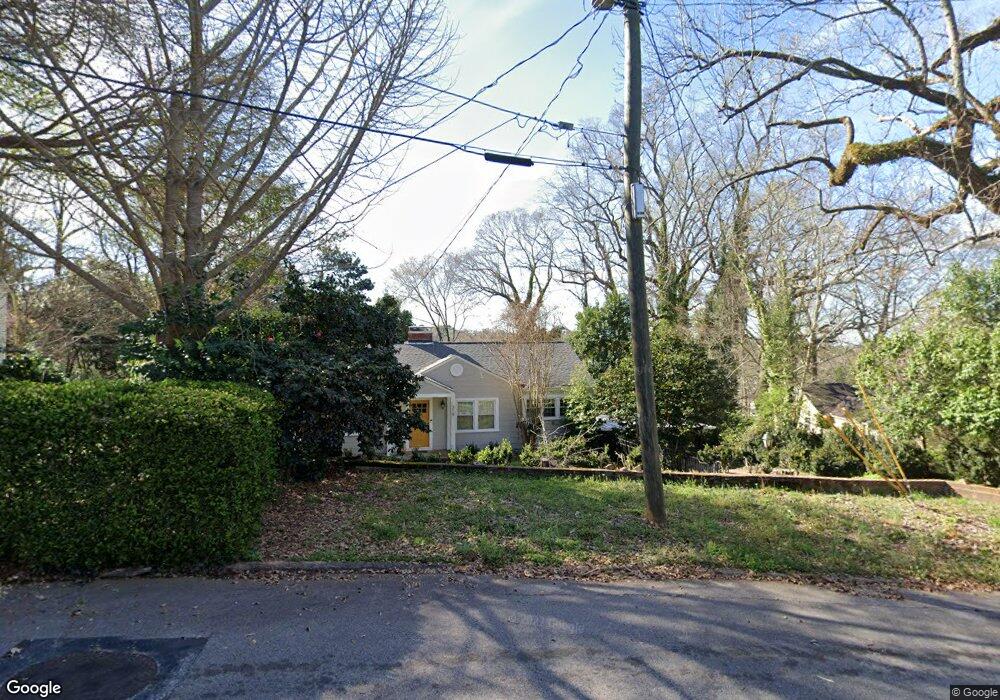
319 W Mclendon Cir Lagrange, GA 30240
Estimated Value: $166,000 - $243,257
3
Beds
1
Bath
1,596
Sq Ft
$128/Sq Ft
Est. Value
About This Home
This home is located at 319 W Mclendon Cir, Lagrange, GA 30240 and is currently estimated at $203,814, approximately $127 per square foot. 319 W Mclendon Cir is a home located in Troup County with nearby schools including Hollis Hand Elementary School, Ethel W. Kight Elementary School, and Franklin Forest Elementary School.
Ownership History
Date
Name
Owned For
Owner Type
Purchase Details
Closed on
May 10, 2019
Sold by
Secretary Of Housing And Urban Developme
Bought by
Miceli Hannah R
Current Estimated Value
Purchase Details
Closed on
Feb 5, 2019
Sold by
Suntrust Bank
Bought by
Secretary Of Housing And Urban Developme and C/O Information Systems & Network Corp
Purchase Details
Closed on
Feb 15, 1999
Sold by
Clements R
Bought by
Steven E Edwards
Purchase Details
Closed on
Dec 30, 1997
Sold by
Taunton Tim
Bought by
Clements R
Purchase Details
Closed on
Jul 29, 1988
Sold by
Mrs Agnes S Hale
Bought by
Taunton Tim
Purchase Details
Closed on
Sep 13, 1982
Sold by
Hale Johnson B
Bought by
Mrs Agnes S Hale
Purchase Details
Closed on
Jan 1, 1948
Bought by
Hale Johnson B
Create a Home Valuation Report for This Property
The Home Valuation Report is an in-depth analysis detailing your home's value as well as a comparison with similar homes in the area
Home Values in the Area
Average Home Value in this Area
Purchase History
| Date | Buyer | Sale Price | Title Company |
|---|---|---|---|
| Miceli Hannah R | $85,299 | -- | |
| Secretary Of Housing And Urban Developme | -- | -- | |
| Suntrust Bank | $117,040 | -- | |
| Steven E Edwards | $91,500 | -- | |
| Clements R | $81,000 | -- | |
| Taunton Tim | -- | -- | |
| Mrs Agnes S Hale | -- | -- | |
| Hale Johnson B | -- | -- |
Source: Public Records
Tax History Compared to Growth
Tax History
| Year | Tax Paid | Tax Assessment Tax Assessment Total Assessment is a certain percentage of the fair market value that is determined by local assessors to be the total taxable value of land and additions on the property. | Land | Improvement |
|---|---|---|---|---|
| 2024 | $1,683 | $61,708 | $18,000 | $43,708 |
| 2023 | $1,590 | $58,312 | $18,000 | $40,312 |
| 2022 | $1,413 | $50,632 | $14,000 | $36,632 |
| 2021 | $1,362 | $45,152 | $14,000 | $31,152 |
| 2020 | $1,362 | $45,152 | $14,000 | $31,152 |
| 2019 | $1,117 | $39,040 | $14,000 | $25,040 |
| 2018 | $1,117 | $39,040 | $14,000 | $25,040 |
| 2017 | $1,100 | $38,448 | $18,000 | $20,448 |
| 2016 | $1,103 | $38,550 | $18,000 | $20,550 |
| 2015 | $1,105 | $38,550 | $18,000 | $20,550 |
| 2014 | $1,094 | $38,126 | $18,000 | $20,126 |
| 2013 | -- | $39,864 | $9,000 | $30,864 |
Source: Public Records
Map
Nearby Homes
- 105 Saynor Cir
- 408 Gordon St
- 203 Waverly Way
- 110 Waverly Way
- 109 Waverly Way
- 705 Piney Woods Dr
- 609 Cherokee Rd
- 206 Broad St
- 209 Boulevard
- 208 Boulevard
- 609 Ridley Ave
- 707 Ridley Ave
- 611 Ridley Ave
- 615 Ridley Ave
- 709 Ridley Ave
- 0 Ridley Ave Unit 10550104
- 219 Banks St
- 109 Thomas St
- 301 E Bacon St
- 500 Boulevard
- 315 W Mclendon Cir
- 323 W Mclendon Cir
- W W Mclendon Cir
- 311 W Mclendon Cir
- 308 Springdale Dr
- 306 Springdale Dr
- 400 Springdale Dr
- 304 Springdale Dr
- 309 W Mclendon Cir
- 509 Sylvan Dr
- 511 Sylvan Dr
- 507 Sylvan Dr
- 404 Springdale Dr
- 402 Springdale Dr
- 505 Sylvan Dr
- 300 Springdale Dr
- 307 W Mclendon Cir
- 320 E Mclendon Cir
- 406 Springdale Dr
- 328 W Mclendon Cir