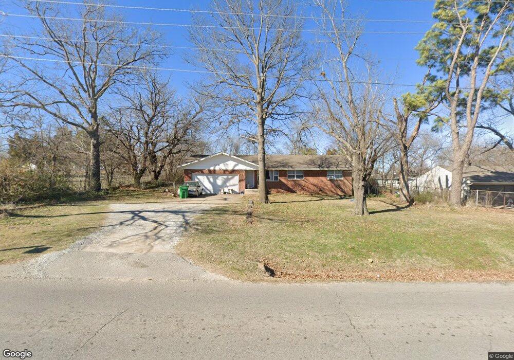
319 W Teel Rd Sapulpa, OK 74066
Estimated Value: $195,632 - $232,000
3
Beds
2
Baths
1,597
Sq Ft
$133/Sq Ft
Est. Value
About This Home
This home is located at 319 W Teel Rd, Sapulpa, OK 74066 and is currently estimated at $211,908, approximately $132 per square foot. 319 W Teel Rd is a home located in Creek County with nearby schools including Sapulpa Middle School, Sapulpa Junior High School, and Sapulpa High School.
Ownership History
Date
Name
Owned For
Owner Type
Purchase Details
Closed on
Jul 14, 2006
Sold by
Bell Phillip M and Bell Amber J
Bought by
Cooper Diane M D
Current Estimated Value
Home Financials for this Owner
Home Financials are based on the most recent Mortgage that was taken out on this home.
Original Mortgage
$105,300
Outstanding Balance
$72,437
Interest Rate
9.85%
Mortgage Type
Adjustable Rate Mortgage/ARM
Estimated Equity
$139,471
Create a Home Valuation Report for This Property
The Home Valuation Report is an in-depth analysis detailing your home's value as well as a comparison with similar homes in the area
Home Values in the Area
Average Home Value in this Area
Purchase History
| Date | Buyer | Sale Price | Title Company |
|---|---|---|---|
| Cooper Diane M D | $117,000 | Frisco Title Corp |
Source: Public Records
Mortgage History
| Date | Status | Borrower | Loan Amount |
|---|---|---|---|
| Open | Cooper Diane M D | $105,300 |
Source: Public Records
Tax History Compared to Growth
Tax History
| Year | Tax Paid | Tax Assessment Tax Assessment Total Assessment is a certain percentage of the fair market value that is determined by local assessors to be the total taxable value of land and additions on the property. | Land | Improvement |
|---|---|---|---|---|
| 2025 | $1,847 | $15,957 | $456 | $15,501 |
| 2024 | $1,847 | $15,197 | $456 | $14,741 |
| 2023 | $1,847 | $14,474 | $456 | $14,018 |
| 2022 | $1,583 | $13,785 | $456 | $13,329 |
| 2021 | $1,558 | $13,128 | $456 | $12,672 |
| 2020 | $1,525 | $12,931 | $456 | $12,475 |
| 2019 | $1,558 | $13,143 | $456 | $12,687 |
| 2018 | $1,696 | $14,017 | $876 | $13,141 |
| 2017 | $1,687 | $14,017 | $876 | $13,141 |
| 2016 | $1,604 | $14,017 | $876 | $13,141 |
| 2015 | -- | $14,017 | $876 | $13,141 |
| 2014 | -- | $14,017 | $876 | $13,141 |
Source: Public Records
Map
Nearby Homes
- 1965 S Scott St
- 2214 S Poplar St
- 605 W Mockingbird Ln
- 1915 S Muskogee St
- 1836 S Oklahoma St
- 142 W Fairlane Ct
- 41 W Fairlane Ct
- 273 W Fairlane Dr
- 19 E Fairlane Ct
- 2244 S Park St
- 416 W Fairlane Dr Unit A-B
- 119 E Ross Ave
- 1424 S Main St
- 103 E Fairlane Ct
- 120 E Burnham Ave
- 211 E Wells Blvd
- 209 W Norma St
- 121 E Davis Ave
- 1220 S Cedar St
- 925 S Oklahoma St
- 2035 S Hickory St
- 2028 S Cedar St
- 2024 S Cedar St
- 2020 S Cedar St
- 2011 S Hickory St
- 2016 S Cedar St
- 2012 S Cedar St
- 2025 S Cedar St
- 2029 S Cedar St
- 2021 S Cedar St
- 98 W Mike Ave
- 102 W Mike Ave
- 94 W Mike Ave
- 106 W Mike Ave
- 2017 S Cedar St
- 90 W Mike Ave
- 75 W Teel Rd
- 2013 S Cedar St
- 80 W Mike Ave
- 323 W Monterey Ave