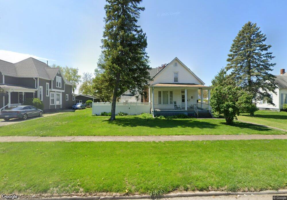
319 Wyatt Ave Lincoln, IL 62656
Estimated Value: $141,000 - $189,592
--
Bed
--
Bath
1,319
Sq Ft
$124/Sq Ft
Est. Value
About This Home
This home is located at 319 Wyatt Ave, Lincoln, IL 62656 and is currently estimated at $163,898, approximately $124 per square foot. 319 Wyatt Ave is a home located in Logan County with nearby schools including Washington-Monroe Elementary School, Lincoln Junior High School, and Lincoln Community High School.
Ownership History
Date
Name
Owned For
Owner Type
Purchase Details
Closed on
Jan 14, 2011
Sold by
Schall Wayne D
Bought by
Mckay Gary L and Mckay Cynthia L
Current Estimated Value
Home Financials for this Owner
Home Financials are based on the most recent Mortgage that was taken out on this home.
Original Mortgage
$124,000
Outstanding Balance
$84,701
Interest Rate
4.82%
Mortgage Type
Stand Alone First
Estimated Equity
$79,197
Create a Home Valuation Report for This Property
The Home Valuation Report is an in-depth analysis detailing your home's value as well as a comparison with similar homes in the area
Home Values in the Area
Average Home Value in this Area
Purchase History
| Date | Buyer | Sale Price | Title Company |
|---|---|---|---|
| Mckay Gary L | $155,000 | -- |
Source: Public Records
Mortgage History
| Date | Status | Borrower | Loan Amount |
|---|---|---|---|
| Open | Mckay Gary L | $124,000 |
Source: Public Records
Tax History Compared to Growth
Tax History
| Year | Tax Paid | Tax Assessment Tax Assessment Total Assessment is a certain percentage of the fair market value that is determined by local assessors to be the total taxable value of land and additions on the property. | Land | Improvement |
|---|---|---|---|---|
| 2024 | $3,530 | $44,500 | $9,480 | $35,020 |
| 2023 | $3,330 | $41,210 | $8,780 | $32,430 |
| 2022 | $3,209 | $38,520 | $8,210 | $30,310 |
| 2021 | $3,067 | $36,980 | $7,880 | $29,100 |
| 2020 | $3,019 | $36,430 | $7,760 | $28,670 |
| 2019 | $2,944 | $35,720 | $7,610 | $28,110 |
| 2018 | $2,910 | $35,020 | $7,460 | $27,560 |
| 2017 | $2,892 | $35,020 | $7,460 | $27,560 |
| 2016 | $2,817 | $34,980 | $7,450 | $27,530 |
| 2015 | $2,577 | $32,560 | $7,460 | $25,100 |
| 2014 | $2,577 | $32,560 | $7,460 | $25,100 |
| 2013 | $2,577 | $30,910 | $7,080 | $23,830 |
| 2012 | $2,577 | $31,470 | $7,210 | $24,260 |
Source: Public Records
Map
Nearby Homes
- 402 Wyatt Ave
- 418 Wyatt Ave
- 419 Decatur St
- 521 Decatur St
- 617 Decatur St
- 716 S Kickapoo St
- 502 Williamette Ave
- 802 Bryan Ave
- 410 S Chicago St
- 515 S Maple St Unit 517
- 929 Decatur St
- 311 S Logan St
- 1025 Broadway St
- 225 4th St
- 928 Broadway St
- 113 N Kickapoo St
- 403 S Elm St
- 228 4th St
- 413 S Elm St
- 1121 Broadway St
- 321 Wyatt Ave
- 303 Wyatt Ave
- 329 Wyatt Ave
- 210 Willard Ave
- 214 Willard Ave
- 528 S Mclean St
- 218 Willard Ave
- 228 Willard Ave
- 206 Willard Ave
- 320 Wyatt Ave
- 322 Wyatt Ave
- 328 Wyatt Ave
- 418 S Mclean St
- 409 Wyatt Ave
- 224 Wyatt Ave
- 203 Willard Ave
- 400 Wyatt Ave
- 419 S Mclean St
- 302 Willard Ave
- 414 S Mclean St