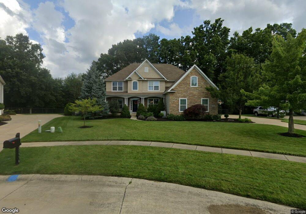
31912 Woodside Cir Avon Lake, OH 44012
Estimated Value: $658,507 - $718,000
4
Beds
5
Baths
3,175
Sq Ft
$219/Sq Ft
Est. Value
About This Home
This home is located at 31912 Woodside Cir, Avon Lake, OH 44012 and is currently estimated at $695,502, approximately $219 per square foot. 31912 Woodside Cir is a home located in Lorain County with nearby schools including Eastview Elementary School, Troy Intermediate Elementary School, and Learwood Middle School.
Ownership History
Date
Name
Owned For
Owner Type
Purchase Details
Closed on
Dec 16, 2010
Sold by
Lubbe Jacob D and Lubbe Agnesia
Bought by
Tinsley Jack Bryan and Tinsley Heather M
Current Estimated Value
Home Financials for this Owner
Home Financials are based on the most recent Mortgage that was taken out on this home.
Original Mortgage
$160,000
Outstanding Balance
$105,386
Interest Rate
4.16%
Mortgage Type
Unknown
Estimated Equity
$590,116
Purchase Details
Closed on
Aug 28, 2008
Sold by
Perritt Building Co
Bought by
Lubbe Jacob D and Lubbe Agnesia
Home Financials for this Owner
Home Financials are based on the most recent Mortgage that was taken out on this home.
Original Mortgage
$360,000
Interest Rate
6.31%
Mortgage Type
Purchase Money Mortgage
Create a Home Valuation Report for This Property
The Home Valuation Report is an in-depth analysis detailing your home's value as well as a comparison with similar homes in the area
Home Values in the Area
Average Home Value in this Area
Purchase History
| Date | Buyer | Sale Price | Title Company |
|---|---|---|---|
| Tinsley Jack Bryan | $450,000 | Lawyers Title Co | |
| Lubbe Jacob D | $450,000 | Lawyers Title Ins |
Source: Public Records
Mortgage History
| Date | Status | Borrower | Loan Amount |
|---|---|---|---|
| Open | Tinsley Jack Bryan | $160,000 | |
| Previous Owner | Lubbe Jacob D | $360,000 |
Source: Public Records
Tax History Compared to Growth
Tax History
| Year | Tax Paid | Tax Assessment Tax Assessment Total Assessment is a certain percentage of the fair market value that is determined by local assessors to be the total taxable value of land and additions on the property. | Land | Improvement |
|---|---|---|---|---|
| 2024 | $9,015 | $190,516 | $43,642 | $146,874 |
| 2023 | $9,408 | $176,880 | $45,070 | $131,810 |
| 2022 | $9,310 | $176,880 | $45,070 | $131,810 |
| 2021 | $9,289 | $176,880 | $45,070 | $131,810 |
| 2020 | $8,787 | $155,020 | $39,500 | $115,520 |
| 2019 | $8,741 | $155,020 | $39,500 | $115,520 |
Source: Public Records
Map
Nearby Homes
- 717 Schiller Ct
- 742 Brookside Cir
- 588 S Port Dr
- 725 Rock Harbor
- 693 Coronado Cir
- 544 Port Side Dr
- Castleton Plan at Port Side - Estates
- Oakmont Plan at Port Side - Reserve
- Continental II Plan at Port Side - Crossings
- Willwood Plan at Port Side - Estates
- Pebble Beach Plan at Port Side - Reserve
- Mercer II Plan at Port Side - Crossings
- Waverly Plan at Port Side - Crossings
- Augusta Plan at Port Side - Reserve
- Newberry II Plan at Port Side - Crossings
- Allison II Plan at Port Side - Estates
- Woodside Plan at Port Side - Estates
- 32000 Liberty Rose Dr
- 0 Lear Rd Unit 5155467
- 522 S Port Dr
- 31908 Woodside Cir
- 31916 Woodside Cir
- 31920 Woodside Cir
- 31904 Woodside Cir
- 31913 Woodside Cir
- 31917 Woodside Cir
- 31909 Woodside Cir
- 31905 Woodside Cir
- 31900 Woodside Cir
- 31912 Fieldstone Cir
- 31908 Fieldstone Cir
- 31901 Woodside Cir
- 31896 Woodside Cir
- 658 Treeside Ln
- 31904 Fieldstone Cir
- 656 Treeside Ln
- 660 Treeside Ln
- 729 Schiller Ct
- 733 Schiller Ct
- 652 Treeside Ln