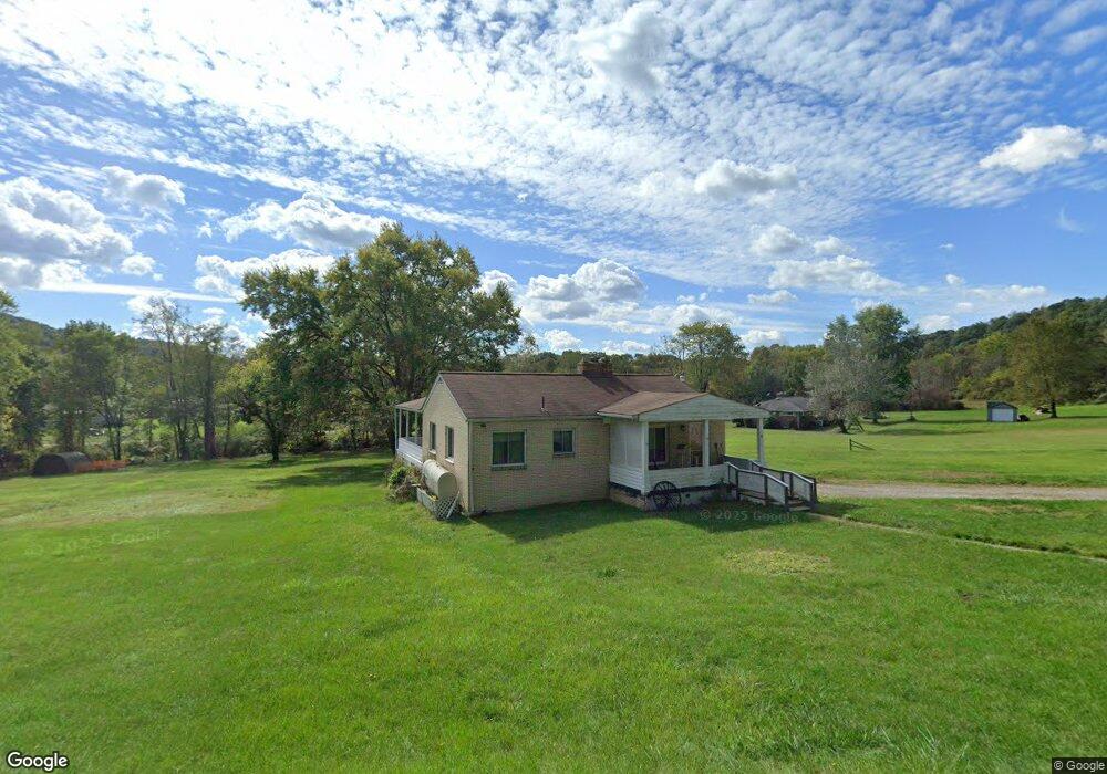
3193 Green Garden Rd Aliquippa, PA 15001
Hopewell Township NeighborhoodEstimated Value: $155,000 - $197,576
3
Beds
1
Bath
925
Sq Ft
$189/Sq Ft
Est. Value
About This Home
This home is located at 3193 Green Garden Rd, Aliquippa, PA 15001 and is currently estimated at $175,144, approximately $189 per square foot. 3193 Green Garden Rd is a home located in Beaver County with nearby schools including Hopewell Senior High School, Bethel Christian School, and Our Lady Of Fatima Elementary School.
Ownership History
Date
Name
Owned For
Owner Type
Purchase Details
Closed on
Apr 14, 2023
Sold by
Gill Thelma Lorraine
Bought by
Burrow Sean D
Current Estimated Value
Home Financials for this Owner
Home Financials are based on the most recent Mortgage that was taken out on this home.
Original Mortgage
$114,460
Outstanding Balance
$111,308
Interest Rate
6.65%
Mortgage Type
New Conventional
Estimated Equity
$63,836
Create a Home Valuation Report for This Property
The Home Valuation Report is an in-depth analysis detailing your home's value as well as a comparison with similar homes in the area
Home Values in the Area
Average Home Value in this Area
Purchase History
| Date | Buyer | Sale Price | Title Company |
|---|---|---|---|
| Burrow Sean D | $118,000 | Penn Bridge Land Abstract |
Source: Public Records
Mortgage History
| Date | Status | Borrower | Loan Amount |
|---|---|---|---|
| Open | Burrow Sean D | $114,460 |
Source: Public Records
Tax History Compared to Growth
Tax History
| Year | Tax Paid | Tax Assessment Tax Assessment Total Assessment is a certain percentage of the fair market value that is determined by local assessors to be the total taxable value of land and additions on the property. | Land | Improvement |
|---|---|---|---|---|
| 2025 | $2,121 | $88,450 | $13,200 | $75,250 |
| 2024 | $3,188 | $88,450 | $13,200 | $75,250 |
| 2023 | $2,763 | $21,850 | $1,500 | $20,350 |
| 2022 | $2,626 | $21,850 | $1,500 | $20,350 |
| 2021 | $2,626 | $21,850 | $1,500 | $20,350 |
| 2020 | $2,539 | $21,850 | $1,500 | $20,350 |
| 2019 | $2,495 | $21,850 | $1,500 | $20,350 |
| 2018 | $2,452 | $21,850 | $1,500 | $20,350 |
| 2017 | $2,452 | $21,850 | $1,500 | $20,350 |
| 2016 | $2,320 | $21,850 | $1,500 | $20,350 |
| 2015 | $485 | $21,850 | $1,500 | $20,350 |
| 2014 | $485 | $21,850 | $1,500 | $20,350 |
Source: Public Records
Map
Nearby Homes
- 104 Patti Ln
- 959 Independence Rd
- 2799 Johnson St
- 14 Cedar Ave
- 105 Cherry Ln
- 2630 Kane Rd
- 2356 West St
- 3013 Woodfield Dr
- 126 Chestnut St
- 1182 Airport Rd
- 2354 Ritchie St
- 2429 W Wade St
- 2515 Martha St
- 2330 Ritchie St
- 0 Chapel Rd Unit 1707634
- 2757 Brodhead Rd
- 2605 Marion St
- 0 Airport Rd Unit 1722586
- 0 Airport Rd Unit 1692178
- 0 Todd Rd Unit 1724113
- 117 Patti Ln
- 3189 Green Garden Rd
- 3185 Green Garden Rd
- 114 Patti Ln
- 112 Patti Ln
- 116 Patti Ln
- 111 Patti Ln
- 3179 Green Garden Rd
- 110 Patti Ln
- 1130 Parrish Dr
- 3180 Green Garden Rd
- 108 Patti Ln
- 1129 Parrish Dr
- 1119 Parrish Dr
- 109 Patti Ln
- 3167 Green Garden Rd
- 1115 Parrish Dr
- 1111 Parrish Dr
- 3161 Green Garden Rd
- 1133 Parrish Dr