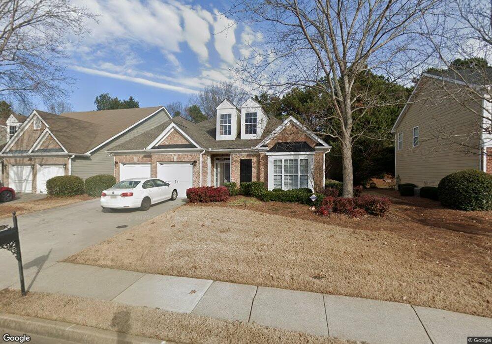
3195 the Commons Dr Cumming, GA 30041
Big Creek NeighborhoodEstimated Value: $569,000 - $626,000
3
Beds
2
Baths
2,448
Sq Ft
$243/Sq Ft
Est. Value
About This Home
This home is located at 3195 the Commons Dr, Cumming, GA 30041 and is currently estimated at $596,047, approximately $243 per square foot. 3195 the Commons Dr is a home located in Forsyth County with nearby schools including Sharon Elementary School, South Forsyth Middle School, and South Forsyth High School.
Ownership History
Date
Name
Owned For
Owner Type
Purchase Details
Closed on
Nov 17, 2010
Sold by
Wall Family Trust
Bought by
Henson Martha E
Current Estimated Value
Purchase Details
Closed on
Mar 17, 2009
Sold by
Wall Clarence M
Bought by
Wall Family Trust
Purchase Details
Closed on
Jun 28, 2007
Sold by
Essex Lauren S
Bought by
Henson Martha B and Wall Clarence
Home Financials for this Owner
Home Financials are based on the most recent Mortgage that was taken out on this home.
Original Mortgage
$148,916
Interest Rate
6.16%
Mortgage Type
New Conventional
Purchase Details
Closed on
Jan 18, 2004
Sold by
D R Horton Inc
Bought by
Essex Lauren S
Home Financials for this Owner
Home Financials are based on the most recent Mortgage that was taken out on this home.
Original Mortgage
$184,000
Interest Rate
4.88%
Mortgage Type
New Conventional
Create a Home Valuation Report for This Property
The Home Valuation Report is an in-depth analysis detailing your home's value as well as a comparison with similar homes in the area
Home Values in the Area
Average Home Value in this Area
Purchase History
| Date | Buyer | Sale Price | Title Company |
|---|---|---|---|
| Henson Martha E | $93,300 | -- | |
| Wall Family Trust | -- | -- | |
| Henson Martha B | $275,000 | -- | |
| Essex Lauren S | $230,000 | -- |
Source: Public Records
Mortgage History
| Date | Status | Borrower | Loan Amount |
|---|---|---|---|
| Previous Owner | Henson Martha B | $148,916 | |
| Previous Owner | Essex Lauren S | $184,000 |
Source: Public Records
Tax History Compared to Growth
Tax History
| Year | Tax Paid | Tax Assessment Tax Assessment Total Assessment is a certain percentage of the fair market value that is determined by local assessors to be the total taxable value of land and additions on the property. | Land | Improvement |
|---|---|---|---|---|
| 2025 | $731 | $218,300 | $78,000 | $140,300 |
| 2024 | $731 | $205,348 | $66,000 | $139,348 |
| 2023 | $634 | $193,548 | $62,000 | $131,548 |
| 2022 | $739 | $137,488 | $40,000 | $97,488 |
| 2021 | $708 | $137,488 | $40,000 | $97,488 |
| 2020 | $704 | $133,224 | $40,000 | $93,224 |
| 2019 | $708 | $132,476 | $40,000 | $92,476 |
| 2018 | $687 | $103,572 | $26,000 | $77,572 |
| 2017 | $695 | $101,624 | $26,000 | $75,624 |
| 2016 | $695 | $101,624 | $26,000 | $75,624 |
| 2015 | $695 | $101,624 | $26,000 | $75,624 |
| 2014 | $612 | $87,040 | $0 | $0 |
Source: Public Records
Map
Nearby Homes
- 2245 Thames Ct
- 355 Laurel Oak Dr
- 2250 Thames Ct
- 2255 Windsor Bluffs Dr
- 2260 Thames Ct
- 4050 Homestead Ridge Dr
- 3275 Cherry Oak Ln Unit 11
- 2690 Portabella Ln
- 3440 Ronnie Ln
- 2850 Brandy Ln
- 2380 Manor Creek Ct
- 3345 Cherry Oak Ln
- 7065 Laurel Oak Dr
- 3440 Canyon Oak Way
- 6505 Caldwell Ct
- Rosalynn with Basement Plan at Jason's Walk
- Ivywood Elite Plan at Westover
- Juneau Elite Plan at Westover
- Hillstone 3-Car Plan at Westover
- Rosalynn Plan at Jason's Walk
- 3185 the Commons Dr
- 3205 the Commons Dr
- 3175 the Commons Dr
- 3215 the Commons Dr
- 3190 the Commons Dr
- 3165 the Commons Dr
- 3210 the Commons Dr
- 3180 the Commons Dr
- 3170 the Commons Dr
- 3225 the Commons Dr
- 3155 the Commons Dr
- 3235 the Commons Dr
- 3160 the Commons Dr
- 3320 Olivia Ct
- 3245 the Commons Dr
- 3145 the Commons Dr
- 3310 Olivia Ct
- 3330 Olivia Ct
- 3340 Olivia Ct
- 3150 the Commons Dr