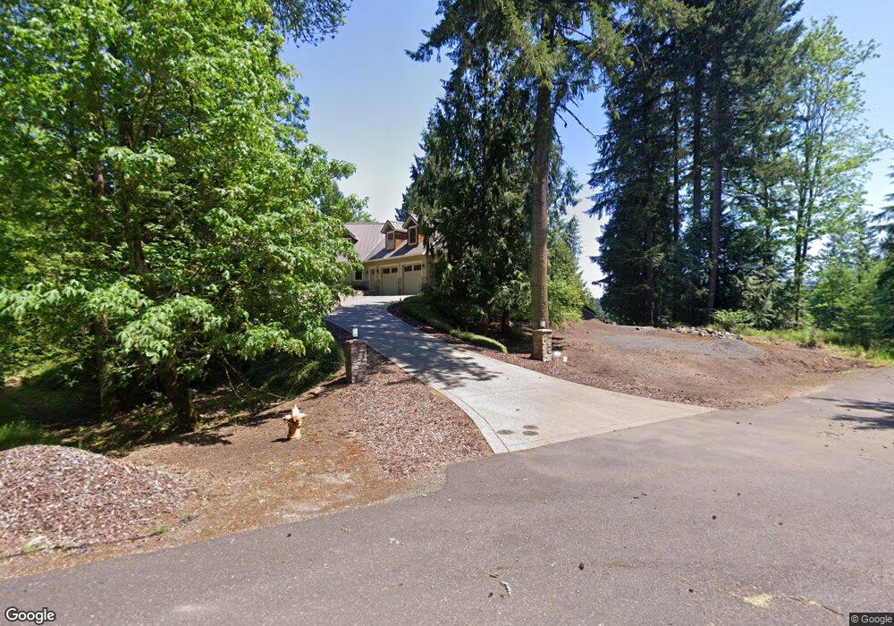
31954 Wayside Ct Scappoose, OR 97056
Estimated Value: $998,597 - $1,130,000
5
Beds
4
Baths
6,220
Sq Ft
$168/Sq Ft
Est. Value
About This Home
This home is located at 31954 Wayside Ct, Scappoose, OR 97056 and is currently estimated at $1,043,199, approximately $167 per square foot. 31954 Wayside Ct is a home located in Columbia County with nearby schools including Scappoose High School.
Ownership History
Date
Name
Owned For
Owner Type
Purchase Details
Closed on
Apr 11, 2017
Sold by
Tonneson Stanley M and Tonneson Jenice M
Bought by
The Jenise Joy Tonnesson & Stanley Hans
Current Estimated Value
Purchase Details
Closed on
May 17, 2016
Sold by
Rogers Alan J and Rogers Suzanne M
Bought by
Tonneson Stanley H and Tonneson Jeniece M
Home Financials for this Owner
Home Financials are based on the most recent Mortgage that was taken out on this home.
Original Mortgage
$417,000
Outstanding Balance
$331,202
Interest Rate
3.59%
Mortgage Type
New Conventional
Estimated Equity
$711,997
Create a Home Valuation Report for This Property
The Home Valuation Report is an in-depth analysis detailing your home's value as well as a comparison with similar homes in the area
Purchase History
| Date | Buyer | Sale Price | Title Company |
|---|---|---|---|
| The Jenise Joy Tonnesson & Stanley Hans | -- | None Available | |
| Tonneson Stanley H | $1,005,000 | Ticor Title |
Source: Public Records
Mortgage History
| Date | Status | Borrower | Loan Amount |
|---|---|---|---|
| Open | Tonneson Stanley H | $417,000 |
Source: Public Records
Tax History
| Year | Tax Paid | Tax Assessment Tax Assessment Total Assessment is a certain percentage of the fair market value that is determined by local assessors to be the total taxable value of land and additions on the property. | Land | Improvement |
|---|---|---|---|---|
| 2025 | $9,529 | $713,910 | $149,140 | $564,770 |
| 2024 | $9,258 | $693,120 | $144,800 | $548,320 |
| 2023 | $9,217 | $672,940 | $136,970 | $535,970 |
| 2022 | $8,803 | $653,340 | $132,980 | $520,360 |
| 2021 | $8,554 | $634,320 | $129,960 | $504,360 |
| 2020 | $7,849 | $615,850 | $114,930 | $500,920 |
| 2019 | $7,652 | $597,920 | $110,190 | $487,730 |
| 2018 | $7,446 | $580,510 | $86,160 | $494,350 |
| 2017 | $7,336 | $563,610 | $83,650 | $479,960 |
| 2016 | $7,273 | $547,200 | $81,220 | $465,980 |
| 2015 | $6,868 | $531,270 | $69,090 | $462,180 |
| 2014 | $6,706 | $515,800 | $83,050 | $432,750 |
Source: Public Records
Map
Nearby Homes
- 0 Hawthorne Unit 8 23537227
- 0 Hawthorne Unit 10 23372609
- 0 Hawthorne Unit 9 23026376
- 0 Callahan Unit 28 23508167
- 0 Callahan Unit 26 23220367
- 0 Callahan Unit 27
- 24 Callahan
- 4 Briarwood Dr Unit 4
- 33281 Kammeyer Rd
- 33370 SW Rokin Way
- 33374 SW Rokin Way
- 33375 SW Rokin Way
- 51082 SW Klompen St
- 51086 SW Klompen St
- 51092 SW Klompen St
- 51350 SW Randstad St
- 51096 SW Klompen St
- 51096 SW Klompen St Unit H138
- 51083 SW Amsterdam Ln
- 51380 SW Randstad St
- 3 Wayside Ct
- 0 Wayside Ct Unit 9017547
- 0 Wayside Ct Unit 9017536
- 0 Wayside Ct Unit 9017522
- 0 Wayside Ct Unit 10004220
- 0 Wayside Ct Unit 10010004
- 0 Wayside Ct Unit Lot 6
- 6 Wayside Ct Unit 6
- 1 Wayside Ct Unit 1
- 2 Wayside Ct Unit 2
- 5 Wayside Ct Unit 5
- 31921 Wayside Ct
- 31967 Wayside Ct
- 31910 Wayside Ct
- 50603 Crystal Ridge Dr
- 31886 Wayside Ct
- 0 Maple Meadows Unit Lot 6 19040573
- 0 Maple Meadows Unit 2 19593941
- 0 Maple Meadows Unit 3 19277791
- 50611 Hemlock Ave
Your Personal Tour Guide
Ask me questions while you tour the home.