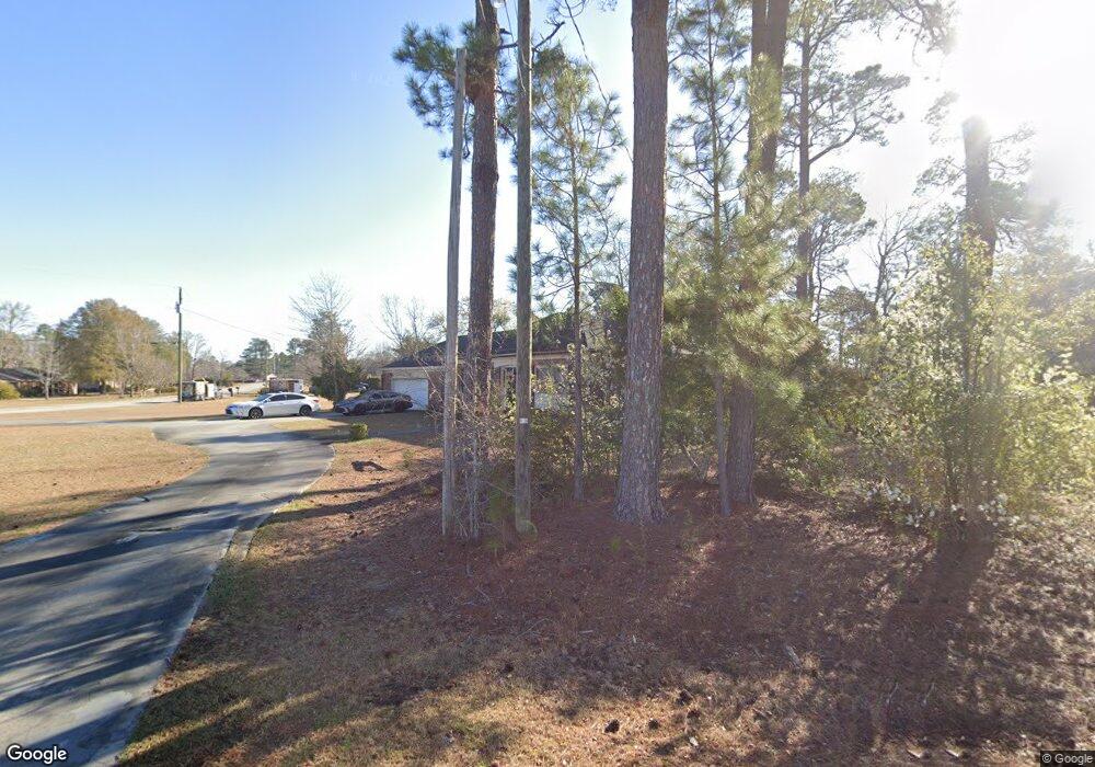
3196 Connor Ln Orangeburg, SC 29118
Estimated Value: $201,000 - $246,000
3
Beds
2
Baths
1,615
Sq Ft
$140/Sq Ft
Est. Value
About This Home
This home is located at 3196 Connor Ln, Orangeburg, SC 29118 and is currently estimated at $226,527, approximately $140 per square foot. 3196 Connor Ln is a home located in Orangeburg County with nearby schools including Marshall Elementary School, Marshall Elementary, and William J. Clark Middle School.
Ownership History
Date
Name
Owned For
Owner Type
Purchase Details
Closed on
Mar 9, 2007
Sold by
Tanner Dustin J
Bought by
Thompson David E and Thompson Cynthia D
Current Estimated Value
Home Financials for this Owner
Home Financials are based on the most recent Mortgage that was taken out on this home.
Original Mortgage
$138,000
Outstanding Balance
$83,163
Interest Rate
6.18%
Mortgage Type
Purchase Money Mortgage
Estimated Equity
$143,364
Purchase Details
Closed on
Jun 30, 2004
Sold by
Ardis Robert C and Ardis Sara S
Bought by
Tanner Dustin J
Create a Home Valuation Report for This Property
The Home Valuation Report is an in-depth analysis detailing your home's value as well as a comparison with similar homes in the area
Home Values in the Area
Average Home Value in this Area
Purchase History
| Date | Buyer | Sale Price | Title Company |
|---|---|---|---|
| Thompson David E | $140,300 | None Available | |
| Tanner Dustin J | $82,500 | -- |
Source: Public Records
Mortgage History
| Date | Status | Borrower | Loan Amount |
|---|---|---|---|
| Open | Thompson David E | $138,000 |
Source: Public Records
Tax History Compared to Growth
Tax History
| Year | Tax Paid | Tax Assessment Tax Assessment Total Assessment is a certain percentage of the fair market value that is determined by local assessors to be the total taxable value of land and additions on the property. | Land | Improvement |
|---|---|---|---|---|
| 2024 | $1,083 | $6,740 | $760 | $5,980 |
| 2023 | $866 | $4,896 | $720 | $4,176 |
| 2022 | $842 | $4,896 | $720 | $4,176 |
| 2021 | $832 | $4,896 | $720 | $4,176 |
| 2020 | $812 | $4,896 | $720 | $4,176 |
| 2019 | $817 | $4,896 | $720 | $4,176 |
| 2018 | $778 | $4,964 | $720 | $4,244 |
| 2017 | $748 | $4,964 | $0 | $0 |
| 2016 | $749 | $4,964 | $0 | $0 |
| 2015 | $709 | $4,964 | $0 | $0 |
| 2014 | $709 | $4,964 | $720 | $4,244 |
| 2013 | -- | $4,904 | $720 | $4,184 |
Source: Public Records
Map
Nearby Homes
- 673 Heyward Dr
- 109 Kirkwood Ct
- 170 Willow Bay Dr
- 171 Willow Bay Dr
- 167 Willow Bay Dr
- 796 Heyward Dr
- 150 Willow Bay Dr
- 135 Willow Bay Dr
- HARRISON Plan at Mulberry Landing
- DEVON Plan at Mulberry Landing
- CAMERON Plan at Mulberry Landing
- ALLEX Plan at Mulberry Landing
- 113 Kirkwood Ct
- 101 Kirkwood Dr
- 167 Tahoe Dr
- 137 Tahoe Dr
- 106 Kirkwood Ct
- 163 Tahoe Dr
- 761 Partridge Rd
- 0 Partridge Rd
- 689 Alexander Dr
- 718 Barrington Dr
- 678 Hampton Dr
- 692 Hampton Dr
- 721 Barrington Dr
- 696 Alexander Dr
- 668 Hampton Dr
- 3241 Connor Ln
- 654 Hampton Dr
- 722 Hampton Dr
- 763 Barrington Dr
- 763 Barrington Dr
- 763 Barrington Dr
- 763 Barrington Dr
- 763 Barrington Dr
- 688 Alexander Dr
- 739 Barrington Dr
- 736 Barrington Dr
- 653 Alexander Dr
- 737 Heyward Dr
