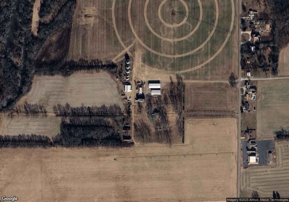
3196 Old Highway 431 Owens Cross Roads, AL 35763
Estimated Value: $574,000 - $792,640
--
Bed
1
Bath
4,100
Sq Ft
$161/Sq Ft
Est. Value
About This Home
This home is located at 3196 Old Highway 431, Owens Cross Roads, AL 35763 and is currently estimated at $659,880, approximately $160 per square foot. 3196 Old Highway 431 is a home with nearby schools including Owens Cross Roads Elementary School and New Hope High School.
Ownership History
Date
Name
Owned For
Owner Type
Purchase Details
Closed on
Feb 4, 2025
Sold by
Mann Gardiner Wilson and Mann Johnna F
Bought by
Mann Fraizer Wilson and Mann Kathryn
Current Estimated Value
Purchase Details
Closed on
Apr 14, 2010
Sold by
Mann Era Jean
Bought by
Mann Gardiner Wilson and Mann Johnna F
Home Financials for this Owner
Home Financials are based on the most recent Mortgage that was taken out on this home.
Original Mortgage
$100,000
Interest Rate
5.06%
Mortgage Type
Credit Line Revolving
Create a Home Valuation Report for This Property
The Home Valuation Report is an in-depth analysis detailing your home's value as well as a comparison with similar homes in the area
Home Values in the Area
Average Home Value in this Area
Purchase History
| Date | Buyer | Sale Price | Title Company |
|---|---|---|---|
| Mann Fraizer Wilson | $541,500 | None Listed On Document | |
| Mann Gardiner Wilson | -- | -- |
Source: Public Records
Mortgage History
| Date | Status | Borrower | Loan Amount |
|---|---|---|---|
| Previous Owner | Mann Gardiner | $150,000 | |
| Previous Owner | Mann Gardine Wilson | $100,000 |
Source: Public Records
Tax History Compared to Growth
Tax History
| Year | Tax Paid | Tax Assessment Tax Assessment Total Assessment is a certain percentage of the fair market value that is determined by local assessors to be the total taxable value of land and additions on the property. | Land | Improvement |
|---|---|---|---|---|
| 2024 | $1,204 | $30,920 | $3,260 | $27,660 |
| 2023 | $1,204 | $30,060 | $3,220 | $26,840 |
| 2022 | $1,051 | $27,140 | $2,460 | $24,680 |
| 2021 | $968 | $25,080 | $2,460 | $22,620 |
| 2020 | $809 | $23,000 | $3,980 | $19,020 |
| 2019 | $780 | $22,280 | $3,980 | $18,300 |
| 2018 | $756 | $19,860 | $0 | $0 |
| 2017 | $756 | $19,860 | $0 | $0 |
| 2016 | $756 | $19,860 | $0 | $0 |
| 2015 | $756 | $19,860 | $0 | $0 |
| 2014 | -- | $19,300 | $0 | $0 |
Source: Public Records
Map
Nearby Homes
- 16 Old 431 Hwy
- 5 U S 431
- 24 Acres U S 431
- 3 acres Highway 431 S
- 713 Rock Spring Rd
- 7306 Pine Run Ln
- 102 Vulcan St
- 104 Vulcan St
- 106 Vulcan St
- 108 Vulcan St
- 110 Vulcan St
- 114 Vulcan St
- 116 Vulcan St
- 124 Vulcan St
- 126 Vulcan St
- 128 Vulcan St
- 10.45 acres Rock Spring Rd
- 11 Acres Rock Spring Rd Unit LOT 24
- 6.5 Acres Rock Spring Rd
- The Butler Plan at Ramsay Cove
- 3171 Old Highway 431
- 3181 Old Highway 431
- 3191 Old Highway 431
- 3161 Old Highway 431
- 3221 Old Highway 431
- 3137 Old Highway 431
- 3127 Old Highway 431
- 3117 Old Highway 431
- 3109 Old Highway 431
- 3091 Old Highway 431
- 168 Sneed Ave
- 2593 Old Highway 431
- 22 acres Old Highway 431
- 1 Old Highway 431
- 2041 Old Highway 431
- 181 Sneed Ave
- 177 Sneed Ave
- 3083 Old Highway 431
- 158 Sneed Ave
- 146 Sneed Ave
