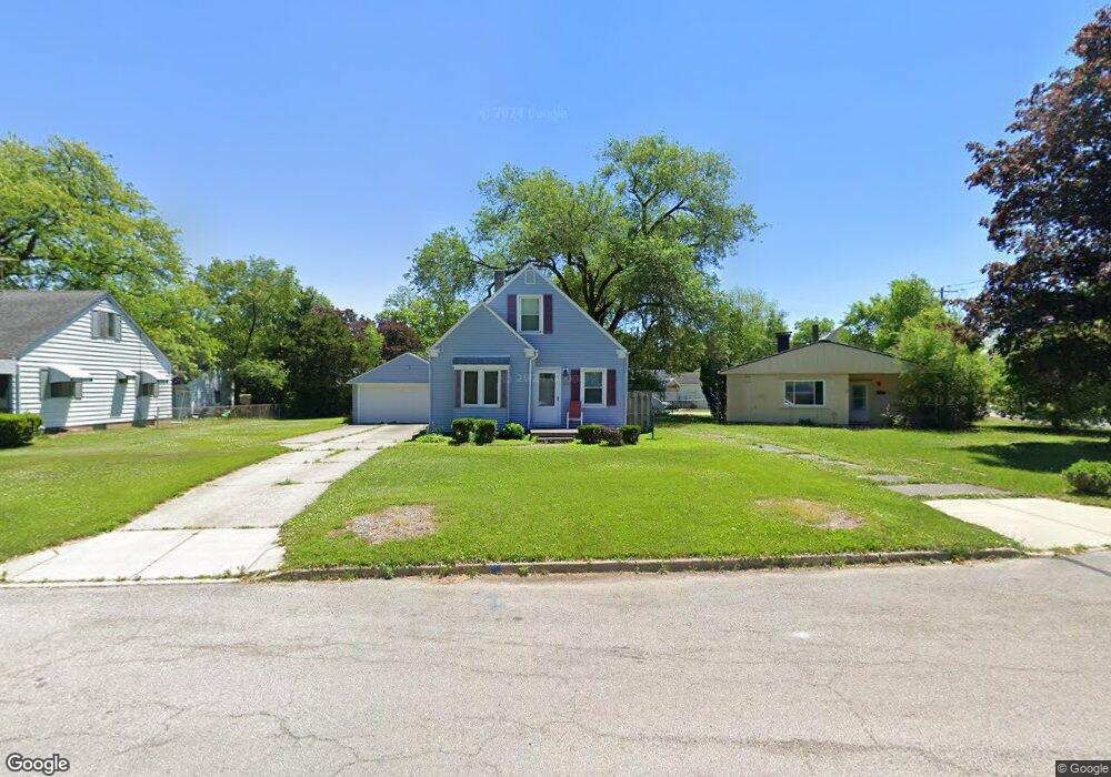
3197 Daleford Dr Toledo, OH 43614
Beverly NeighborhoodEstimated Value: $132,000 - $171,000
4
Beds
1
Bath
1,456
Sq Ft
$105/Sq Ft
Est. Value
About This Home
This home is located at 3197 Daleford Dr, Toledo, OH 43614 and is currently estimated at $153,289, approximately $105 per square foot. 3197 Daleford Dr is a home located in Lucas County with nearby schools including Beverly Elementary School, Bowsher High School, and St. Patrick of Heatherdowns School.
Ownership History
Date
Name
Owned For
Owner Type
Purchase Details
Closed on
Jun 13, 2008
Sold by
Lewinski William E and Lewinski Tiffany
Bought by
Akins Donald R
Current Estimated Value
Home Financials for this Owner
Home Financials are based on the most recent Mortgage that was taken out on this home.
Original Mortgage
$94,274
Outstanding Balance
$60,619
Interest Rate
6.09%
Mortgage Type
FHA
Estimated Equity
$92,670
Purchase Details
Closed on
Jul 8, 2006
Sold by
Rasmus Alison K
Bought by
Lewinski William E
Home Financials for this Owner
Home Financials are based on the most recent Mortgage that was taken out on this home.
Original Mortgage
$95,000
Interest Rate
6.7%
Mortgage Type
Purchase Money Mortgage
Purchase Details
Closed on
Jan 2, 1998
Sold by
Robedeau Eugene A and Robedeau Marlene P
Bought by
Miller Anne M
Home Financials for this Owner
Home Financials are based on the most recent Mortgage that was taken out on this home.
Original Mortgage
$61,796
Interest Rate
7.28%
Create a Home Valuation Report for This Property
The Home Valuation Report is an in-depth analysis detailing your home's value as well as a comparison with similar homes in the area
Home Values in the Area
Average Home Value in this Area
Purchase History
| Date | Buyer | Sale Price | Title Company |
|---|---|---|---|
| Akins Donald R | $95,500 | Attorney | |
| Lewinski William E | $95,000 | None Available | |
| Miller Anne M | $55,500 | -- |
Source: Public Records
Mortgage History
| Date | Status | Borrower | Loan Amount |
|---|---|---|---|
| Open | Akins Donald R | $94,274 | |
| Previous Owner | Lewinski William E | $95,000 | |
| Previous Owner | Miller Anne M | $61,796 |
Source: Public Records
Tax History Compared to Growth
Tax History
| Year | Tax Paid | Tax Assessment Tax Assessment Total Assessment is a certain percentage of the fair market value that is determined by local assessors to be the total taxable value of land and additions on the property. | Land | Improvement |
|---|---|---|---|---|
| 2024 | $866 | $28,175 | $5,495 | $22,680 |
| 2023 | $1,725 | $27,020 | $4,830 | $22,190 |
| 2022 | $1,727 | $27,020 | $4,830 | $22,190 |
| 2021 | $1,768 | $27,020 | $4,830 | $22,190 |
| 2020 | $1,749 | $23,590 | $6,125 | $17,465 |
| 2019 | $1,702 | $23,590 | $6,125 | $17,465 |
| 2018 | $1,720 | $23,590 | $6,125 | $17,465 |
| 2017 | $1,753 | $23,065 | $5,985 | $17,080 |
| 2016 | $1,748 | $65,900 | $17,100 | $48,800 |
| 2015 | $1,732 | $65,900 | $17,100 | $48,800 |
| 2014 | $1,451 | $23,070 | $5,990 | $17,080 |
| 2013 | $1,451 | $23,070 | $5,990 | $17,080 |
Source: Public Records
Map
Nearby Homes
- 2930 S Byrne Rd
- 3054 S Byrne Rd
- 3626 Greenlawn Ct
- 3128 Penrose Ave
- 4113 S Detroit Ave
- 3619 Prairie Ave
- 3111 Astor Ave
- 3627 Golfgate Dr
- 2134 Tedrow Rd
- 4213 Rugby Dr
- 4320 Beverly Dr
- 4224 Beverly Dr
- 3214 Escott Ave
- 3148 Glanzman Rd
- 3157 Dorian Dr
- 3264 Escott Ave
- 4669 S Detroit Ave
- 3157 Strathmoor Ave
- 5022 Stengel Ave
- 3728 Richlawn Dr
- 3193 Daleford Dr
- 2975 S Byrne Rd
- 3189 Daleford Dr
- 2979 S Byrne Rd
- 4034 Folkstone Rd
- 3185 Daleford Dr
- 4030 Folkstone Rd
- 2985 S Byrne Rd
- 3194 Daleford Dr
- 3181 Daleford Dr
- 4024 Folkstone Rd
- 3184 Daleford Dr
- 2990 S Byrne Rd
- 3175 Daleford Dr
- 4018 Folkstone Rd
- 2970 S Byrne Rd
- 2974 S Byrne Rd
- 2966 S Byrne Rd
- 3171 Daleford Dr
- 2955 S Byrne Rd