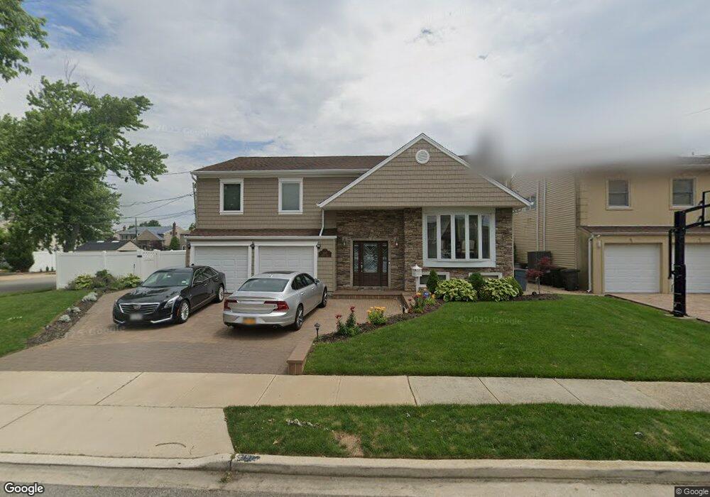
3197 Denton Dr Merrick, NY 11566
Estimated Value: $1,159,000 - $1,159,453
--
Bed
3
Baths
2,483
Sq Ft
$467/Sq Ft
Est. Value
About This Home
This home is located at 3197 Denton Dr, Merrick, NY 11566 and is currently estimated at $1,159,227, approximately $466 per square foot. 3197 Denton Dr is a home located in Nassau County with nearby schools including Burcham Elementary School, Merrick Avenue Middle School, and John F. Kennedy High School.
Ownership History
Date
Name
Owned For
Owner Type
Purchase Details
Closed on
Nov 29, 1999
Sold by
Kulberg Martin and Kulberg Vicki
Bought by
Lamonsoff Eric and Lamonsoff Michelle
Current Estimated Value
Home Financials for this Owner
Home Financials are based on the most recent Mortgage that was taken out on this home.
Original Mortgage
$369,200
Outstanding Balance
$110,260
Interest Rate
7.25%
Mortgage Type
Purchase Money Mortgage
Estimated Equity
$1,048,967
Create a Home Valuation Report for This Property
The Home Valuation Report is an in-depth analysis detailing your home's value as well as a comparison with similar homes in the area
Home Values in the Area
Average Home Value in this Area
Purchase History
| Date | Buyer | Sale Price | Title Company |
|---|---|---|---|
| Lamonsoff Eric | $461,500 | Commonwealth Land Title Ins |
Source: Public Records
Mortgage History
| Date | Status | Borrower | Loan Amount |
|---|---|---|---|
| Open | Lamonsoff Eric | $369,200 |
Source: Public Records
Tax History Compared to Growth
Tax History
| Year | Tax Paid | Tax Assessment Tax Assessment Total Assessment is a certain percentage of the fair market value that is determined by local assessors to be the total taxable value of land and additions on the property. | Land | Improvement |
|---|---|---|---|---|
| 2025 | $24,072 | $793 | $288 | $505 |
| 2024 | $5,485 | $793 | $288 | $505 |
| 2023 | $21,678 | $793 | $288 | $505 |
| 2022 | $21,678 | $793 | $288 | $505 |
| 2021 | $29,051 | $762 | $277 | $485 |
| 2020 | $19,788 | $935 | $706 | $229 |
| 2019 | $17,786 | $935 | $706 | $229 |
| 2018 | $16,704 | $935 | $0 | $0 |
| 2017 | $9,333 | $935 | $562 | $373 |
| 2016 | $13,532 | $1,175 | $706 | $469 |
| 2015 | $4,842 | $1,175 | $564 | $611 |
| 2014 | $4,842 | $1,175 | $564 | $611 |
| 2013 | $4,582 | $1,175 | $564 | $611 |
Source: Public Records
Map
Nearby Homes
- 3205 Denton Dr
- 3153 Camden Ln
- 3215 Denton Dr
- 3200 Denton Dr
- 3150 Camden Ln
- 3149 Camden Ln
- 3194 Denton Dr
- 3200 Shore Dr
- 3206 Denton Dr
- 3194 Shore Dr
- 3216 Denton Dr
- 3145 Camden Ln
- 3177 Denton Dr
- 3134 Camden Ln
- 3182 Denton Dr
- 3186 Shore Dr
- 3215 Clubhouse Rd
- 3141 Camden Ln
- 3203 Clubhouse Rd
- 3176 Denton Dr