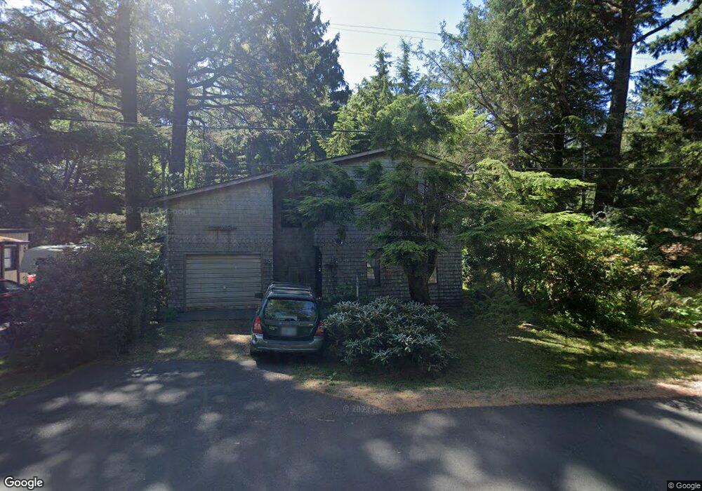
31982 E Shingle Mill Ln Arch Cape, OR 97102
Estimated Value: $495,458 - $894,000
3
Beds
2
Baths
738
Sq Ft
$964/Sq Ft
Est. Value
About This Home
This home is located at 31982 E Shingle Mill Ln, Arch Cape, OR 97102 and is currently estimated at $711,365, approximately $963 per square foot. 31982 E Shingle Mill Ln is a home located in Clatsop County with nearby schools including Seaside High School, The Cannon Beach Academy, and Fire Mountain School.
Ownership History
Date
Name
Owned For
Owner Type
Purchase Details
Closed on
Aug 3, 2015
Sold by
Akeson Scott Darrow
Bought by
Akeson Scott D and The Akeson Family Trust
Current Estimated Value
Purchase Details
Closed on
Oct 21, 2011
Sold by
Akeson Stephen Paine
Bought by
Akeson Stephen Paine and Knowlton Christine
Purchase Details
Closed on
Apr 26, 2008
Sold by
Akeson Susan Lou
Bought by
Akeson Susan L and 2006 Akeson Steiner Family Trust
Purchase Details
Closed on
Nov 10, 2007
Sold by
Akeson Stephen Paine
Bought by
Akeson Stephen Paine and Akeson Scott Darrow
Create a Home Valuation Report for This Property
The Home Valuation Report is an in-depth analysis detailing your home's value as well as a comparison with similar homes in the area
Purchase History
| Date | Buyer | Sale Price | Title Company |
|---|---|---|---|
| Akeson Scott D | -- | None Available | |
| Akeson Stephen Paine | -- | None Available | |
| Akeson Susan L | -- | None Available | |
| Akeson Stephen Paine | -- | None Available | |
| Akeson Stephen Paine | -- | None Available |
Source: Public Records
Tax History
| Year | Tax Paid | Tax Assessment Tax Assessment Total Assessment is a certain percentage of the fair market value that is determined by local assessors to be the total taxable value of land and additions on the property. | Land | Improvement |
|---|---|---|---|---|
| 2025 | $3,254 | $221,480 | -- | -- |
| 2024 | $3,026 | $215,030 | -- | -- |
| 2023 | $2,756 | $208,768 | $0 | $0 |
| 2021 | $2,644 | $196,787 | $0 | $0 |
| 2020 | $2,587 | $191,057 | $0 | $0 |
| 2019 | $2,445 | $185,493 | $0 | $0 |
Source: Public Records
Map
Nearby Homes
- 0 Walsh Ln
- 0 Greenleaf Rd
- 0 Wildwood Ln Unit 2904
- 0 Wildwood Ln Unit 26-225
- 79906 Greenleaf Rd
- 79519 Ray Brown Rd
- 31911 Clatsop Ln
- 0 Clatsop Ln Unit Lot 408
- 79364 Ray Brown Rd
- 32073 Cedar Ln
- 79274 Ray Brown Rd
- 80444 Carnahan Rd
- 0 Ocean Ave Unit 25-686
- 0 Ocean Ave Unit 402119772
- 347 Deer Place
- 0 Tl 2701 Beulah Reed Rd
- 3763 E Chinook Ave
- 3772 W Chinook Ave
- 0
- VL S
- 31984 E Shingle Mill Ln
- 500 E Shingle Mill Ln
- 31970 E Shingle Mill Ln
- 0 E Shingle Mill Rd
- 31993 E Shingle Mill Ln
- 0 E Shingle Mill Ln (Tax Lot #500)
- 31960 E Shingle Mill Ln
- 32001 E Shingle Mill Ln
- 31959 E Shingle Mill Ln
- 0 First Unit 18-848
- 0 First Unit 18616451
- 32016 E Shingle Mill Ln
- 32009 E Shingle Mill Ln
- 0 E Shingle Mill Ln Unit 24-847
- 0 E Shingle Mill Ln Unit 177 24444029
- 0 E Shingle Mill Ln Unit 22153981
- 0 E Shingle Mill Ln
- 79804 Fire Rock Rd
- 0 Fire Rock Rd
- 31941 E Shingle Mill Ln
Your Personal Tour Guide
Ask me questions while you tour the home.