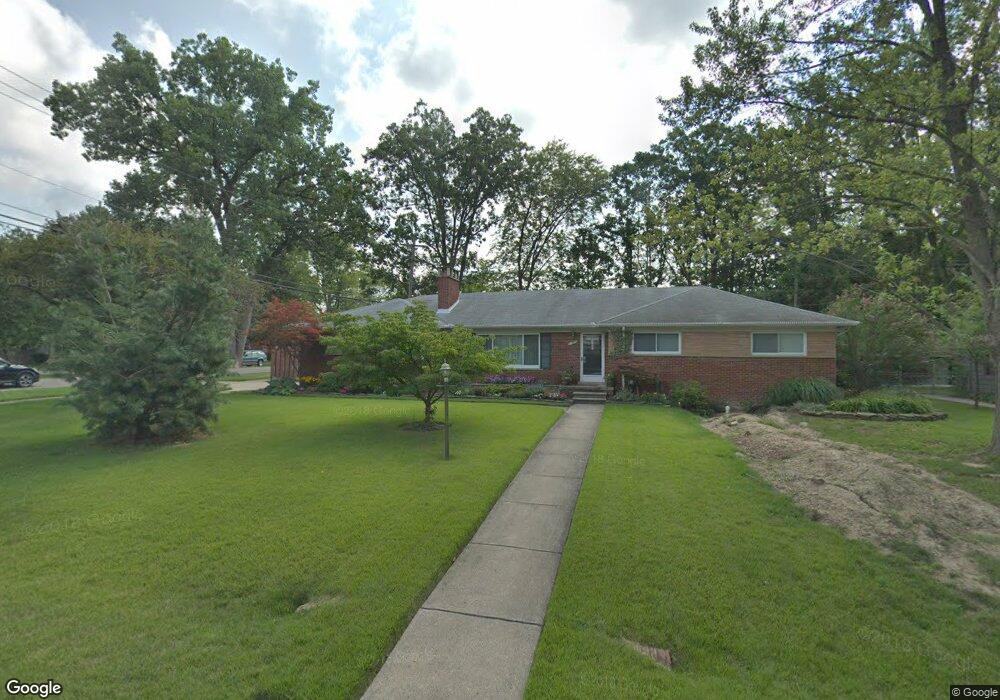
31986 Mayfair Ln Beverly Hills, MI 48025
Estimated Value: $440,200 - $528,000
3
Beds
3
Baths
1,786
Sq Ft
$276/Sq Ft
Est. Value
About This Home
This home is located at 31986 Mayfair Ln, Beverly Hills, MI 48025 and is currently estimated at $492,050, approximately $275 per square foot. 31986 Mayfair Ln is a home located in Oakland County with nearby schools including Beverly Elementary School, Wylie E. Groves High School, and Berkshire Middle School.
Ownership History
Date
Name
Owned For
Owner Type
Purchase Details
Closed on
Mar 3, 2025
Sold by
Allen Michael J and Allen Carolyn S
Bought by
Michael J Allen And Carolyn S Allen Living Tr and Allen
Current Estimated Value
Purchase Details
Closed on
Sep 14, 1999
Sold by
Rankin Paul T
Bought by
Allen Michael J
Purchase Details
Closed on
Jan 21, 1998
Sold by
Rankin Paul T
Bought by
Rankin Paul T
Purchase Details
Closed on
Mar 14, 1997
Sold by
Kohlhof George W
Bought by
Rankin Paul T
Home Financials for this Owner
Home Financials are based on the most recent Mortgage that was taken out on this home.
Original Mortgage
$120,000
Interest Rate
7.73%
Create a Home Valuation Report for This Property
The Home Valuation Report is an in-depth analysis detailing your home's value as well as a comparison with similar homes in the area
Home Values in the Area
Average Home Value in this Area
Purchase History
| Date | Buyer | Sale Price | Title Company |
|---|---|---|---|
| Michael J Allen And Carolyn S Allen Living Tr | -- | None Listed On Document | |
| Allen Michael J | $243,500 | -- | |
| Rankin Paul T | -- | -- | |
| Rankin Paul T | $192,500 | -- |
Source: Public Records
Mortgage History
| Date | Status | Borrower | Loan Amount |
|---|---|---|---|
| Previous Owner | Allen Carolyn Sue | $165,500 | |
| Previous Owner | Rankin Paul T | $120,000 |
Source: Public Records
Tax History Compared to Growth
Tax History
| Year | Tax Paid | Tax Assessment Tax Assessment Total Assessment is a certain percentage of the fair market value that is determined by local assessors to be the total taxable value of land and additions on the property. | Land | Improvement |
|---|---|---|---|---|
| 2024 | $3,783 | $174,350 | $0 | $0 |
| 2023 | $3,629 | $160,000 | $0 | $0 |
| 2022 | $3,937 | $149,790 | $0 | $0 |
| 2021 | $3,969 | $145,230 | $0 | $0 |
| 2020 | $3,325 | $133,710 | $0 | $0 |
| 2019 | $2,626 | $130,220 | $0 | $0 |
| 2018 | $3,838 | $127,770 | $0 | $0 |
| 2017 | $3,818 | $127,770 | $0 | $0 |
| 2016 | $3,827 | $122,710 | $0 | $0 |
| 2015 | -- | $114,110 | $0 | $0 |
| 2014 | -- | $107,120 | $0 | $0 |
| 2011 | -- | $81,530 | $0 | $0 |
Source: Public Records
Map
Nearby Homes
- 19332 Beverly Rd
- 31698 Southview St
- 32470 Norchester St
- 19905 Beverly Rd
- 31018 Pickwick Ln
- 19938 Waltham Rd
- 19710 W 13 Mile Rd Unit 107
- 19710 W 13 Mile Rd Unit 111
- 19710 W 13 Mile Rd Unit 105
- 19710 W 13 Mile Rd Unit 108
- 19710 W 13 Mile Rd Unit 201
- 1897 Norfolk St
- 31462 Waltham Rd
- 30560 Northgate Dr
- 1130 Wakefield St
- 19245 Eldridge Ln
- 955 Wakefield St
- 30301 Spring River Dr
- 1850 Shipman Blvd
- 1395 Northlawn Blvd
- 31964 Mayfair Ln
- 31985 Mayfair Ln
- 18954 Beverly Rd
- 18978 Beverly Rd
- 31940 Mayfair Ln
- 31961 Mayfair Ln
- 18942 Beverly Rd
- 18990 Beverly Rd
- 18930 Beverly Rd
- 31929 Mayfair Ln
- 18906 Beverly Rd
- 31900 Nixon St
- 18931 Devonshire St
- 18951 Devonshire St
- 18921 Devonshire St
- 18894 Beverly Rd
- 19060 Beverly Rd
- 18901 Devonshire St
- 31964 Alden Ct
- 31857 Mayfair Ln