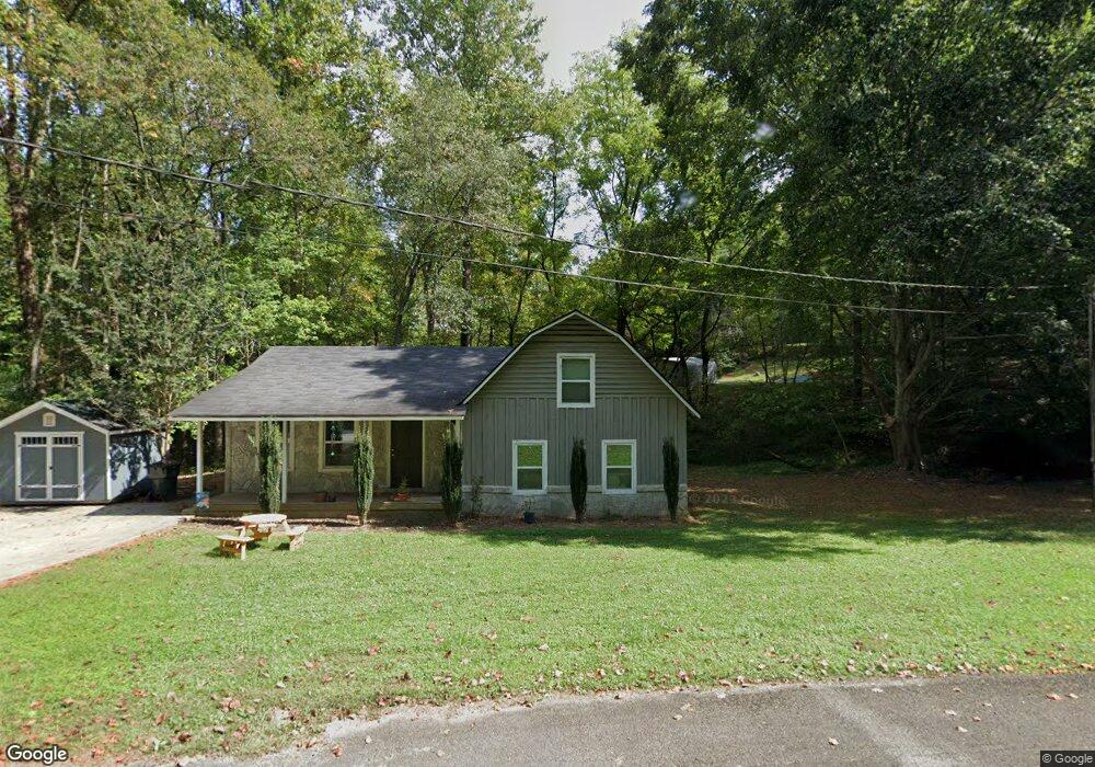
32 Anderson Dr Dahlonega, GA 30533
Estimated Value: $259,306 - $341,000
--
Bed
2
Baths
1,296
Sq Ft
$239/Sq Ft
Est. Value
About This Home
This home is located at 32 Anderson Dr, Dahlonega, GA 30533 and is currently estimated at $309,827, approximately $239 per square foot. 32 Anderson Dr is a home located in Lumpkin County with nearby schools including Clay County Middle School and Lumpkin County High School.
Ownership History
Date
Name
Owned For
Owner Type
Purchase Details
Closed on
Jan 27, 2010
Sold by
Chastain Stephanie
Bought by
Bostick Hildegard H
Current Estimated Value
Home Financials for this Owner
Home Financials are based on the most recent Mortgage that was taken out on this home.
Original Mortgage
$79,000
Interest Rate
5.16%
Mortgage Type
New Conventional
Purchase Details
Closed on
Apr 2, 2007
Sold by
Not Provided
Bought by
Bostick Hildegard H
Purchase Details
Closed on
Aug 27, 2003
Sold by
Smith Raymond
Bought by
Anderson William Gladstone and Anderson Evelyn
Purchase Details
Closed on
Sep 15, 1995
Sold by
Anderson William K
Bought by
Smith Raymond
Purchase Details
Closed on
Aug 31, 1993
Bought by
Anderson William K
Create a Home Valuation Report for This Property
The Home Valuation Report is an in-depth analysis detailing your home's value as well as a comparison with similar homes in the area
Home Values in the Area
Average Home Value in this Area
Purchase History
| Date | Buyer | Sale Price | Title Company |
|---|---|---|---|
| Bostick Hildegard H | $119,000 | -- | |
| Bostick Hildegard H | -- | -- | |
| Anderson William Gladstone | $115,500 | -- | |
| Smith Raymond | $71,000 | -- | |
| Anderson William K | -- | -- |
Source: Public Records
Mortgage History
| Date | Status | Borrower | Loan Amount |
|---|---|---|---|
| Closed | Bostick Hildegard H | $79,000 |
Source: Public Records
Tax History Compared to Growth
Tax History
| Year | Tax Paid | Tax Assessment Tax Assessment Total Assessment is a certain percentage of the fair market value that is determined by local assessors to be the total taxable value of land and additions on the property. | Land | Improvement |
|---|---|---|---|---|
| 2024 | $1,856 | $77,243 | $10,571 | $66,672 |
| 2023 | $2 | $71,773 | $9,880 | $61,893 |
| 2022 | $1,509 | $60,958 | $8,235 | $52,723 |
| 2021 | $1,317 | $51,430 | $8,235 | $43,195 |
| 2020 | $1,412 | $49,763 | $7,886 | $41,877 |
| 2019 | $1,412 | $49,763 | $7,886 | $41,877 |
| 2018 | $1,274 | $44,896 | $7,886 | $37,010 |
| 2017 | $0 | $42,492 | $7,886 | $34,606 |
| 2016 | $1,057 | $37,737 | $7,886 | $29,851 |
| 2015 | -- | $37,737 | $7,886 | $29,851 |
| 2014 | -- | $38,096 | $7,886 | $30,210 |
| 2013 | -- | $38,797 | $7,886 | $30,911 |
Source: Public Records
Map
Nearby Homes
- 22 Deer Ridge Rd
- 122 Tritt Rd
- 77 Old River Rd
- 955 Camp Wahsega Rd
- 149 Highland Rd S
- 65 Golden Autumn Dr
- 96 Elbert Gaddis Rd
- 98 Elbert Gaddis Rd
- 70 Avery Trail
- 238 Grand View St
- 159 Misty Way
- 97 Beaumont Dr
- LOT 6 Sky Country Rd
- 94 Mountain View Dr
- 1202 Oak Grove Rd
- 4039 Highway 19 N
- 2589 Morrison Moore Pkwy E
- 64 Hickory Ln
- 26 Dowdy Ct
- 10 Rustin Ridge
- 82 Anderson Dr
- 112 Anderson Dr
- 2451 Highway 19 N
- 2451 Highway 19n
- 15 Anderson Dr
- 172 Anderson Dr
- 0 Anderson Dr
- 0 Anderson Dr Unit 2602987
- 0 Anderson Dr Unit 3204457
- 0 Anderson Dr Unit 3845028
- 0 Anderson Dr Unit 4282419
- 24 Noah Mountain Rd
- 182 Anderson Dr
- 149 Anderson Dr
- 2503 Highway 19 N
- 157 Anderson Dr
- 212 Anderson Dr
- 183 Anderson Dr
- 66 Noahs Mountain Rd
- 66 Noah Mountain Rd