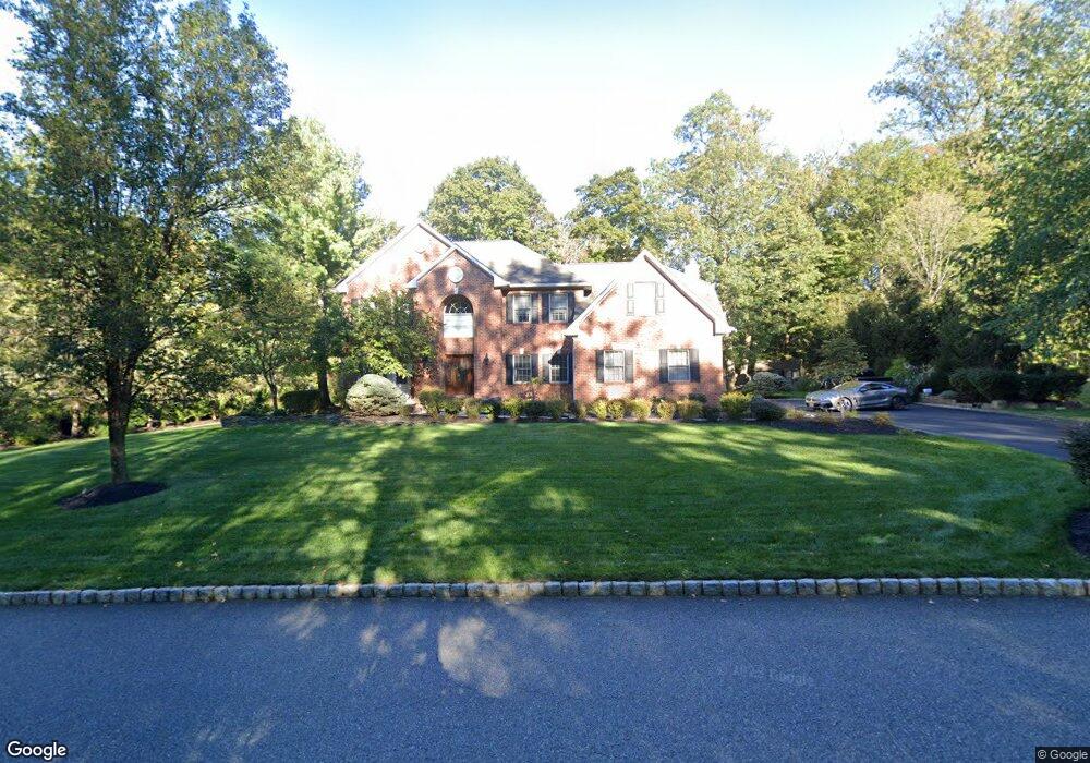
32 Angus Ln Warren, NJ 07059
Estimated Value: $1,479,768 - $1,570,000
Studio
--
Bath
3,428
Sq Ft
$443/Sq Ft
Est. Value
About This Home
This home is located at 32 Angus Ln, Warren, NJ 07059 and is currently estimated at $1,519,192, approximately $443 per square foot. 32 Angus Ln is a home located in Somerset County with nearby schools including Mt. Horeb School, Warren Middle School, and Watchung Hills Regional High School.
Ownership History
Date
Name
Owned For
Owner Type
Purchase Details
Closed on
Nov 7, 2008
Sold by
Coppa Paul J
Bought by
Harrison Christine
Current Estimated Value
Purchase Details
Closed on
Dec 10, 2007
Sold by
Harrison Christine B
Bought by
Coppa Paul J
Purchase Details
Closed on
Apr 20, 2001
Sold by
Meadows Greenwood
Bought by
Harrison Christine
Home Financials for this Owner
Home Financials are based on the most recent Mortgage that was taken out on this home.
Original Mortgage
$200,000
Interest Rate
6.88%
Purchase Details
Closed on
Jul 8, 1998
Sold by
Skytop Land Realty Co
Bought by
Greenwood Meadows At Warren
Create a Home Valuation Report for This Property
The Home Valuation Report is an in-depth analysis detailing your home's value as well as a comparison with similar homes in the area
Home Values in the Area
Average Home Value in this Area
Purchase History
| Date | Buyer | Sale Price | Title Company |
|---|---|---|---|
| Harrison Christine | -- | None Available | |
| Coppa Paul J | -- | None Available | |
| Harrison Christine | $589,809 | -- | |
| Greenwood Meadows At Warren | $82,500 | -- |
Source: Public Records
Mortgage History
| Date | Status | Borrower | Loan Amount |
|---|---|---|---|
| Previous Owner | Harrison Christine | $200,000 |
Source: Public Records
Tax History Compared to Growth
Tax History
| Year | Tax Paid | Tax Assessment Tax Assessment Total Assessment is a certain percentage of the fair market value that is determined by local assessors to be the total taxable value of land and additions on the property. | Land | Improvement |
|---|---|---|---|---|
| 2025 | $18,681 | $1,105,900 | $394,800 | $711,100 |
| 2024 | $18,681 | $1,016,400 | $354,800 | $661,600 |
Source: Public Records
Map
Nearby Homes
- 25 Angus Ln
- 7 Nottingham Way
- 21 Angus Ln
- 27 Elm Ave
- 29 Elm Ave
- 14 9th St
- 6 Elm Ave
- 120-122 Mountainview Rd
- 144 Liberty Corner Rd
- 61 Christy Dr
- 341 Penns Way Unit D2
- 7 Tower Rd
- 59 Ferguson Rd
- 2 Monmouth Rd
- 279 English Place
- 267 English Place
- 1899 Washington Valley Rd
- 2 Willow Woods Trail
- 67 Woodward Ln
- 26 Woodward Ln