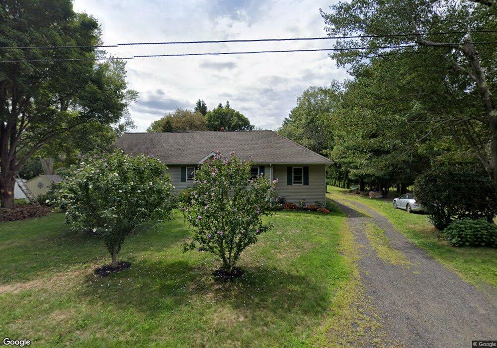
32 Atwood Rd Woodbury, CT 06798
Estimated Value: $403,000 - $452,836
3
Beds
2
Baths
1,763
Sq Ft
$247/Sq Ft
Est. Value
About This Home
This home is located at 32 Atwood Rd, Woodbury, CT 06798 and is currently estimated at $435,459, approximately $246 per square foot. 32 Atwood Rd is a home located in Litchfield County with nearby schools including Mitchell Elementary School, Bethlehem Elementary School, and Woodbury Middle School.
Ownership History
Date
Name
Owned For
Owner Type
Purchase Details
Closed on
Jun 5, 2014
Sold by
Vitalis Lincoln and Vitalis Pam
Bought by
Vitalis Lincoln
Current Estimated Value
Purchase Details
Closed on
Feb 22, 2006
Sold by
Kovacs 3Rd Benjamin and Kovacs Patricia
Bought by
Vitalis Lincoln and Vitalis Pamela
Purchase Details
Closed on
Mar 3, 2005
Sold by
Gilligan Nadine
Bought by
Kovacs 3Rd Benjamin and Kovacs Patricia
Purchase Details
Closed on
Oct 3, 2003
Sold by
Verrastro Barbara
Bought by
Gilligan Nadine
Create a Home Valuation Report for This Property
The Home Valuation Report is an in-depth analysis detailing your home's value as well as a comparison with similar homes in the area
Home Values in the Area
Average Home Value in this Area
Purchase History
| Date | Buyer | Sale Price | Title Company |
|---|---|---|---|
| Vitalis Lincoln | -- | -- | |
| Vitalis Lincoln | $240,000 | -- | |
| Kovacs 3Rd Benjamin | $160,000 | -- | |
| Gilligan Nadine | $142,500 | -- |
Source: Public Records
Mortgage History
| Date | Status | Borrower | Loan Amount |
|---|---|---|---|
| Open | Gilligan Nadine | $153,439 | |
| Previous Owner | Gilligan Nadine | $179,200 | |
| Previous Owner | Gilligan Nadine | $75,000 |
Source: Public Records
Tax History Compared to Growth
Tax History
| Year | Tax Paid | Tax Assessment Tax Assessment Total Assessment is a certain percentage of the fair market value that is determined by local assessors to be the total taxable value of land and additions on the property. | Land | Improvement |
|---|---|---|---|---|
| 2025 | $6,008 | $254,380 | $60,970 | $193,410 |
| 2024 | $5,894 | $254,380 | $60,970 | $193,410 |
| 2023 | $5,154 | $177,360 | $60,980 | $116,380 |
| 2022 | $5,174 | $177,360 | $60,980 | $116,380 |
| 2021 | $5,174 | $177,360 | $60,980 | $116,380 |
| 2020 | $5,174 | $177,360 | $60,980 | $116,380 |
| 2019 | $5,174 | $177,360 | $60,980 | $116,380 |
| 2018 | $5,016 | $188,710 | $61,600 | $127,110 |
| 2017 | $5,125 | $188,710 | $61,600 | $127,110 |
| 2016 | $4,961 | $188,710 | $61,600 | $127,110 |
| 2015 | $4,920 | $188,710 | $61,600 | $127,110 |
| 2014 | $4,920 | $191,510 | $64,400 | $127,110 |
Source: Public Records
Map
Nearby Homes
- 10 Lake Rd
- 432 Quassapaug Rd
- 31 McVeigh Rd
- 1461 Bunker Hill Rd
- 781 Hamilton Ave
- 437 Middle Road Turnpike
- 393 Middle Road Turnpike
- 94 Old Town Farm Rd
- LOT#9 Wolf Hill Rd
- 38 Barnhill Rd
- 237 Concord Dr
- 0 Main St N Unit 24072824
- 109 Cannon Ridge Dr
- 29 Cannon Ridge Dr
- 819 Main St N
- 200 N Farm Rd
- 92 Minortown Rd
- 105 Minortown Rd
- 7 Circuit Ave
- 45 N Gate Rd