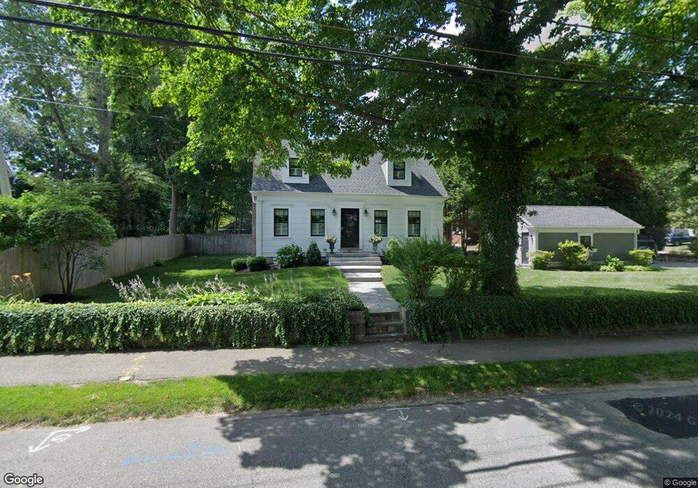
32 Atwood St Wellesley, MA 02482
Estimated Value: $1,017,000 - $1,552,000
2
Beds
2
Baths
1,268
Sq Ft
$1,076/Sq Ft
Est. Value
About This Home
This home is located at 32 Atwood St, Wellesley, MA 02482 and is currently estimated at $1,364,991, approximately $1,076 per square foot. 32 Atwood St is a home located in Norfolk County with nearby schools including Sprague Elementary School, Wellesley Middle School, and Wellesley Sr High School.
Ownership History
Date
Name
Owned For
Owner Type
Purchase Details
Closed on
Nov 30, 2011
Sold by
Murphy Patricia A
Bought by
32 Atwood Rt and Waban Management Tr
Current Estimated Value
Home Financials for this Owner
Home Financials are based on the most recent Mortgage that was taken out on this home.
Original Mortgage
$497,600
Outstanding Balance
$341,859
Interest Rate
4.1%
Mortgage Type
Purchase Money Mortgage
Estimated Equity
$1,023,132
Purchase Details
Closed on
Jul 28, 2004
Sold by
Valente Andrea J
Bought by
Murphy Patricia
Home Financials for this Owner
Home Financials are based on the most recent Mortgage that was taken out on this home.
Original Mortgage
$548,000
Interest Rate
6.33%
Mortgage Type
Purchase Money Mortgage
Purchase Details
Closed on
Mar 3, 1997
Sold by
Melanson Ann B
Bought by
Valente Andea J
Home Financials for this Owner
Home Financials are based on the most recent Mortgage that was taken out on this home.
Original Mortgage
$261,250
Interest Rate
7.78%
Mortgage Type
Purchase Money Mortgage
Create a Home Valuation Report for This Property
The Home Valuation Report is an in-depth analysis detailing your home's value as well as a comparison with similar homes in the area
Purchase History
| Date | Buyer | Sale Price | Title Company |
|---|---|---|---|
| 32 Atwood Rt | $622,000 | -- | |
| Murphy Patricia | $685,000 | -- | |
| Valente Andea J | $275,000 | -- |
Source: Public Records
Mortgage History
| Date | Status | Borrower | Loan Amount |
|---|---|---|---|
| Open | 32 Atwood Rt | $497,600 | |
| Previous Owner | Murphy Patricia | $548,000 | |
| Previous Owner | Valente Andea J | $132,935 | |
| Previous Owner | Valente Andea J | $275,000 | |
| Previous Owner | Valente Andea J | $45,000 | |
| Previous Owner | Valente Andea J | $261,250 |
Source: Public Records
Tax History
| Year | Tax Paid | Tax Assessment Tax Assessment Total Assessment is a certain percentage of the fair market value that is determined by local assessors to be the total taxable value of land and additions on the property. | Land | Improvement |
|---|---|---|---|---|
| 2025 | $13,559 | $1,319,000 | $1,043,000 | $276,000 |
| 2024 | $13,148 | $1,263,000 | $997,000 | $266,000 |
| 2023 | $12,755 | $1,114,000 | $870,000 | $244,000 |
| 2022 | $11,423 | $978,000 | $720,000 | $258,000 |
| 2021 | $11,492 | $978,000 | $720,000 | $258,000 |
| 2020 | $10,543 | $912,000 | $720,000 | $192,000 |
| 2019 | $10,205 | $882,000 | $690,000 | $192,000 |
| 2018 | $9,644 | $807,000 | $681,000 | $126,000 |
| 2017 | $9,515 | $807,000 | $681,000 | $126,000 |
| 2016 | $9,523 | $805,000 | $670,000 | $135,000 |
| 2015 | $8,982 | $777,000 | $641,000 | $136,000 |
Source: Public Records
Map
Nearby Homes
- 45 Kingsbury St
- 11 Oak St Unit 43
- 16 Oak St
- 100 Linden St Unit 111
- 65 Grove St Unit 152
- 15 Great Plain Ave
- 26B Pleasant St Unit B
- 34 Pleasant St Unit 5
- 85 Grove St Unit 311
- 85 Grove St Unit 306
- 85 Grove St Unit 203
- 5 Abbott St
- 28 Rice St
- 63 Linden St Unit 1
- 63 Linden St Unit 6
- 63 Oak St Unit B
- 16 Stearns Rd Unit 207
- 16 Stearns Rd Unit 106
- 16 Stearns Rd Unit 304
- 16 Stearns Rd Unit 208
Your Personal Tour Guide
Ask me questions while you tour the home.