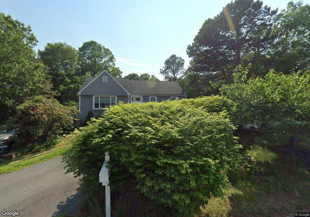
32 Barbaras Way Plymouth, MA 02360
Estimated Value: $473,000 - $584,000
2
Beds
1
Bath
1,162
Sq Ft
$468/Sq Ft
Est. Value
About This Home
This home is located at 32 Barbaras Way, Plymouth, MA 02360 and is currently estimated at $544,141, approximately $468 per square foot. 32 Barbaras Way is a home located in Plymouth County with nearby schools including Indian Brook, Plymouth South Middle School, and Plymouth South High School.
Ownership History
Date
Name
Owned For
Owner Type
Purchase Details
Closed on
Apr 5, 2016
Sold by
Mcgrath Irene T
Bought by
Mcgrath Paul C
Current Estimated Value
Purchase Details
Closed on
Oct 1, 2012
Sold by
Mcgrath Irene T
Bought by
Mcgrath Irene T and Mcgrath Paul C
Purchase Details
Closed on
Oct 31, 2008
Sold by
Mcgrath Thomas P
Bought by
Mcgrath Irene T
Purchase Details
Closed on
Aug 9, 2001
Sold by
Hynds Francis J Jr Est and Hynds
Bought by
Mcgrath Irene T and Mcgrath Thomas P
Purchase Details
Closed on
Aug 9, 1990
Sold by
Roland P Leary Co Inc
Bought by
Hynds Francis J
Home Financials for this Owner
Home Financials are based on the most recent Mortgage that was taken out on this home.
Original Mortgage
$116,400
Interest Rate
10.04%
Mortgage Type
Purchase Money Mortgage
Create a Home Valuation Report for This Property
The Home Valuation Report is an in-depth analysis detailing your home's value as well as a comparison with similar homes in the area
Home Values in the Area
Average Home Value in this Area
Purchase History
| Date | Buyer | Sale Price | Title Company |
|---|---|---|---|
| Mcgrath Paul C | -- | -- | |
| Mcgrath Irene T | -- | -- | |
| Mcgrath Irene T | -- | -- | |
| Mcgrath Irene T | $190,000 | -- | |
| Hynds Francis J | $158,000 | -- | |
| Hynds Francis J | $158,000 | -- |
Source: Public Records
Mortgage History
| Date | Status | Borrower | Loan Amount |
|---|---|---|---|
| Previous Owner | Hynds Francis J | $115,600 | |
| Previous Owner | Hynds Francis J | $116,400 |
Source: Public Records
Tax History Compared to Growth
Tax History
| Year | Tax Paid | Tax Assessment Tax Assessment Total Assessment is a certain percentage of the fair market value that is determined by local assessors to be the total taxable value of land and additions on the property. | Land | Improvement |
|---|---|---|---|---|
| 2025 | $6,501 | $512,300 | $235,400 | $276,900 |
| 2024 | $6,100 | $474,000 | $214,500 | $259,500 |
| 2023 | $5,938 | $433,100 | $193,700 | $239,400 |
| 2022 | $5,422 | $351,400 | $182,600 | $168,800 |
| 2021 | $5,341 | $330,500 | $182,600 | $147,900 |
| 2020 | $5,268 | $322,200 | $166,100 | $156,100 |
| 2019 | $5,410 | $327,100 | $176,100 | $151,000 |
| 2018 | $5,145 | $312,600 | $163,600 | $149,000 |
| 2017 | $4,881 | $294,400 | $157,100 | $137,300 |
| 2016 | $4,321 | $265,600 | $127,100 | $138,500 |
| 2015 | $3,975 | $255,800 | $116,100 | $139,700 |
| 2014 | $3,699 | $244,500 | $116,100 | $128,400 |
Source: Public Records
Map
Nearby Homes
- 115 Andrews Way
- 39 Miter Dr Unit 8-1
- 24 Drum Dr Unit 24
- 40 Drum Dr Unit 40
- 91 Miter Dr Unit 18-1
- 91 Miter Dr Unit 16-1
- 91 Miter Dr Unit 18-2
- 91 Miter Dr Unit 16-3
- The Hickory Plan at Alden's Reach - Attached & Detached Single Family Homes
- The Pine Plan at Alden's Reach - Attached & Detached Single Family Homes
- The Oak Plan at Alden's Reach - Attached & Detached Single Family Homes
- The Spruce Plan at Alden's Reach - Attached & Detached Single Family Homes
- 91 Miter Dr Unit 3-2
- 91 Miter Dr Unit 25-2
- 88 Miter Dr Unit 1-1
- 90 Miter Dr Unit 1-3
- 82 Miter Dr Unit 2-1
- 87 Miter Dr Unit 6-1
- 83 Miter Dr Unit 6-3
- 81 Miter Dr Unit 7-1
- 26 Barbaras Way
- 111 Kathleen Dr
- 29 Barbara's Way
- 33 Barbaras Way
- 25 Barbaras Way
- 25 Barbara's Way
- 101 Kathleen Dr
- 29 Barbaras Way
- 22 Barbaras Way
- 118 Andrews Way
- 116 Kathleen Dr
- 123 Kathleen Dr
- 110 Kathleen Dr
- 110 Kathleen Dr
- 114 Andrews Way
- 100 Kathleen Dr
- 21 Barbaras Way
- 110 Andrews Way
- 114 Andrews Way
- 14 Barbaras Way