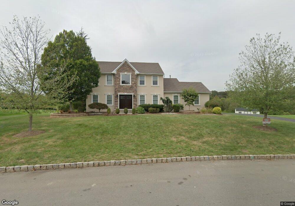
32 Bering Way Somerset, NJ 08873
Estimated Value: $878,000 - $1,014,000
--
Bed
--
Bath
2,466
Sq Ft
$386/Sq Ft
Est. Value
About This Home
This home is located at 32 Bering Way, Somerset, NJ 08873 and is currently estimated at $952,814, approximately $386 per square foot. 32 Bering Way is a home located in Somerset County with nearby schools including Franklin High School, Central Jersey College Prep Charter School, and Thomas Edison EnergySmart Charter School.
Ownership History
Date
Name
Owned For
Owner Type
Purchase Details
Closed on
Aug 15, 2003
Sold by
Bell Donta D
Bought by
Maddalon Thomas B and Maddalon Lisa M
Current Estimated Value
Home Financials for this Owner
Home Financials are based on the most recent Mortgage that was taken out on this home.
Original Mortgage
$300,000
Outstanding Balance
$131,145
Interest Rate
5.52%
Estimated Equity
$821,669
Purchase Details
Closed on
Apr 8, 1998
Sold by
Sunrise Communities Ii Inc
Bought by
Bell Dante D
Home Financials for this Owner
Home Financials are based on the most recent Mortgage that was taken out on this home.
Original Mortgage
$251,000
Interest Rate
6.98%
Purchase Details
Closed on
Mar 19, 1997
Sold by
Vancleef John
Bought by
Sunrise Communties
Home Financials for this Owner
Home Financials are based on the most recent Mortgage that was taken out on this home.
Original Mortgage
$936,000
Interest Rate
7.68%
Create a Home Valuation Report for This Property
The Home Valuation Report is an in-depth analysis detailing your home's value as well as a comparison with similar homes in the area
Home Values in the Area
Average Home Value in this Area
Purchase History
| Date | Buyer | Sale Price | Title Company |
|---|---|---|---|
| Maddalon Thomas B | $470,000 | -- | |
| Bell Dante D | $280,899 | -- | |
| Sunrise Communties | $960,000 | -- |
Source: Public Records
Mortgage History
| Date | Status | Borrower | Loan Amount |
|---|---|---|---|
| Open | Maddalon Thomas B | $300,000 | |
| Previous Owner | Bell Dante D | $251,000 | |
| Previous Owner | Sunrise Communties | $936,000 |
Source: Public Records
Tax History Compared to Growth
Tax History
| Year | Tax Paid | Tax Assessment Tax Assessment Total Assessment is a certain percentage of the fair market value that is determined by local assessors to be the total taxable value of land and additions on the property. | Land | Improvement |
|---|---|---|---|---|
| 2025 | $14,000 | $875,200 | $459,600 | $415,600 |
| 2024 | $14,000 | $770,100 | $459,600 | $310,500 |
| 2023 | $13,596 | $704,100 | $393,600 | $310,500 |
| 2022 | $12,756 | $625,900 | $316,600 | $309,300 |
| 2021 | $12,158 | $548,900 | $239,600 | $309,300 |
| 2020 | $11,929 | $526,900 | $217,600 | $309,300 |
| 2019 | $12,129 | $526,900 | $217,600 | $309,300 |
| 2018 | $12,000 | $515,900 | $206,600 | $309,300 |
| 2017 | $11,528 | $493,900 | $184,600 | $309,300 |
| 2016 | $11,612 | $493,900 | $184,600 | $309,300 |
| 2015 | $11,789 | $504,900 | $195,600 | $309,300 |
| 2014 | $11,218 | $487,300 | $178,000 | $309,300 |
Source: Public Records
Map
Nearby Homes
- 1 Miller Farm Rd
- 521 Canal Rd
- 12 Zeller Dr
- 20 Horseshoe Dr
- 623 Elizabeth Ave
- 16 McMannus Dr
- 48 Franklin St
- 33 Market St
- 15 Market St
- NA Market St
- 1955 Old Amwell Rd
- 7 Market St
- 0-0 Amwell Rd
- 358 S Middlebush Rd
- 10 Powelson Dr
- 126 Smith Rd
- 45 Amwell Rd
- 1393 Millstone River Rd
- 37 Maple Terrace
- 1868 Amwell Rd