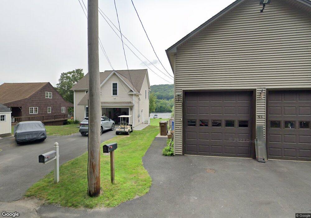
32 Birchbank Rd Shelton, CT 06484
Estimated Value: $536,775 - $661,000
2
Beds
4
Baths
1,656
Sq Ft
$373/Sq Ft
Est. Value
About This Home
This home is located at 32 Birchbank Rd, Shelton, CT 06484 and is currently estimated at $618,444, approximately $373 per square foot. 32 Birchbank Rd is a home located in Fairfield County with nearby schools including Elizabeth Shelton Elementary School, Perry Hill School, and Shelton Intermediate School.
Ownership History
Date
Name
Owned For
Owner Type
Purchase Details
Closed on
Oct 28, 2016
Sold by
Frolish Joseph and Frolish Kathlen
Bought by
Frolish Joseph and Frolish Kathleen
Current Estimated Value
Home Financials for this Owner
Home Financials are based on the most recent Mortgage that was taken out on this home.
Original Mortgage
$308,700
Outstanding Balance
$248,456
Interest Rate
3.5%
Mortgage Type
Stand Alone Refi Refinance Of Original Loan
Estimated Equity
$369,988
Purchase Details
Closed on
Apr 16, 2010
Sold by
Frolish Joseph and Walkinshaw Kathleen
Bought by
Frolish Joseph and Warkinshaw Kathleen
Purchase Details
Closed on
Oct 20, 2006
Sold by
Bunosso Peter
Bought by
F & B Birchbank Road Llc
Create a Home Valuation Report for This Property
The Home Valuation Report is an in-depth analysis detailing your home's value as well as a comparison with similar homes in the area
Home Values in the Area
Average Home Value in this Area
Purchase History
| Date | Buyer | Sale Price | Title Company |
|---|---|---|---|
| Frolish Joseph | -- | -- | |
| Frolish Joseph | -- | -- | |
| Frolish Joseph | -- | -- | |
| Frolish Joseph | -- | -- | |
| F & B Birchbank Road Llc | $175,000 | -- | |
| F & B Birchbank Road Llc | $175,000 | -- |
Source: Public Records
Mortgage History
| Date | Status | Borrower | Loan Amount |
|---|---|---|---|
| Open | F & B Birchbank Road Llc | $308,700 | |
| Closed | F & B Birchbank Road Llc | $308,700 |
Source: Public Records
Tax History Compared to Growth
Tax History
| Year | Tax Paid | Tax Assessment Tax Assessment Total Assessment is a certain percentage of the fair market value that is determined by local assessors to be the total taxable value of land and additions on the property. | Land | Improvement |
|---|---|---|---|---|
| 2025 | $6,210 | $329,980 | $92,400 | $237,580 |
| 2024 | $6,329 | $329,980 | $92,400 | $237,580 |
| 2023 | $5,765 | $329,980 | $92,400 | $237,580 |
| 2022 | $5,765 | $329,980 | $92,400 | $237,580 |
| 2021 | $6,341 | $287,840 | $48,160 | $239,680 |
| 2020 | $6,453 | $287,840 | $48,160 | $239,680 |
| 2019 | $10,074 | $287,840 | $48,160 | $239,680 |
| 2017 | $6,393 | $287,840 | $48,160 | $239,680 |
| 2015 | $6,455 | $289,310 | $54,180 | $235,130 |
| 2014 | $6,455 | $289,310 | $54,180 | $235,130 |
Source: Public Records
Map
Nearby Homes
- 256 Roosevelt Dr
- 113 Squantuck Rd
- 207 Roosevelt Dr
- 95 Squantuck Rd
- 14 Spruce Brook Rd
- 452 Roosevelt Dr
- 6 Byron Place
- 31 Meghan Ln
- 80 Birchbank Rd
- 154 S Benham Rd
- 190 Thoreau Dr
- 181 Great Hill Rd
- 26 Stendahl Dr
- 20 Argonne Terrace
- 108 Webb Cir
- 56 Great Hill Rd
- 197 Lenore Dr
- 30 E Village Rd
- 29 Great Hill Rd
- 47 Pine Tree Hill Rd
- 31 Birchbank Rd
- 31 Birchbank Rd
- 33 Birchbank Rd
- 29 Birchbank Rd
- 34 Birchbank Rd
- 35 Birchbank Rd
- 30 Birchbank Rd
- 36 Birchbank Rd
- 28 Birchbank Rd
- 37 Birchbank Rd
- 38A Birchbank Rd
- 38 Birchbank Rd
- 39 Birchbank Rd
- 39 Birchbank Rd
- 25 Birchbank Rd
- 24 Birchbank Rd
- 23 Birchbank Rd
- 40 Birchbank Rd
- 41 Birchbank Rd
- 22 Birchbank Rd