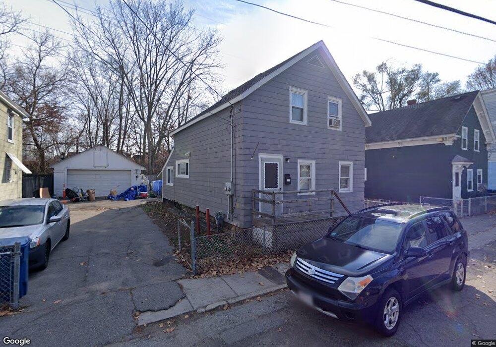
32 Border St Lawrence, MA 01843
South West NeighborhoodEstimated Value: $387,000 - $467,000
3
Beds
1
Bath
1,200
Sq Ft
$349/Sq Ft
Est. Value
About This Home
This home is located at 32 Border St, Lawrence, MA 01843 and is currently estimated at $418,789, approximately $348 per square foot. 32 Border St is a home located in Essex County with nearby schools including John Breen School, Emily G. Wetherbee School (K-8), and School For Exceptional Studies.
Ownership History
Date
Name
Owned For
Owner Type
Purchase Details
Closed on
Jul 30, 2001
Sold by
Franklin Michael S
Bought by
Duchaine Eric
Current Estimated Value
Home Financials for this Owner
Home Financials are based on the most recent Mortgage that was taken out on this home.
Original Mortgage
$105,000
Outstanding Balance
$41,048
Interest Rate
7.18%
Mortgage Type
Purchase Money Mortgage
Estimated Equity
$377,741
Create a Home Valuation Report for This Property
The Home Valuation Report is an in-depth analysis detailing your home's value as well as a comparison with similar homes in the area
Home Values in the Area
Average Home Value in this Area
Purchase History
| Date | Buyer | Sale Price | Title Company |
|---|---|---|---|
| Duchaine Eric | $125,000 | -- |
Source: Public Records
Mortgage History
| Date | Status | Borrower | Loan Amount |
|---|---|---|---|
| Open | Duchaine Eric | $105,000 | |
| Previous Owner | Duchaine Eric | $80,500 | |
| Previous Owner | Duchaine Eric | $13,270 |
Source: Public Records
Tax History
| Year | Tax Paid | Tax Assessment Tax Assessment Total Assessment is a certain percentage of the fair market value that is determined by local assessors to be the total taxable value of land and additions on the property. | Land | Improvement |
|---|---|---|---|---|
| 2025 | $2,889 | $328,300 | $97,800 | $230,500 |
| 2024 | $2,774 | $299,900 | $105,900 | $194,000 |
| 2023 | $2,862 | $281,700 | $98,300 | $183,400 |
| 2022 | $2,670 | $233,400 | $89,000 | $144,400 |
| 2021 | $2,605 | $212,300 | $89,000 | $123,300 |
| 2020 | $2,406 | $193,600 | $84,400 | $109,200 |
| 2019 | $2,486 | $181,700 | $70,100 | $111,600 |
| 2018 | $2,285 | $159,600 | $66,400 | $93,200 |
| 2017 | $2,235 | $145,700 | $62,700 | $83,000 |
| 2016 | $2,100 | $135,400 | $51,600 | $83,800 |
| 2015 | $2,047 | $135,400 | $51,600 | $83,800 |
Source: Public Records
Map
Nearby Homes
- 91-93 Newton St
- 49 Bowdoin St Unit 51
- 33-35 Coolidge St
- 543 Andover St Unit 6
- 82 S Broadway
- 87-87A Brookfield St
- 37 Tewksbury St Unit 39
- 11 W Hawley St
- 31 Garfield St
- 24 Inman St Unit 6
- 24 Inman St Unit 4
- 341 S Broadway- Parcel II
- 312 Water St Unit 4
- 82 Water St
- 100 Bailey St Unit 1
- 100 Bailey St Unit 3
- 27-29 Dorchester St
- 46-46A Dorchester St
- 18 Doyle St
- 356-360 S Union St
- 30 Border St
- 36 Border St
- 28 Border St
- 31 Border St
- 38-40 Border St
- 38 Border St Unit 40
- 22 Border St Unit 22
- 110 Newton St
- 20 Border St
- 102 Newton St
- 106 Newton St
- 484 Andover St
- 112 Newton St
- 114 Newton St
- 474 Andover St
- 21-23 Border St
- 105 Newton St
- 470 Andover St Unit 476
- 470-476 Andover St
- 98 Newton St
Your Personal Tour Guide
Ask me questions while you tour the home.