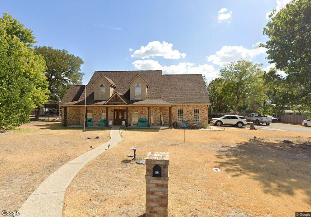
32 Branding Iron Dr Unit R Belton, TX 76513
Morgan's Point Resort NeighborhoodEstimated Value: $475,000 - $590,000
4
Beds
3
Baths
2,696
Sq Ft
$205/Sq Ft
Est. Value
About This Home
This home is located at 32 Branding Iron Dr Unit R, Belton, TX 76513 and is currently estimated at $551,497, approximately $204 per square foot. 32 Branding Iron Dr Unit R is a home located in Bell County with nearby schools including Lakewood Elementary School, Lake Belton Middle School, and Lake Belton H.S..
Ownership History
Date
Name
Owned For
Owner Type
Purchase Details
Closed on
Aug 13, 2024
Sold by
Anderson Shawn and Anderson Mary
Bought by
Fuller Clayton and Fuller Ashlyn
Current Estimated Value
Home Financials for this Owner
Home Financials are based on the most recent Mortgage that was taken out on this home.
Original Mortgage
$418,250
Outstanding Balance
$413,589
Interest Rate
6.95%
Mortgage Type
New Conventional
Estimated Equity
$137,908
Create a Home Valuation Report for This Property
The Home Valuation Report is an in-depth analysis detailing your home's value as well as a comparison with similar homes in the area
Home Values in the Area
Average Home Value in this Area
Purchase History
| Date | Buyer | Sale Price | Title Company |
|---|---|---|---|
| Fuller Clayton | -- | Monteith Abstract & Title |
Source: Public Records
Mortgage History
| Date | Status | Borrower | Loan Amount |
|---|---|---|---|
| Open | Fuller Clayton | $418,250 |
Source: Public Records
Tax History Compared to Growth
Tax History
| Year | Tax Paid | Tax Assessment Tax Assessment Total Assessment is a certain percentage of the fair market value that is determined by local assessors to be the total taxable value of land and additions on the property. | Land | Improvement |
|---|---|---|---|---|
| 2025 | $11,251 | $460,000 | $23,345 | $436,655 |
| 2024 | $11,251 | $530,352 | $23,345 | $507,007 |
| 2023 | $10,724 | $523,996 | $23,345 | $500,651 |
| 2022 | $7,743 | $342,729 | $0 | $0 |
| 2021 | $7,445 | $352,038 | $13,685 | $338,353 |
| 2020 | $7,122 | $311,558 | $13,685 | $297,873 |
| 2019 | $6,953 | $257,497 | $13,685 | $243,812 |
| 2018 | $6,574 | $243,491 | $21,685 | $221,806 |
| 2017 | $6,068 | $239,186 | $21,685 | $217,501 |
| 2016 | $5,865 | $231,166 | $21,685 | $209,481 |
| 2014 | $5,452 | $223,391 | $0 | $0 |
Source: Public Records
Map
Nearby Homes
- 33 Branding Iron Dr
- 24 Branding Iron Dr
- 4 Sobrante Rd
- 2 Rawhide Cir
- TBD Morgan's Point Rd
- 10 Riverstone Pkwy
- 63 Cedar Trails Dr
- 108 Scout Island
- 23 Riverstone Pkwy
- 28 Cheyenne Trail
- 59 Sobrante Rd
- 50 Spur Dr
- 4 Oakmont Cir
- 130 Sobrante Rd Unit 112
- 2 Tanyard Rd
- 1 Timberline Dr
- 13313 Rattlesnake Rd Unit 1
- 4 Canyon Cir
- 1 S Sherwood Dr
- 30 S Sherwood Dr
- 32 Branding Iron Dr
- 26 Branding Iron Dr
- 3 Wrangler Dr
- 2 Holly Crossing
- 40 Branding Iron Dr
- 4 Holly Crossing
- 37 Branding Iron Dr
- 1 Holly Crossing
- 22 Branding Iron Dr
- 10 Wrangler Dr
- 20 Branding Iron Dr
- 11 Wrangler Dr
- 6 Holly Crossing
- 3 Holly Crossing
- 18 Branding Iron Dr
- 43 Branding Iron Dr
- 16 Branding Iron Dr
- 5 Holly Oaks Dr
- 6 Holly Oaks Dr
- 1 Hollywood Ct