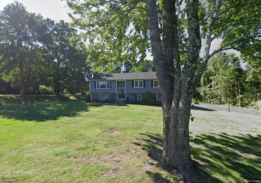
32 Brinsmaid Rd Monroe, CT 06468
Estimated Value: $593,768 - $674,000
3
Beds
2
Baths
2,090
Sq Ft
$304/Sq Ft
Est. Value
About This Home
This home is located at 32 Brinsmaid Rd, Monroe, CT 06468 and is currently estimated at $635,442, approximately $304 per square foot. 32 Brinsmaid Rd is a home located in Fairfield County with nearby schools including Fawn Hollow Elementary School, Jockey Hollow Middle School, and Masuk High School.
Ownership History
Date
Name
Owned For
Owner Type
Purchase Details
Closed on
Mar 26, 2024
Sold by
Rubis James and Rubis Gloria
Bought by
Rubis Gloria
Current Estimated Value
Purchase Details
Closed on
Sep 9, 1971
Bought by
Rubis James and Rubis Gloria
Create a Home Valuation Report for This Property
The Home Valuation Report is an in-depth analysis detailing your home's value as well as a comparison with similar homes in the area
Home Values in the Area
Average Home Value in this Area
Purchase History
| Date | Buyer | Sale Price | Title Company |
|---|---|---|---|
| Rubis Gloria | -- | None Available | |
| Rubis Gloria | -- | None Available | |
| Rubis Gloria | -- | None Available | |
| Rubis James | -- | -- |
Source: Public Records
Mortgage History
| Date | Status | Borrower | Loan Amount |
|---|---|---|---|
| Previous Owner | Rubis James | $200,000 | |
| Previous Owner | Rubis James | $150,000 |
Source: Public Records
Tax History Compared to Growth
Tax History
| Year | Tax Paid | Tax Assessment Tax Assessment Total Assessment is a certain percentage of the fair market value that is determined by local assessors to be the total taxable value of land and additions on the property. | Land | Improvement |
|---|---|---|---|---|
| 2025 | $9,729 | $339,340 | $105,140 | $234,200 |
| 2024 | $8,683 | $226,900 | $91,100 | $135,800 |
| 2023 | $8,520 | $226,900 | $91,100 | $135,800 |
| 2022 | $8,364 | $226,900 | $91,100 | $135,800 |
| 2021 | $29,418 | $226,900 | $91,100 | $135,800 |
| 2020 | $8,050 | $226,900 | $91,100 | $135,800 |
| 2019 | $7,603 | $213,700 | $91,100 | $122,600 |
| 2018 | $31,711 | $213,700 | $91,100 | $122,600 |
| 2017 | $31,238 | $213,700 | $91,100 | $122,600 |
| 2016 | $7,480 | $213,700 | $91,100 | $122,600 |
| 2015 | $7,341 | $213,700 | $91,100 | $122,600 |
| 2014 | $7,320 | $236,040 | $115,640 | $120,400 |
Source: Public Records
Map
Nearby Homes
- 128 Barn Hill Rd
- 96 Big Horn Rd
- 44 Block Farm Rd
- 27 Osborn Ln
- 20 Nicholdale Rd
- 40 Walnut St
- 23 Revere Rd
- 999 Monroe Turnpike
- 12 Millbrook Rd
- 30 E Village Rd
- 39 Short St
- 132 Old Tannery Rd
- 1093 Monroe Turnpike
- 1115 Monroe Turnpike
- 40 Winthrop Place
- 1161 Monroe Turnpike
- 19 Pamela Dr
- 108 Webb Cir
- 140 Highland Dr Unit 140
- 15 Legacy Ln
- 26 Brinsmaid Rd
- 27 Brinsmaid Rd
- 33 Brinsmaid Rd
- 32 Swendsen Dr
- 20 Brinsmaid Rd
- 24 Swendsen Dr
- 21 Brinsmaid Rd
- 41 Swendsen Dr
- 15 Brinsmaid Rd
- 14 Brinsmaid Rd
- 44 Swendsen Dr
- 51 Swendsen Dr
- 9 Brinsmaid Rd
- 36 Captains Hill Rd
- 48 Captains Hill Rd
- 67 Israel Hill Rd
- 45 Captains Hill Rd
- 42 Captains Hill Rd
- 136 Barn Hill Rd
- 30 Captains Hill Rd