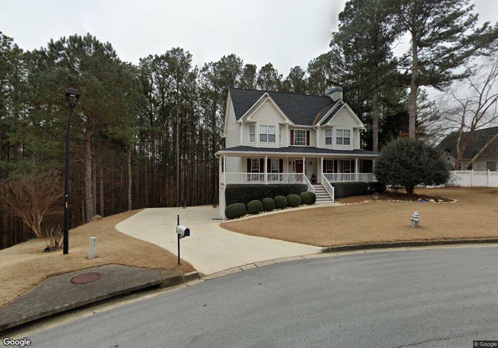
32 Bristol Ct Dallas, GA 30132
East Paulding County NeighborhoodEstimated Value: $363,631 - $380,000
3
Beds
3
Baths
2,066
Sq Ft
$179/Sq Ft
Est. Value
About This Home
This home is located at 32 Bristol Ct, Dallas, GA 30132 and is currently estimated at $370,408, approximately $179 per square foot. 32 Bristol Ct is a home located in Paulding County with nearby schools including W.C. Abney Elementary School, Lena Mae Moses Middle School, and East Paulding High School.
Ownership History
Date
Name
Owned For
Owner Type
Purchase Details
Closed on
Apr 19, 2001
Sold by
Dodd Quailty Homes Inc
Bought by
Odom Steve W
Current Estimated Value
Home Financials for this Owner
Home Financials are based on the most recent Mortgage that was taken out on this home.
Original Mortgage
$154,650
Outstanding Balance
$56,713
Interest Rate
6.95%
Mortgage Type
New Conventional
Estimated Equity
$313,695
Create a Home Valuation Report for This Property
The Home Valuation Report is an in-depth analysis detailing your home's value as well as a comparison with similar homes in the area
Home Values in the Area
Average Home Value in this Area
Purchase History
| Date | Buyer | Sale Price | Title Company |
|---|---|---|---|
| Odom Steve W | $159,500 | -- |
Source: Public Records
Mortgage History
| Date | Status | Borrower | Loan Amount |
|---|---|---|---|
| Open | Odom Steve W | $154,650 |
Source: Public Records
Tax History Compared to Growth
Tax History
| Year | Tax Paid | Tax Assessment Tax Assessment Total Assessment is a certain percentage of the fair market value that is determined by local assessors to be the total taxable value of land and additions on the property. | Land | Improvement |
|---|---|---|---|---|
| 2024 | $993 | $146,476 | $16,000 | $130,476 |
| 2023 | $1,209 | $151,324 | $16,000 | $135,324 |
| 2022 | $975 | $121,172 | $16,000 | $105,172 |
| 2021 | $963 | $97,400 | $16,000 | $81,400 |
| 2020 | $966 | $92,196 | $16,000 | $76,196 |
| 2019 | $937 | $86,360 | $16,000 | $70,360 |
| 2018 | $862 | $80,612 | $16,000 | $64,612 |
| 2017 | $806 | $73,056 | $16,000 | $57,056 |
| 2016 | $1,232 | $65,976 | $16,000 | $49,976 |
| 2015 | $1,242 | $65,024 | $16,000 | $49,024 |
| 2014 | $1,140 | $58,320 | $16,000 | $42,320 |
| 2013 | -- | $58,440 | $16,000 | $42,440 |
Source: Public Records
Map
Nearby Homes
- 67 Severn Way
- 18 Ardmore Place
- 836 Stable View Loop
- 345 Stable View Loop
- 169 Kipling Dr
- 104 Jones Ridge Dr
- 251 Eagle Lake Dr
- 359 Westridge Cir
- 345 Westridge Cir
- 103 Cyrilla Walk
- 265 Jabo Carter Rd
- 24 Cannon Ridge View
- 360 Crimson Dr
- 469 Sienna Bluff
- 103 W Chestnut Way
- 696 River Run Dr Unit 46
- 696 River Run Dr
- 680 River Run Dr Unit 47
- 670 River Run Dr Unit 48
- 176 Deven Dr
- 42 Severn Way
- 38 Bristol Ct
- 29 Bristol Ct
- 18 Severn Way
- 43 Bristol Ct
- 49 Severn Way
- 23 Severn Way
- 4 Severn Way
- 4 Severn Way Unit 54
- 83 Severn Way
- 99 Severn Way
- 109 Ardmore Place
- 161 Ardmore Place
- 7 Severn Way
- 0 Severn Way Unit 8826348
- 125 Severn Way
- 188 Annandale Dr Unit 38
- 188 Annandale Dr
- 71 Ardmore Place
- 164 Annandale Dr