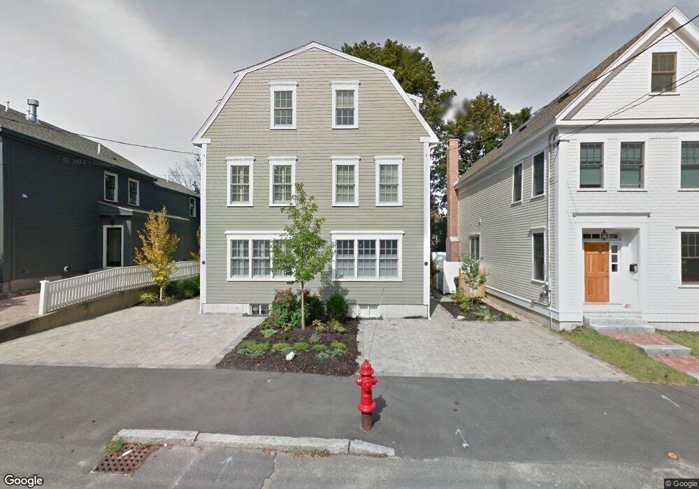
32 Bromfield St Unit A Newburyport, MA 01950
Estimated Value: $1,159,734 - $1,339,000
3
Beds
3
Baths
1,600
Sq Ft
$779/Sq Ft
Est. Value
About This Home
This home is located at 32 Bromfield St Unit A, Newburyport, MA 01950 and is currently estimated at $1,245,684, approximately $778 per square foot. 32 Bromfield St Unit A is a home located in Essex County with nearby schools including Francis T. Bresnahan Elementary School, Edward G. Molin Elementary School, and Rupert A. Nock Middle School.
Ownership History
Date
Name
Owned For
Owner Type
Purchase Details
Closed on
Mar 5, 2021
Sold by
32A Bromfield Street Rt
Bought by
Lacaire Ft
Current Estimated Value
Purchase Details
Closed on
Oct 25, 2017
Sold by
Lacaire John A and Rochette Patrice
Bought by
32A Bromfield Street R
Purchase Details
Closed on
Dec 10, 2010
Sold by
Boston Choice Mgmt Llc
Bought by
Lacaire John A and Rochette Patrice
Create a Home Valuation Report for This Property
The Home Valuation Report is an in-depth analysis detailing your home's value as well as a comparison with similar homes in the area
Home Values in the Area
Average Home Value in this Area
Purchase History
| Date | Buyer | Sale Price | Title Company |
|---|---|---|---|
| Lacaire Ft | -- | None Available | |
| 32A Bromfield Street R | -- | -- | |
| Lacaire John A | $540,000 | -- |
Source: Public Records
Tax History Compared to Growth
Tax History
| Year | Tax Paid | Tax Assessment Tax Assessment Total Assessment is a certain percentage of the fair market value that is determined by local assessors to be the total taxable value of land and additions on the property. | Land | Improvement |
|---|---|---|---|---|
| 2025 | $9,388 | $980,000 | $0 | $980,000 |
| 2024 | $9,163 | $919,100 | $0 | $919,100 |
| 2023 | $9,128 | $849,900 | $0 | $849,900 |
| 2022 | $9,006 | $749,900 | $0 | $749,900 |
| 2021 | $8,948 | $707,900 | $0 | $707,900 |
| 2020 | $8,720 | $679,100 | $0 | $679,100 |
| 2019 | $8,417 | $643,500 | $0 | $643,500 |
| 2018 | $8,370 | $631,200 | $0 | $631,200 |
| 2017 | $8,205 | $610,000 | $0 | $610,000 |
| 2016 | $7,395 | $552,300 | $0 | $552,300 |
| 2015 | $7,121 | $533,800 | $0 | $533,800 |
Source: Public Records
Map
Nearby Homes
- 164 Water St Unit A
- 166 Water St Unit B
- 57 Lime St Unit 1
- 58 Lime St Unit 5
- 113 Prospect St Unit B
- 42 Federal St Unit B
- 17 Madison St
- 11 Orange St Unit 2
- 11 Charter St
- 30-32 Water St Unit 4
- 26 Beacon Ave
- 4 Goodwin Ave
- 10 10th St
- 105 State St Unit 301
- 105 State St Unit 101
- 105 State St Unit 201
- 33 Union St
- 95 High St Unit 4
- 95 High St Unit 1
- 1 Lancaster Rd
- 32 Bromfield St
- 32 Bromfield St Unit B
- 32B Bromfield St Unit 32B
- 32 Bromfield St Unit 2
- 32B Bromfield St Unit B
- 30 Bromfield St
- 30 Bromfield St
- 34 Bromfield St
- 28 Bromfield St
- 31 Franklin St
- 35 Franklin St
- 35 Bromfield St Unit D
- 33 Bromfield St Unit D
- 33 Bromfield St Unit B
- 33 Bromfield St Unit A
- 33 Bromfield St Unit C
- 33 Bromfield St Unit 1
- 33 Bromfield St
- 26 Bromfield St
- 29 Franklin St