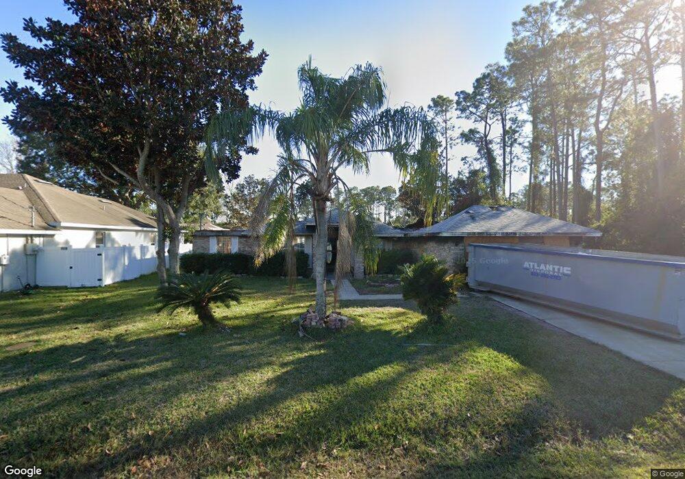
32 Burning Ember Ln Palm Coast, FL 32137
Estimated Value: $345,091 - $422,000
3
Beds
2
Baths
2,263
Sq Ft
$173/Sq Ft
Est. Value
About This Home
This home is located at 32 Burning Ember Ln, Palm Coast, FL 32137 and is currently estimated at $391,523, approximately $173 per square foot. 32 Burning Ember Ln is a home located in Flagler County with nearby schools including Belle Terre Elementary School, Indian Trails Middle School, and Matanzas High School.
Ownership History
Date
Name
Owned For
Owner Type
Purchase Details
Closed on
Jan 14, 2004
Sold by
Bultman Charles F J and Bultman Victoria L
Bought by
Mcneal Ronald and Mcneal Gloria
Current Estimated Value
Home Financials for this Owner
Home Financials are based on the most recent Mortgage that was taken out on this home.
Original Mortgage
$154,900
Outstanding Balance
$73,093
Interest Rate
6.03%
Estimated Equity
$318,430
Purchase Details
Closed on
Oct 23, 2003
Sold by
Adams Homes Nw Fl Inc
Bought by
Bultman Charles F J and Bultman Victoria L
Home Financials for this Owner
Home Financials are based on the most recent Mortgage that was taken out on this home.
Original Mortgage
$127,710
Interest Rate
6.03%
Purchase Details
Closed on
Sep 28, 2001
Sold by
Pokorny Frank and Lee Marika Macej
Bought by
Landmark Com Inc and Palm Coast Holdings Inc
Create a Home Valuation Report for This Property
The Home Valuation Report is an in-depth analysis detailing your home's value as well as a comparison with similar homes in the area
Home Values in the Area
Average Home Value in this Area
Purchase History
| Date | Buyer | Sale Price | Title Company |
|---|---|---|---|
| Mcneal Ronald | $174,900 | -- | |
| Bultman Charles F J | $141,900 | -- | |
| Landmark Com Inc | $5,500 | -- |
Source: Public Records
Mortgage History
| Date | Status | Borrower | Loan Amount |
|---|---|---|---|
| Open | Mcneal Ronald | $154,900 | |
| Previous Owner | Bultman Charles F J | $127,710 |
Source: Public Records
Tax History Compared to Growth
Tax History
| Year | Tax Paid | Tax Assessment Tax Assessment Total Assessment is a certain percentage of the fair market value that is determined by local assessors to be the total taxable value of land and additions on the property. | Land | Improvement |
|---|---|---|---|---|
| 2024 | $1,817 | $145,019 | -- | -- |
| 2023 | $1,817 | $140,795 | $0 | $0 |
| 2022 | $1,788 | $136,694 | $0 | $0 |
| 2021 | $1,757 | $132,712 | $0 | $0 |
| 2020 | $1,750 | $130,878 | $0 | $0 |
| 2019 | $1,714 | $127,935 | $0 | $0 |
| 2018 | $1,699 | $125,550 | $0 | $0 |
| 2017 | $1,663 | $123,405 | $0 | $0 |
| 2016 | $1,619 | $120,867 | $0 | $0 |
| 2015 | $1,620 | $120,027 | $0 | $0 |
| 2014 | $1,625 | $119,074 | $0 | $0 |
Source: Public Records
Map
Nearby Homes
- 32 Burning Sands Ln
- 24 Lakeside Place W
- 62 Barkley Ln
- 45 Barkwood Ln
- 103 Barrington Dr
- 1 Barbera Ln
- 8 Lakeside Place W
- 23 Burning View Ln
- 56 Barkley Ln
- 32 Barrister Ln
- 81 Barrington Dr
- 8 Burning Sands Ln
- 21 Lakeside Place W
- 39 Bird of Paradise Dr
- 7 Burning View Ln
- 1 Burning Sands Ln
- 20 Barkley Ln
- 25 Bassett Ln
- 29 Bassett Ln
- 6 Lakeside Place E
- 34 Burning Ember Ln
- 30 Burning Ember Ln
- 47 Burning Bush Dr
- 45 Burning Bush Dr
- 36 Burning Ember Ln
- 33 Burning Ember Ln
- 28 Burning Ember Ln
- 35 Burning Ember Ln
- 51 Burning Bush Dr
- 43 Burning Bush Dr
- 31 Burning Ember Ln
- 37 Burning Ember Ln
- 38 Burning Ember Ln
- 29 Burning Ember Ln
- 26 Burning Ember Ln
- 53 Burning Bush Dr
- 41 Burning Bush Dr
- 39 Burning Ember Ln
- 34 Burning Sands Ln
- 48 Burning Bush Dr