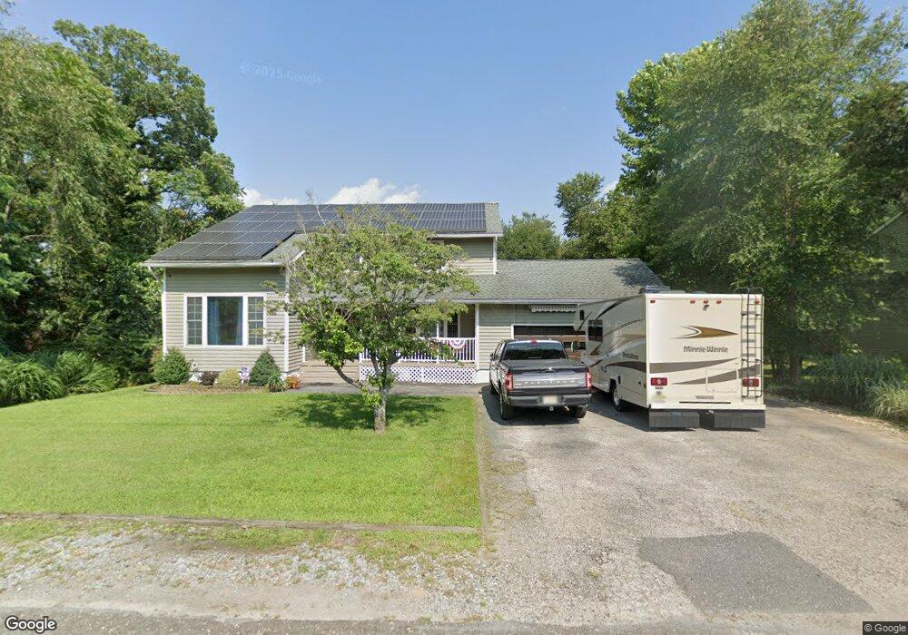
32 Central Ave Mays Landing, NJ 08330
Estimated Value: $444,000 - $560,000
Studio
--
Bath
2,781
Sq Ft
$172/Sq Ft
Est. Value
About This Home
This home is located at 32 Central Ave, Mays Landing, NJ 08330 and is currently estimated at $479,319, approximately $172 per square foot. 32 Central Ave is a home located in Atlantic County with nearby schools including Joseph Shaner School, George L. Hess Educational Complex, and William Davies Middle School.
Ownership History
Date
Name
Owned For
Owner Type
Purchase Details
Closed on
Dec 11, 2002
Sold by
Lynch J Michael
Bought by
Barber Wesley and Barber Wendi
Current Estimated Value
Home Financials for this Owner
Home Financials are based on the most recent Mortgage that was taken out on this home.
Original Mortgage
$171,000
Outstanding Balance
$70,337
Interest Rate
6.16%
Mortgage Type
Purchase Money Mortgage
Estimated Equity
$408,982
Create a Home Valuation Report for This Property
The Home Valuation Report is an in-depth analysis detailing your home's value as well as a comparison with similar homes in the area
Home Values in the Area
Average Home Value in this Area
Purchase History
We collect this data history from publicly available records. To have your information removed, we recommend requesting removal directly through your county’s website.
| Date | Buyer | Sale Price | Title Company |
|---|---|---|---|
| Barber Wesley | $180,000 | -- | |
| Barber Wesley | $180,000 | -- |
Source: Public Records
Mortgage History
We collect this data history from publicly available records. To have your information removed, we recommend requesting removal directly through your county’s website.
| Date | Status | Borrower | Loan Amount |
|---|---|---|---|
| Open | Barber Wesley | $171,000 | |
| Closed | Barber Wesley | $171,000 |
Source: Public Records
Tax History
| Year | Tax Paid | Tax Assessment Tax Assessment Total Assessment is a certain percentage of the fair market value that is determined by local assessors to be the total taxable value of land and additions on the property. | Land | Improvement |
|---|---|---|---|---|
| 2025 | $9,761 | $284,500 | $43,700 | $240,800 |
| 2024 | $9,761 | $284,500 | $43,700 | $240,800 |
| 2023 | $9,178 | $284,500 | $43,700 | $240,800 |
| 2022 | $9,178 | $284,500 | $43,700 | $240,800 |
| 2021 | $9,158 | $284,500 | $43,700 | $240,800 |
| 2020 | $9,158 | $284,500 | $43,700 | $240,800 |
| 2019 | $9,181 | $284,500 | $43,700 | $240,800 |
| 2018 | $8,859 | $284,500 | $43,700 | $240,800 |
| 2017 | $8,720 | $284,500 | $43,700 | $240,800 |
| 2016 | $8,475 | $284,500 | $43,700 | $240,800 |
| 2015 | $8,188 | $284,500 | $43,700 | $240,800 |
| 2014 | $8,104 | $308,500 | $52,400 | $256,100 |
Source: Public Records
Map
Nearby Homes
- 80 Mill St
- 1 Mill St
- Rt 50 and Old Mays Landing Rd
- 535 Park Rd
- 302 Lenape Ave
- 0 3rd St
- 921 Blake Dr
- 907 Blake Dr
- 6138 Robin Dr
- 900 Adams Ave
- 5616 Atlantic Ave
- 246 Old River Rd
- 6171 Robin Dr
- 706 Park Rd
- 88 11th Ave
- 6185 Towhee Ln
- 0 Harding Hwy Unit 605975
- 6305 Palmer Ave
- 4 Rainbow Dr
- 147 Katherine Ave
Your Personal Tour Guide
Ask me questions while you tour the home.