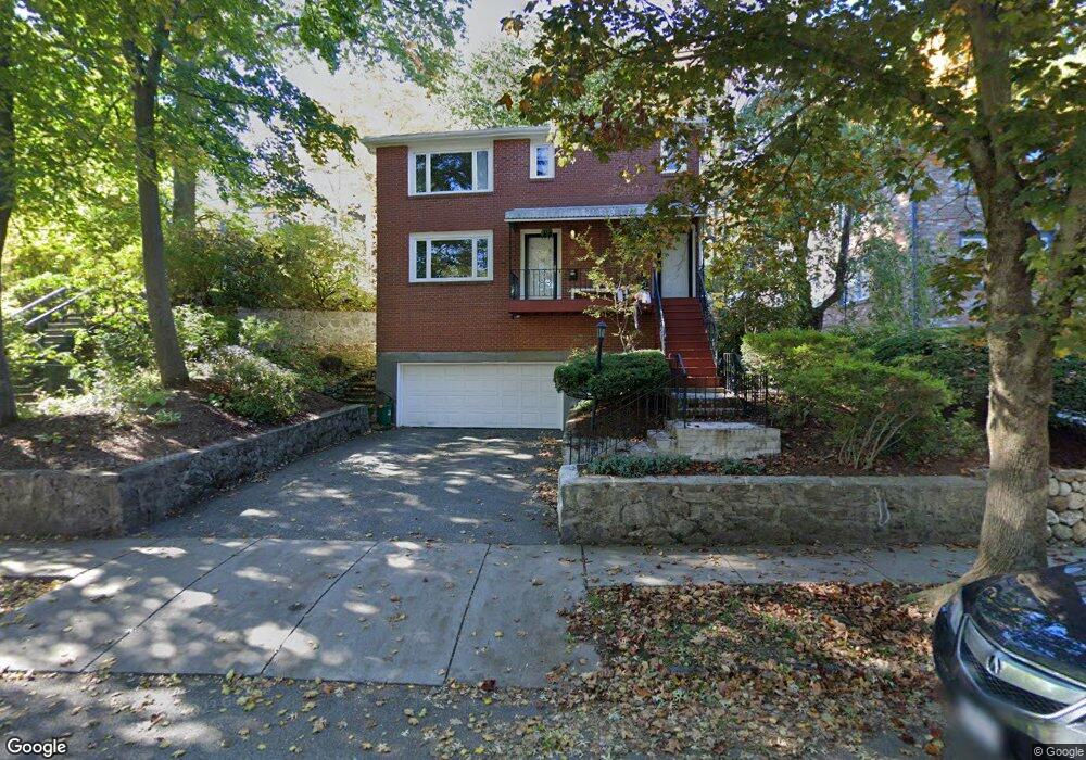
32 Clark Rd Unit 34 Brookline, MA 02445
Brookline Village NeighborhoodEstimated Value: $1,967,000 - $2,547,898
6
Beds
4
Baths
2,844
Sq Ft
$763/Sq Ft
Est. Value
About This Home
This home is located at 32 Clark Rd Unit 34, Brookline, MA 02445 and is currently estimated at $2,169,225, approximately $762 per square foot. 32 Clark Rd Unit 34 is a home located in Norfolk County with nearby schools including John D. Runkle School, Brookline High School, and Maimonides School.
Ownership History
Date
Name
Owned For
Owner Type
Purchase Details
Closed on
Dec 30, 2013
Sold by
Jamshidi Roya
Bought by
Roya Jamshidi Irt
Current Estimated Value
Purchase Details
Closed on
Jun 23, 2008
Sold by
32 Clark Road Read Rt
Bought by
Jamshidi Roya
Create a Home Valuation Report for This Property
The Home Valuation Report is an in-depth analysis detailing your home's value as well as a comparison with similar homes in the area
Home Values in the Area
Average Home Value in this Area
Purchase History
| Date | Buyer | Sale Price | Title Company |
|---|---|---|---|
| Roya Jamshidi Irt | -- | -- | |
| Jamshidi Roya | $989,000 | -- |
Source: Public Records
Tax History
| Year | Tax Paid | Tax Assessment Tax Assessment Total Assessment is a certain percentage of the fair market value that is determined by local assessors to be the total taxable value of land and additions on the property. | Land | Improvement |
|---|---|---|---|---|
| 2025 | $21,402 | $2,168,400 | $1,218,200 | $950,200 |
| 2024 | $20,979 | $2,147,300 | $1,171,300 | $976,000 |
| 2023 | $19,281 | $1,933,900 | $938,000 | $995,900 |
| 2022 | $18,768 | $1,841,800 | $893,300 | $948,500 |
| 2021 | $17,355 | $1,770,900 | $858,900 | $912,000 |
| 2020 | $16,314 | $1,726,300 | $780,900 | $945,400 |
| 2019 | $15,405 | $1,644,100 | $743,700 | $900,400 |
| 2018 | $14,553 | $1,538,400 | $676,100 | $862,300 |
| 2017 | $14,072 | $1,424,300 | $637,700 | $786,600 |
| 2016 | $13,492 | $1,294,800 | $596,000 | $698,800 |
| 2015 | $12,571 | $1,177,100 | $557,000 | $620,100 |
| 2014 | $12,286 | $1,078,700 | $506,500 | $572,200 |
Source: Public Records
Map
Nearby Homes
- 140 Sumner Rd Unit 1
- 24 Blake Rd
- 75 Greenough St Unit 2
- 71 Greenough St Unit 71-1
- 236 Walnut St
- 42 Prince St
- 8 Leverett St Unit 3
- 20 Rice St Unit 2
- 18 Chestnut Place
- 11 Goodwin Place Unit 1
- 11 Goodwin Place Unit 11-1
- 11 Goodwin Place Unit 11-2
- 12 Goodwin Place Unit 12-1
- 12 Goodwin Place Unit 12-2
- 370 Washington St
- 401 Washington St Unit 6
- 12 Thayer St
- 15 Colbourne Crescent Unit 2
- 84 Winthrop Rd Unit 1
- 84 Winthrop Rd
- 32 Clark Rd Unit 36
- 32 Clark Rd
- 34 Clark Rd
- 32 Clark Rd Unit 32
- 32/34 Clark Rd
- 36 Clark Rd Unit 38
- 36 Clark Rd Unit 36
- 38 Clark Rd
- 28 Clark Rd
- 19 Philbrick Rd
- 40 Clark Rd Unit 42
- 40 Clark Rd Unit 40
- 40 Clark Rd
- 40-42 Clark Rd
- 42 Clark Rd
- 42 Clark Rd Unit n/a
- 42 Clark Rd Unit 2
- 44 Clark Rd
- 33 Clark Rd Unit 1
- 33 Clark Rd Unit 2
Your Personal Tour Guide
Ask me questions while you tour the home.