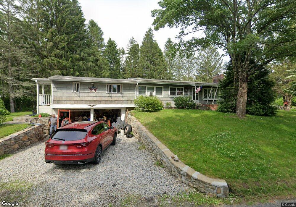
32 Davidson Rd Charlton, MA 01507
Estimated Value: $476,369 - $512,000
4
Beds
2
Baths
1,690
Sq Ft
$291/Sq Ft
Est. Value
About This Home
This home is located at 32 Davidson Rd, Charlton, MA 01507 and is currently estimated at $491,842, approximately $291 per square foot. 32 Davidson Rd is a home located in Worcester County with nearby schools including Shepherd Hill Regional High School.
Ownership History
Date
Name
Owned For
Owner Type
Purchase Details
Closed on
Mar 29, 2018
Sold by
Jones Christopher K
Bought by
Jones Stephen P
Current Estimated Value
Home Financials for this Owner
Home Financials are based on the most recent Mortgage that was taken out on this home.
Original Mortgage
$111,000
Outstanding Balance
$94,911
Interest Rate
4.38%
Mortgage Type
New Conventional
Estimated Equity
$396,931
Purchase Details
Closed on
Sep 18, 1984
Bought by
Hicks Margaret
Create a Home Valuation Report for This Property
The Home Valuation Report is an in-depth analysis detailing your home's value as well as a comparison with similar homes in the area
Home Values in the Area
Average Home Value in this Area
Purchase History
| Date | Buyer | Sale Price | Title Company |
|---|---|---|---|
| Jones Stephen P | $111,000 | -- | |
| Jones Stephen P | $111,000 | -- | |
| Jones Stephen P | -- | -- | |
| Jones Stephen P | -- | -- | |
| Hicks Margaret | $76,900 | -- |
Source: Public Records
Mortgage History
| Date | Status | Borrower | Loan Amount |
|---|---|---|---|
| Open | Jones Stephen P | $111,000 | |
| Closed | Jones Stephen P | $111,000 | |
| Previous Owner | Hicks Margaret | $43,000 | |
| Previous Owner | Hicks Margaret | $13,798 |
Source: Public Records
Tax History Compared to Growth
Tax History
| Year | Tax Paid | Tax Assessment Tax Assessment Total Assessment is a certain percentage of the fair market value that is determined by local assessors to be the total taxable value of land and additions on the property. | Land | Improvement |
|---|---|---|---|---|
| 2025 | $4,551 | $408,900 | $96,100 | $312,800 |
| 2024 | $4,383 | $386,500 | $95,800 | $290,700 |
| 2023 | $4,442 | $365,000 | $91,100 | $273,900 |
| 2022 | $4,165 | $313,400 | $82,700 | $230,700 |
| 2021 | $3,722 | $248,000 | $78,500 | $169,500 |
| 2020 | $3,660 | $245,000 | $75,500 | $169,500 |
| 2019 | $3,530 | $239,000 | $69,500 | $169,500 |
| 2018 | $3,227 | $239,000 | $69,500 | $169,500 |
| 2017 | $2,924 | $207,400 | $63,500 | $143,900 |
| 2016 | $2,858 | $207,400 | $63,500 | $143,900 |
| 2015 | $2,783 | $207,400 | $63,500 | $143,900 |
| 2014 | $2,661 | $210,200 | $67,800 | $142,400 |
Source: Public Records
Map
Nearby Homes
- 15 Priscilla Ln
- 0 Oxbow Rd
- 71 Bay Path Rd
- 9 Oak Dr
- 44 Hycrest Rd
- 39 Hycrest Rd
- 8 Hycrest Rd
- 40 Carroll Hill Rd
- 7 Hycrest Rd
- 57 Coughlin Rd
- 45 Leicester St
- 31-37 Leicester St
- 20 Leicester St
- 105 Carroll Hill Rd
- 3 Michelle Ln
- 18 Old Worcester Rd
- Lot 7 Coughlin Rd
- Lot 8 Coughlin Rd
- Lot 6 Coughlin Rd
- Lot 4 Coughlin Rd