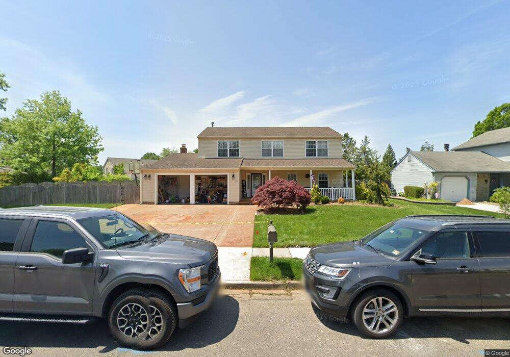
32 Duncan Rd Sewell, NJ 08080
Estimated Value: $476,000 - $512,000
4
Beds
3
Baths
2,478
Sq Ft
$199/Sq Ft
Est. Value
About This Home
This home is located at 32 Duncan Rd, Sewell, NJ 08080 and is currently estimated at $492,291, approximately $198 per square foot. 32 Duncan Rd is a home located in Gloucester County with nearby schools including Washington Township High School, Hurffville Elementary School, and Chestnut Ridge Midle School.
Ownership History
Date
Name
Owned For
Owner Type
Purchase Details
Closed on
Oct 17, 2008
Sold by
Federal Home Loan Mortgage Corporation
Bought by
Petracci Robert and Petracci Denise
Current Estimated Value
Purchase Details
Closed on
Jan 23, 2008
Sold by
Hull George H
Bought by
Wells Fargo Bank Na
Create a Home Valuation Report for This Property
The Home Valuation Report is an in-depth analysis detailing your home's value as well as a comparison with similar homes in the area
Home Values in the Area
Average Home Value in this Area
Purchase History
| Date | Buyer | Sale Price | Title Company |
|---|---|---|---|
| Petracci Robert | $155,000 | Multiple | |
| Wells Fargo Bank Na | -- | None Available |
Source: Public Records
Tax History
| Year | Tax Paid | Tax Assessment Tax Assessment Total Assessment is a certain percentage of the fair market value that is determined by local assessors to be the total taxable value of land and additions on the property. | Land | Improvement |
|---|---|---|---|---|
| 2025 | $10,305 | $278,600 | $51,600 | $227,000 |
| 2024 | $10,016 | $278,600 | $51,600 | $227,000 |
| 2023 | $10,016 | $278,600 | $51,600 | $227,000 |
| 2022 | $9,687 | $278,600 | $51,600 | $227,000 |
| 2021 | $7,137 | $278,600 | $51,600 | $227,000 |
| 2020 | $9,419 | $278,600 | $51,600 | $227,000 |
| 2019 | $9,047 | $248,200 | $36,600 | $211,600 |
| 2018 | $8,945 | $248,200 | $36,600 | $211,600 |
| 2017 | $8,833 | $248,200 | $36,600 | $211,600 |
| 2016 | $8,781 | $248,200 | $36,600 | $211,600 |
| 2015 | $8,657 | $248,200 | $36,600 | $211,600 |
| 2014 | $8,384 | $248,200 | $36,600 | $211,600 |
Source: Public Records
Map
Nearby Homes
- 22 Duncan Rd
- 3 Turner Ct
- 1011 Hillsboro Ct Unit 1011
- 610 Hartland Ct Unit 610
- 216 Pratt Ct Unit 216
- 121 Bound Brook Ct
- 3 Wiltshire Dr
- 8 Grant Cir
- 14 Diane Ct
- 117 Shire Dr
- 144 Hurffville Grenloch Rd
- 125 Trent Rd
- 14 Benner Rd
- 257 Chapel Heights Rd
- 1 Windsor Ct Unit D1
- 111 Belfry Place
- 137 Meridian Ln
- 458 Egg Harbor Rd
- 105 Meridian Ln
- 20 Kent Place Unit R3
Your Personal Tour Guide
Ask me questions while you tour the home.