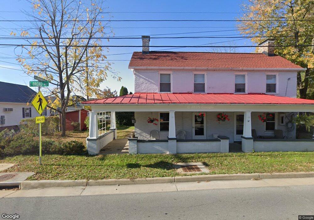
32 E Broad Way Lovettsville, VA 20180
Estimated Value: $530,000 - $586,189
3
Beds
2
Baths
2,427
Sq Ft
$229/Sq Ft
Est. Value
About This Home
This home is located at 32 E Broad Way, Lovettsville, VA 20180 and is currently estimated at $556,547, approximately $229 per square foot. 32 E Broad Way is a home located in Loudoun County with nearby schools including Lovettsville Elementary School, Woodgrove High School, and Harmony Middle School.
Ownership History
Date
Name
Owned For
Owner Type
Purchase Details
Closed on
Oct 2, 2023
Sold by
Spannaus Edward W and Spannaus Nancy B
Bought by
Spannaus Family Revocable Trust and Spannaus
Current Estimated Value
Purchase Details
Closed on
Oct 16, 1996
Bought by
Spannaus Edward W and Spannaus Nancy B
Home Financials for this Owner
Home Financials are based on the most recent Mortgage that was taken out on this home.
Original Mortgage
$26,000
Interest Rate
8.26%
Mortgage Type
Credit Line Revolving
Create a Home Valuation Report for This Property
The Home Valuation Report is an in-depth analysis detailing your home's value as well as a comparison with similar homes in the area
Home Values in the Area
Average Home Value in this Area
Purchase History
| Date | Buyer | Sale Price | Title Company |
|---|---|---|---|
| Spannaus Family Revocable Trust | -- | None Listed On Document | |
| Spannaus Edward W | -- | -- |
Source: Public Records
Mortgage History
| Date | Status | Borrower | Loan Amount |
|---|---|---|---|
| Previous Owner | Spannaus Edward W | $26,000 |
Source: Public Records
Tax History Compared to Growth
Tax History
| Year | Tax Paid | Tax Assessment Tax Assessment Total Assessment is a certain percentage of the fair market value that is determined by local assessors to be the total taxable value of land and additions on the property. | Land | Improvement |
|---|---|---|---|---|
| 2025 | $4,080 | $506,890 | $171,200 | $335,690 |
| 2024 | $3,948 | $456,360 | $151,200 | $305,160 |
| 2023 | $3,641 | $416,150 | $113,700 | $302,450 |
| 2022 | $3,339 | $375,190 | $113,700 | $261,490 |
| 2021 | $3,034 | $309,590 | $96,200 | $213,390 |
| 2020 | $2,923 | $282,380 | $96,200 | $186,180 |
| 2019 | $2,650 | $253,600 | $96,200 | $157,400 |
| 2018 | $2,752 | $253,600 | $96,200 | $157,400 |
| 2017 | $2,771 | $246,280 | $96,200 | $150,080 |
| 2016 | $2,778 | $242,620 | $0 | $0 |
| 2015 | $2,557 | $129,120 | $0 | $129,120 |
| 2014 | $2,298 | $112,250 | $0 | $112,250 |
Source: Public Records
Map
Nearby Homes
- 45 E Broad Way
- 11 S Berlin Pike
- 45 A-1 S Loudoun St
- 27 Mills Ct
- 40 N Berlin Pike
- 35 Eisentown Dr
- 34 Lange Dr
- 7 Cooper Run St
- 11965 Berlin Turnpike
- 12821 Milltown Rd
- 11 Family Ln
- 12080 Sunflower Field Place
- 40455 Quarter Branch Rd
- 12851 April Cir
- 39699 Wenner Rd
- 13267 Berlin Turnpike
- 40462 Lovettsville Rd
- 0 Catoctin View Ln
- 38628 Patent House Ln
- 11407 Olde Stone Ln
- 30 E Broad Way
- 34 E Broad Way
- 18 E Pennsylvania Ave
- 28 E Broad Way
- 36 E Broad Way
- 25 E Broad Way
- 27 E Broad Way
- 23 E Broad Way
- 20 E Pennsylvania Ave
- 29 E Broad Way
- 1 S Loudoun St
- 38 E Broad Way
- 0 Unknown Unit VALO428838
- 0 Unknown Unit VALO415214
- 0 Unknown Unit VALO400574
- 0 S Locust St
- 5 S Locust St
- 31 E Broad Way
- 22 E Pennsylvania Ave
- 33 E Broad Way