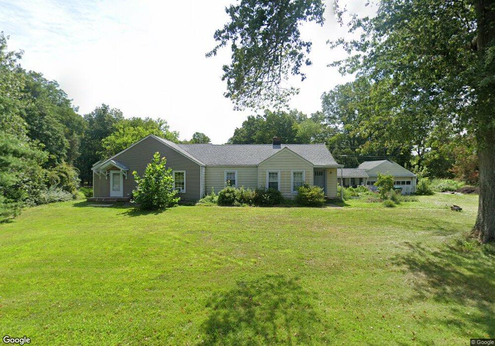
32 E Mountain Rd Hillsborough, NJ 08844
Estimated Value: $612,720 - $717,000
--
Bed
--
Bath
2,002
Sq Ft
$339/Sq Ft
Est. Value
About This Home
This home is located at 32 E Mountain Rd, Hillsborough, NJ 08844 and is currently estimated at $677,680, approximately $338 per square foot. 32 E Mountain Rd is a home located in Somerset County with nearby schools including Hillsborough High School, Cherry Blossom Montessori School, and Brighthorizons at Hillsborough.
Ownership History
Date
Name
Owned For
Owner Type
Purchase Details
Closed on
Feb 12, 2002
Sold by
Kehoe Jane
Bought by
Damerow Ian
Current Estimated Value
Home Financials for this Owner
Home Financials are based on the most recent Mortgage that was taken out on this home.
Original Mortgage
$170,250
Outstanding Balance
$70,496
Interest Rate
7.08%
Mortgage Type
Purchase Money Mortgage
Estimated Equity
$607,184
Create a Home Valuation Report for This Property
The Home Valuation Report is an in-depth analysis detailing your home's value as well as a comparison with similar homes in the area
Home Values in the Area
Average Home Value in this Area
Purchase History
| Date | Buyer | Sale Price | Title Company |
|---|---|---|---|
| Damerow Ian | $227,000 | -- |
Source: Public Records
Mortgage History
| Date | Status | Borrower | Loan Amount |
|---|---|---|---|
| Open | Damerow Ian | $170,250 |
Source: Public Records
Tax History Compared to Growth
Tax History
| Year | Tax Paid | Tax Assessment Tax Assessment Total Assessment is a certain percentage of the fair market value that is determined by local assessors to be the total taxable value of land and additions on the property. | Land | Improvement |
|---|---|---|---|---|
| 2025 | $10,025 | $525,300 | $268,100 | $257,200 |
| 2024 | $10,025 | $467,800 | $248,100 | $219,700 |
| 2023 | $7,710 | $358,100 | $243,100 | $115,000 |
| 2022 | $7,411 | $331,900 | $223,100 | $108,800 |
| 2021 | $7,206 | $306,900 | $198,100 | $108,800 |
| 2020 | $9,028 | $378,700 | $175,100 | $203,600 |
| 2019 | $8,565 | $356,300 | $151,300 | $205,000 |
| 2018 | $8,367 | $345,900 | $137,800 | $208,100 |
| 2017 | $8,189 | $339,100 | $128,800 | $210,300 |
| 2016 | $8,546 | $354,000 | $142,300 | $211,700 |
| 2015 | $7,686 | $322,400 | $142,300 | $180,100 |
| 2014 | $7,499 | $321,300 | $128,800 | $192,500 |
Source: Public Records
Map
Nearby Homes
- 0 Amwell Rd
- 71 Buckland Dr
- 710 Whitenack Ct
- 436 Conover Dr
- 68 Dunedain St
- 195 Beekman Ln
- 104 Devonshire Ct
- 73 Beechwood Cir
- 106 Perrine Pike
- 668 - E2 Marshall Rd
- 912 Merritt Dr Unit D
- 911 Merritt Dr Unit B2
- 902 Merritt Dr Unit E
- 303 Gemini Dr Unit 2B
- 7 Monfort Dr
- 13 Wesley Rd
- 118 Bluebird Dr Unit 3
- 718 Mill Ln
- 107 Bluebird Dr Unit 1D
- 3120 Revere Ct
- 30 E Mountain Rd
- 34 E Mountain Rd
- 25 E Mountain Rd
- 23 E Mountain Rd
- 412 Ernest Dr
- 36 E Mountain Rd
- 414 Ernest Dr
- 410 Ernest Dr
- 408 Ernest Dr
- 340 S Branch Rd Pad Site 127 Unit 127
- 27 E Mountain Rd
- 406 Ernest Dr
- 416 Ernest Dr
- 340 S Branch Rd Unit 435
- 340 S Branch Rd Unit 434
- 340 S Branch Rd Unit 433
- 340 S Branch Rd Unit 432
- 340 S Branch Rd Unit 431
- 340 S Branch Rd Unit 430
- 340 S Branch Rd Unit 429