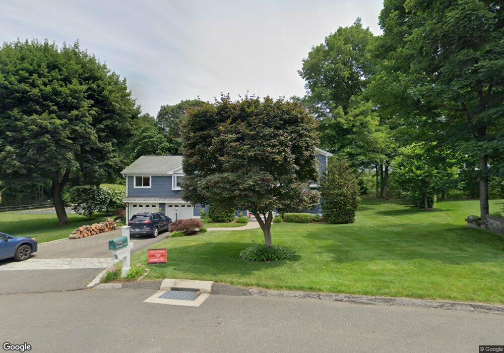
32 Esquire Rd Norwalk, CT 06851
Woods Pond NeighborhoodEstimated Value: $789,000 - $922,724
4
Beds
2
Baths
2,554
Sq Ft
$340/Sq Ft
Est. Value
About This Home
This home is located at 32 Esquire Rd, Norwalk, CT 06851 and is currently estimated at $867,181, approximately $339 per square foot. 32 Esquire Rd is a home located in Fairfield County with nearby schools including Tracey School, West Rocks Middle School, and Norwalk High School.
Ownership History
Date
Name
Owned For
Owner Type
Purchase Details
Closed on
Jan 7, 1999
Sold by
Tsung Ma Tein and Jung-Jia Jenn
Bought by
Orlando Anthony P and Casinelli Susanne L
Current Estimated Value
Purchase Details
Closed on
Jun 30, 1993
Sold by
Wallenrod Lionel and Wallenrod Joyce
Bought by
Ma Tien Tsung and Jiu Jenn Jung
Create a Home Valuation Report for This Property
The Home Valuation Report is an in-depth analysis detailing your home's value as well as a comparison with similar homes in the area
Home Values in the Area
Average Home Value in this Area
Purchase History
| Date | Buyer | Sale Price | Title Company |
|---|---|---|---|
| Orlando Anthony P | $260,000 | -- | |
| Orlando Anthony P | $260,000 | -- | |
| Ma Tien Tsung | $222,500 | -- | |
| Ma Tien Tsung | $222,500 | -- |
Source: Public Records
Mortgage History
| Date | Status | Borrower | Loan Amount |
|---|---|---|---|
| Open | Ma Tien Tsung | $155,000 | |
| Closed | Ma Tien Tsung | $222,000 | |
| Closed | Ma Tien Tsung | $191,075 |
Source: Public Records
Tax History Compared to Growth
Tax History
| Year | Tax Paid | Tax Assessment Tax Assessment Total Assessment is a certain percentage of the fair market value that is determined by local assessors to be the total taxable value of land and additions on the property. | Land | Improvement |
|---|---|---|---|---|
| 2025 | $13,236 | $552,730 | $240,720 | $312,010 |
| 2024 | $13,039 | $552,730 | $240,720 | $312,010 |
| 2023 | $11,125 | $442,170 | $183,880 | $258,290 |
| 2022 | $10,918 | $442,170 | $183,880 | $258,290 |
| 2021 | $10,634 | $442,170 | $183,880 | $258,290 |
| 2020 | $10,628 | $442,170 | $183,880 | $258,290 |
| 2019 | $10,331 | $442,170 | $183,880 | $258,290 |
| 2018 | $11,842 | $444,170 | $190,890 | $253,280 |
| 2017 | $11,436 | $444,170 | $190,890 | $253,280 |
| 2016 | $11,326 | $444,170 | $190,890 | $253,280 |
| 2015 | $11,295 | $444,170 | $190,890 | $253,280 |
| 2014 | $11,149 | $444,170 | $190,890 | $253,280 |
Source: Public Records
Map
Nearby Homes
- 9 Allen Ct
- 1 Blue Mountain Ridge
- 2 Wildgoose Ln
- 14 E Rocks Rd
- 20 W Rocks Rd
- 46 Sunrise Hill Rd
- 34 Sunrise Hill Rd
- 24 Sawmill Rd
- 30 Honeysuckle Dr
- 71 Saddle Rd
- 71 Aiken St Unit J11
- 71 Aiken St Unit P12
- 12 Merrill Rd
- 29 Saddle Rd
- 33 Center Ave
- 50 Aiken St Unit 312
- 50 Aiken St Unit 241
- 50 Aiken St Unit 305
- 50 Aiken St Unit 223
- 50 Aiken St Unit 225