32 Flint St Shelby, OH 44875
Estimated Value: $30,000 - $63,000
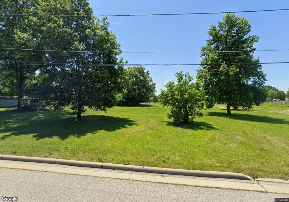
Highlights
- Landscaped with Trees
- Level Lot
- 4-minute walk to McBride Park
About This Lot
As of March 2018Nice level building lot in city limits (lot is staked). Acceptable transfer. City utilities. Water, sewer, electric available. Rough cut-in driveway. Zoning change in process. Call Listing Agent for details.
Property Details
Property Type
- Land
Est. Annual Taxes
- $63
Lot Details
- 0.31 Acre Lot
- Level Lot
- Landscaped with Trees
Location
- City Lot
Listing and Financial Details
- Assessor Parcel Number 0460805512000
Ownership History
Purchase Details
Purchase Details
Home Financials for this Owner
Home Financials are based on the most recent Mortgage that was taken out on this home.Purchase Details
Purchase Details
Purchase Details
Home Values in the Area
Average Home Value in this Area
Purchase History
| Date | Buyer | Sale Price | Title Company |
|---|---|---|---|
| Brown Kenneth | $8,000 | None Available | |
| Shirk Ii Bobby E | $8,000 | Hawkins Title Research | |
| Lotz Brent | -- | None Available | |
| Richland County Land Reutilization Corpo | -- | None Available | |
| -- | $25,000 | -- |
Property History
| Date | Event | Price | List to Sale | Price per Sq Ft |
|---|---|---|---|---|
| 03/09/2018 03/09/18 | Sold | $4,000 | -27.3% | -- |
| 03/02/2018 03/02/18 | Pending | -- | -- | -- |
| 02/23/2018 02/23/18 | For Sale | $5,500 | -- | -- |
Tax History Compared to Growth
Tax History
| Year | Tax Paid | Tax Assessment Tax Assessment Total Assessment is a certain percentage of the fair market value that is determined by local assessors to be the total taxable value of land and additions on the property. | Land | Improvement |
|---|---|---|---|---|
| 2024 | $63 | $1,610 | $1,610 | $0 |
| 2023 | $63 | $1,610 | $1,610 | $0 |
| 2022 | $73 | $1,670 | $1,670 | $0 |
| 2021 | $73 | $1,670 | $1,670 | $0 |
| 2020 | $73 | $1,670 | $1,670 | $0 |
| 2019 | $67 | $1,410 | $1,410 | $0 |
| 2018 | $67 | $1,410 | $1,410 | $0 |
| 2017 | $414 | $8,830 | $4,690 | $4,140 |
| 2016 | $443 | $9,500 | $5,570 | $3,930 |
| 2015 | $443 | $9,500 | $5,570 | $3,930 |
| 2014 | $415 | $9,500 | $5,570 | $3,930 |
| 2012 | -- | $10,010 | $5,870 | $4,140 |
Map
Source: Mansfield Association of REALTORS®
MLS Number: 9039525
APN: 046-08-055-12-000
Disclaimer: Certain information contained herein is derived from information provided by parties other than Homes.com. All information provided is deemed reliable, but is not guaranteed to be accurate and should be independently verified.
![]() IDX information is provided exclusively for personal, non-commercial use, and may not be used for any purpose other than to identify prospective properties consumers may be interested in purchasing. Information is deemed reliable but not guaranteed.
IDX information is provided exclusively for personal, non-commercial use, and may not be used for any purpose other than to identify prospective properties consumers may be interested in purchasing. Information is deemed reliable but not guaranteed.