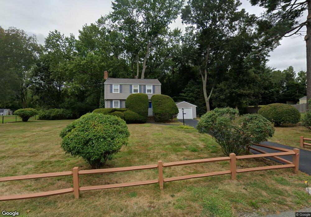
32 Gail Rd Hanover, MA 02339
Estimated Value: $633,000 - $736,000
3
Beds
1
Bath
1,170
Sq Ft
$570/Sq Ft
Est. Value
About This Home
This home is located at 32 Gail Rd, Hanover, MA 02339 and is currently estimated at $666,402, approximately $569 per square foot. 32 Gail Rd is a home located in Plymouth County with nearby schools including Hanover High School, The Master's Academy, and Cardinal Cushing Centers.
Ownership History
Date
Name
Owned For
Owner Type
Purchase Details
Closed on
Oct 11, 2019
Sold by
Hession 2014 T
Bought by
2019 Hession Ft
Current Estimated Value
Purchase Details
Closed on
Jun 23, 2014
Sold by
Hession Daniel F and Hession Anne M
Bought by
Hession T and Hession Daniel F
Purchase Details
Closed on
Mar 23, 1965
Bought by
Hession T
Create a Home Valuation Report for This Property
The Home Valuation Report is an in-depth analysis detailing your home's value as well as a comparison with similar homes in the area
Home Values in the Area
Average Home Value in this Area
Purchase History
| Date | Buyer | Sale Price | Title Company |
|---|---|---|---|
| 2019 Hession Ft | -- | -- | |
| Hession T | -- | -- | |
| Hession T | -- | -- |
Source: Public Records
Tax History
| Year | Tax Paid | Tax Assessment Tax Assessment Total Assessment is a certain percentage of the fair market value that is determined by local assessors to be the total taxable value of land and additions on the property. | Land | Improvement |
|---|---|---|---|---|
| 2025 | $7,067 | $572,200 | $269,600 | $302,600 |
| 2024 | $6,971 | $542,900 | $269,600 | $273,300 |
| 2023 | $6,265 | $464,400 | $245,100 | $219,300 |
| 2022 | $6,771 | $444,000 | $245,100 | $198,900 |
| 2021 | $6,454 | $395,200 | $211,600 | $183,600 |
| 2020 | $6,315 | $387,200 | $211,600 | $175,600 |
| 2019 | $6,170 | $376,000 | $211,600 | $164,400 |
| 2018 | $5,861 | $360,000 | $211,600 | $148,400 |
| 2017 | $5,751 | $348,100 | $210,000 | $138,100 |
| 2016 | $5,496 | $326,000 | $191,000 | $135,000 |
| 2015 | $5,265 | $326,000 | $191,000 | $135,000 |
Source: Public Records
Map
Nearby Homes
- 95 Tecumseh Dr
- 51 Cervelli Farm Dr
- 37 Dr
- 23 Cervelli Farm Dr
- 38 Cervelli Farm Dr
- 9 Cervelli Farm Dr
- 250 Center St
- 36 Grove St
- 430 Brook Bend Rd
- 114 Graham Hill Dr
- 339 State St
- 75 School St
- 139 Fairwood Dr
- 127 King St
- 51 Farmside Dr
- 724 Whitman St
- 285 W Elm St
- 17 Hayford Trail Unit 12
- 60 Summer Path Way
- 7 Hayford Trail Unit 12
Your Personal Tour Guide
Ask me questions while you tour the home.