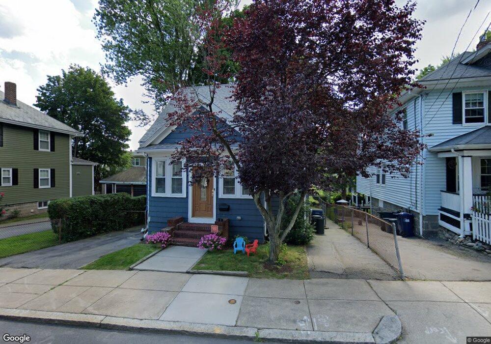
32 Garner Rd Unit 1 Dorchester, MA 02122
Neponset-Port Norfolk NeighborhoodEstimated Value: $808,000 - $856,000
3
Beds
3
Baths
1,367
Sq Ft
$616/Sq Ft
Est. Value
About This Home
This home is located at 32 Garner Rd Unit 1, Dorchester, MA 02122 and is currently estimated at $842,624, approximately $616 per square foot. 32 Garner Rd Unit 1 is a home located in Suffolk County with nearby schools including Neighborhood House Charter School and St Brendan School.
Ownership History
Date
Name
Owned For
Owner Type
Purchase Details
Closed on
May 11, 2020
Sold by
Purton Fergus K
Bought by
Purton Fergus K and Purton Maria C
Current Estimated Value
Purchase Details
Closed on
Dec 12, 2019
Sold by
Mcgrath Bryan T and Mcgrath Kristen E
Bought by
Purton Fergus K
Home Financials for this Owner
Home Financials are based on the most recent Mortgage that was taken out on this home.
Original Mortgage
$465,950
Interest Rate
3.7%
Mortgage Type
New Conventional
Purchase Details
Closed on
Sep 16, 2016
Sold by
Mannion Monica
Bought by
Mcgrath Bryan T and Mcgrath Kristen E
Home Financials for this Owner
Home Financials are based on the most recent Mortgage that was taken out on this home.
Original Mortgage
$521,550
Interest Rate
3.43%
Mortgage Type
Unknown
Purchase Details
Closed on
Aug 23, 1996
Sold by
Hutchison James H and Hutchinson Diane M
Bought by
Mannion Patrick T and Mannion Monica
Home Financials for this Owner
Home Financials are based on the most recent Mortgage that was taken out on this home.
Original Mortgage
$108,000
Interest Rate
8.4%
Mortgage Type
Purchase Money Mortgage
Purchase Details
Closed on
May 11, 1989
Sold by
Thornton William
Bought by
Hutchinson James H
Create a Home Valuation Report for This Property
The Home Valuation Report is an in-depth analysis detailing your home's value as well as a comparison with similar homes in the area
Home Values in the Area
Average Home Value in this Area
Purchase History
| Date | Buyer | Sale Price | Title Company |
|---|---|---|---|
| Purton Fergus K | -- | None Available | |
| Purton Fergus K | $655,999 | None Available | |
| Mcgrath Bryan T | $549,000 | -- | |
| Mannion Patrick T | $120,000 | -- | |
| Hutchinson James H | $125,000 | -- |
Source: Public Records
Mortgage History
| Date | Status | Borrower | Loan Amount |
|---|---|---|---|
| Previous Owner | Purton Fergus K | $465,950 | |
| Previous Owner | Mcgrath Bryan T | $521,550 | |
| Previous Owner | Hutchinson James H | $125,000 | |
| Previous Owner | Hutchinson James H | $20,000 | |
| Previous Owner | Hutchinson James H | $108,000 |
Source: Public Records
Tax History Compared to Growth
Tax History
| Year | Tax Paid | Tax Assessment Tax Assessment Total Assessment is a certain percentage of the fair market value that is determined by local assessors to be the total taxable value of land and additions on the property. | Land | Improvement |
|---|---|---|---|---|
| 2025 | $8,722 | $753,200 | $193,800 | $559,400 |
| 2024 | $8,043 | $737,900 | $183,300 | $554,600 |
| 2023 | $7,405 | $689,500 | $171,300 | $518,200 |
| 2022 | $7,141 | $656,300 | $163,000 | $493,300 |
| 2021 | $6,740 | $631,700 | $158,300 | $473,400 |
| 2020 | $5,823 | $551,400 | $158,500 | $392,900 |
| 2019 | $5,383 | $510,700 | $122,000 | $388,700 |
| 2018 | $5,000 | $477,100 | $122,000 | $355,100 |
| 2017 | $4,326 | $408,500 | $122,000 | $286,500 |
| 2016 | $4,199 | $381,700 | $122,000 | $259,700 |
| 2015 | $3,546 | $292,800 | $108,300 | $184,500 |
| 2014 | $3,475 | $276,200 | $108,300 | $167,900 |
Source: Public Records
Map
Nearby Homes
- 45 S Munroe Terrace Unit 2
- 667 Adams St
- 114 Wrentham St Unit 1
- 41 Rosemont St Unit 3
- 51 Florida St Unit 3
- 217 Neponset Ave Unit 33
- 223 Neponset Ave Unit 2
- 1 Claymont Terrace
- 80-84 Shepton St Unit 80-3
- 48 Coffey St Unit PH:10D
- 96 King St Unit 1
- 41 King St Unit 1
- 104 King St Unit 2
- 108 King St Unit 3
- 61 Shepton St
- 56 Coffey St Unit 7
- 97 Oakton Ave Unit two
- 45 Coffey St Unit 45-1
- 54 Msgr Patrick j Lydon Way
- 51 Coffey St Unit 51C