
Seller's Agent in 2025
Laura Guisti-McSweeney
ERA Key Realty Services- Milf
(508) 380-9350
1 in this area
51 Total Sales
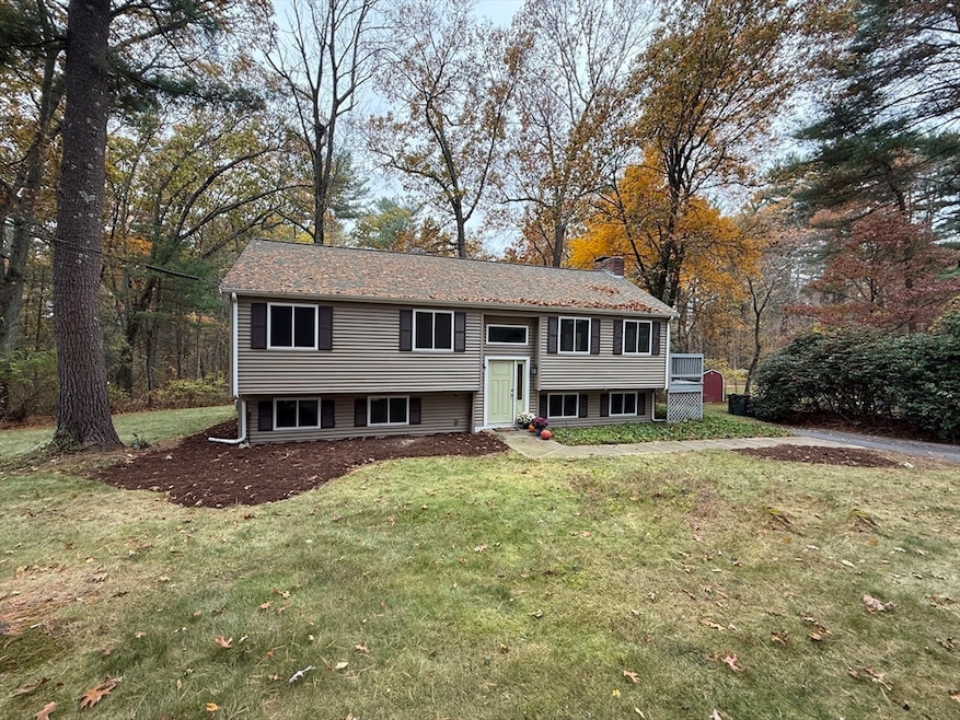
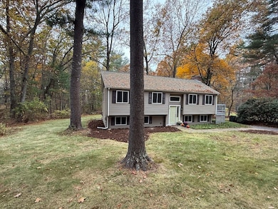
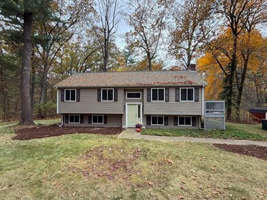
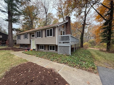
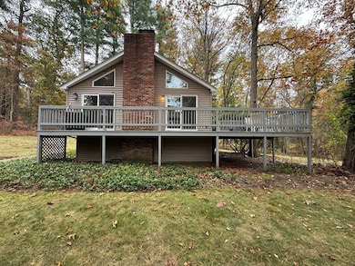
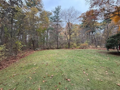
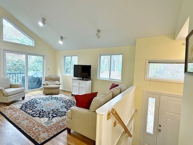
Welcome to this inviting & over-sized Split-Entry Style Home, located on a country road, & ready for its next chapter. The Living Rm is beautifully complemented by a flr to ceiling brick FP promising cozy evenings, & serves as a dramatic focal point; featuring beautiful hardwood flrs, recessed lighting, & a vaulted ceiling that amplifies the sense of space. The Kitchen offers a delightful space to create culinary masterpieces, showcasing shaker style cabinets & a beautiful Pergo flr that enhances the room's aesthetic. The Dining Rm w/built-ins provide plenty of storage & serving space for entertaining & family gatherings. Three good-sized Bedrms & Full Bath complete the Main Flr.. The finished walk-out LL provides a flex-space for many uses. The 2.2 acre lot provides ample space to enjoy the outdoors. Enjoy the wrap around deck for relaxing, dining or enjoying the beautiful sunsets. This well cared for property is waiting to welcome you. Nothing to do but move-in, unpack & enjoy!
Last Agent to Sell the Property
ERA Key Realty Services- Milf Listed on: 10/30/2025
| Date | Type | Sale Price | Title Company |
|---|---|---|---|
| Quit Claim Deed | $575,000 | -- | |
| Deed | $91,000 | -- |
| Date | Status | Loan Amount | Loan Type |
|---|---|---|---|
| Open | $447,000 | New Conventional | |
| Previous Owner | $30,000 | No Value Available | |
| Previous Owner | $68,000 | No Value Available | |
| Previous Owner | $69,000 | No Value Available |
| Date | Event | Price | List to Sale | Price per Sq Ft |
|---|---|---|---|---|
| 12/03/2025 12/03/25 | Sold | $575,000 | 0.0% | $263 / Sq Ft |
| 11/05/2025 11/05/25 | Pending | -- | -- | -- |
| 10/30/2025 10/30/25 | For Sale | $575,000 | -- | $263 / Sq Ft |
| Year | Tax Paid | Tax Assessment Tax Assessment Total Assessment is a certain percentage of the fair market value that is determined by local assessors to be the total taxable value of land and additions on the property. | Land | Improvement |
|---|---|---|---|---|
| 2025 | $5,595 | $445,500 | $146,800 | $298,700 |
| 2024 | $5,365 | $417,200 | $134,100 | $283,100 |
| 2023 | $5,169 | $396,100 | $127,600 | $268,500 |
| 2022 | $5,103 | $362,400 | $108,000 | $254,400 |
| 2021 | $4,931 | $342,200 | $108,000 | $234,200 |
| 2020 | $4,533 | $318,800 | $108,000 | $210,800 |
| 2019 | $4,432 | $311,900 | $108,000 | $203,900 |
| 2018 | $4,136 | $287,000 | $108,900 | $178,100 |
| 2017 | $3,939 | $274,700 | $108,900 | $165,800 |
| 2016 | $3,825 | $267,700 | $113,300 | $154,400 |
| 2015 | $3,668 | $257,400 | $108,900 | $148,500 |
| 2014 | $3,655 | $249,300 | $105,400 | $143,900 |
Seller's Agent in 2025
Laura Guisti-McSweeney
ERA Key Realty Services- Milf
(508) 380-9350
1 in this area
51 Total Sales
Buyer's Agent in 2025
Annie Chiarelli
Four Points Real Estate, LLC
1 in this area
5 Total Sales
Source: MLS Property Information Network (MLS PIN)
MLS Number: 73449354
APN: BELL-000028-000003G
Disclaimer: Certain information contained herein is derived from information provided by parties other than Homes.com. All information provided is deemed reliable, but is not guaranteed to be accurate and should be independently verified.
![]() The property listing data and information, or the Images, set forth herein were provided to MLS Property Information Network, Inc. from third party sources, including sellers, lessors and public records, and were compiled by MLS Property Information Network, Inc. The property listing data and information, and the Images, are for the personal, non-commercial use of consumers having a good faith interest in purchasing or leasing listed properties of the type displayed to them and may not be used for any purpose other than to identify prospective properties which such consumers may have a good faith interest in purchasing or leasing. MLS Property Information Network, Inc. and its subscribers disclaim any and all representations and warranties as to the accuracy of the property listing data and information, or as to the accuracy of any of the Images, set forth herein.
The property listing data and information, or the Images, set forth herein were provided to MLS Property Information Network, Inc. from third party sources, including sellers, lessors and public records, and were compiled by MLS Property Information Network, Inc. The property listing data and information, and the Images, are for the personal, non-commercial use of consumers having a good faith interest in purchasing or leasing listed properties of the type displayed to them and may not be used for any purpose other than to identify prospective properties which such consumers may have a good faith interest in purchasing or leasing. MLS Property Information Network, Inc. and its subscribers disclaim any and all representations and warranties as to the accuracy of the property listing data and information, or as to the accuracy of any of the Images, set forth herein.
Ask me questions while you tour the home.